June 24: With Amanda around, I wanted to take advantage of slackpacking opportunities as much as possible. The problem, however, was that there weren't a lot of locations along the trail where Amanda's rental car could reach. Pouring over maps and trailheads, however, it looked like we could meet up at Sargents Mesa a little over 20 miles up the trail. The risk, however, was that there was a blowdown or the road was too rough for a low-clearance vehicle. We had actually stopped at a visitor center yesterday to inquire about the road and the woman judged as a definite maybe. Not really recommended, but probably doable if Amanda drives slowly and carefully.

So my plan was to slackpack there. However, on the chance that Amanda was unable to drive up to the location, I'd start hiking down the gravel road in the direction that she was supposed to drive and just keep walking until I found as far as she could drive. Hopefully it wouldn't be far out of my way. Worst-case scenario, it could add an extra ten miles to my day's hike! But ideally, she'd meet me at Sargents Mesa and we'd just camp out at the trailhead there. Lodging in town was super expensive (well over $100/night) so camping for free at a trailhead seemed like a much better option.
To get the necessary mileage and give myself plenty of time to hike out in the event Amanda couldn't reach the trailhead, we woke up at 5:00am with the hope of starting my hike at Cottonwood Pass by 6:00am, but we missed that goal by about 15 minutes. Not the end of the world, though!
The trail was rugged with lots of ups and downs, but I made good time without a full pack on. An hour or two into the day's hike, I surprised Moonshine doing a poop. She called out to me before I saw anything and asked for me not to go any further until she finished her business, so I took the opportunity for a short break and a couple of minutes later, Moonshine was done and I continued hiking. She was sure that there weren't any other hikers behind her--at least not nearby--but hadn't expected someone like me coming in from Cottonwood Pass or hiking so fast!
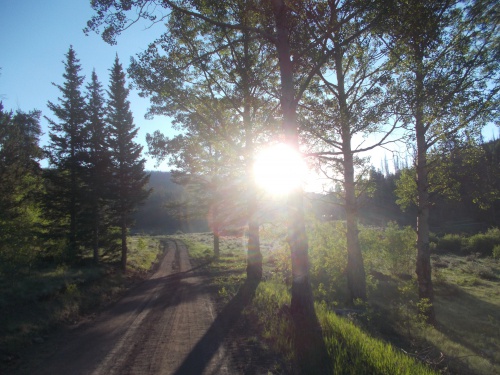 |
| The day started clear and beautiful! It wouldn't stay that way, though.... |
I'd never met Moonshine before, so we made quick introductions, but I soon outpaced her with my near-empty pack.
I also passed a Colorado Trail thru-hiker heading southbound who reported passing about 40 CDT hikers heading northbound in the last couple of days. Forty?! Where are they all?! I'm lucky to see just one or two each day!
Later in the afternoon, dark clouds started rolling in. Then came the storm. Rain! Thunder! Lightning! BOOM! Crash! BOOM! The worst of the storm seemed to be just a mile or two ahead of me, up on Sargents Mesa. I wondered if Amanda was enjoying the show. The rain, fortunately, stayed rather light for me and only hit me the last mile or so before reaching the trailhead.
The CDT doesn't pass directly by the trailhead. The trailhead was actually located maybe a quarter-mile off trail, but when I saw a small portable cooler with trail magic at the junction to the trailhead, I knew Amanda had made it and was at the trailhead. Yes! I had been a bit concerned that the vehicle might not make it and I'd have to hike who-knows how far back down the road.
 |
| When I found this cooler of trail magic at the junction with the CDT, I knew Amanda had successfully made the journey up the gravel road. That's the candy bar and two peanut butter cups I took out to eat during my walk to the trailhead. =) |
I grabbed a candy bar and peanut butter cups out of the trail magic to eat right away but didn't linger long. I knew the car would have plenty more trail magic that Amanda couldn't (and wouldn't) hike up to the trail carrying.
I soon arrived at the car and quickly jumped into the passenger seat to get out of the rain. Amanda told me that the road up wasn't bad, but the hike to the CDT with the trail magic was a terrifying adventure since the thunderstorm came in heavy at the very point where she was most exposed. She said she took shelter by a log, lightning crashing nearby and even included a hard hail just to add insult to injury. And carrying a heavy cooler up the steep trail.
"I texted you to pick up the trail magic when you came down," she told me, "because I'm definitely not going back up to get it." I hadn't picked up the trail magic, though. It was still at the junction. In fact, I didn't even get a cell phone signal up here.
"No cell phone signal," I told her, pointing at my phone. Somewhat surprisingly, she actually did have a signal. Usually I'm the one who had a signal and she did not. "But don't worry, I'll go back and get it after the storm passes."
I also knew that Moonshine was behind me somewhere and would likely pass by at some point. She might want some of the trail magic. Although if it was still raining and miserable out, she might just decide to pass by it. It was in a pretty exposed location. There might be other hikers behind me that I didn't know about as well, and it was also possible that southbound Colorado Trail hikers could still pass by. So I was content leaving the cooler there for now.
Amanda also told me about Soldierstone. We were at the trailhead for this wonderful and amazing monument. I had passed by it during my Colorado Trail thru-hike completely oblivious to its existence and kicked myself for missing it when I was in the area. This time, I came with the knowledge of the place's existence. I wasn't going to miss it again. It was also another reason I encouraged Amanda to drive out to this remote trailhead: I thought she might find it interesting as well.
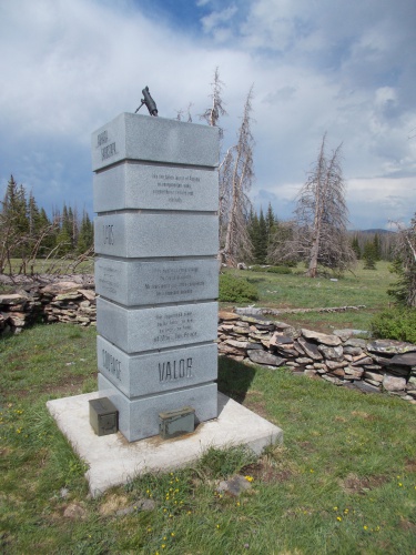 |
| Soldierstone |
So what is Soldierstone? It's a memorial for our allies in Indochina during the 30 years after WWII. There are memorials for our killed and wounded soldiers all over the place, for every war and battle the US ever participated in, but this was the first memorial I ever heard of that wasn't to honor our own soldiers, but rather those of our allies which--to me--makes it an unusually interesting monument.
And it's a little bit of a secret monument as well. It was created on the down-low, and the people who built it required that no signs or anything mark the location, and they didn't want it showing up on maps or pretty much anywhere. It was meant to be largely shared via word-of-mouth among vets.
Of course, this was before the days of the Internet. The Internet kind of outted the monument, but it's still a relatively unknown and hidden monument. No road signs mark the route, and even now, a search for Soldierstone on Google Maps just redirects to "Sargents Mesa". It won't show the precise location of Soldierstone--even though Google clearly knows about its existence.
If you'd like to read more about the monument, I'd recommend checking out The Story of Soldierstone which has a good write-up about the place.
Although I knew the monument was on Sargents Meas near the Colorado Trail and CDT, I poured over satellite imagery trying to figure out its precise location using what little information I could find about the place before heading out here. I didn't want to miss it a second time!
So Amanda had checked out Soldierstone first when she arrived and took a few photos before carrying the trail magic up to the trail and getting bombarded by the storm, and she shared those photos with me pointing out the direction of the monument.
Eventually, the storm had lightened up. Dark clouds were still in the sky, but the thunder and lightning had long since passed and the hail and rain stopped. Pockets of sun even peaked out! I took the opportunity to check out Soldierstone, but Amanda chose to wait in the car while I did my explorations.
The main part of the monument is a large block inscribed with words from various languages that our allies used, and a few ammo cans surrounded it with trinkets like old photos, miniature American flags, a few bullets and so forth.
It's a touching experience, and I had it all to myself.
Surrounding the main block were two or three dozen small plaques spaced seemingly at random around it. They were flat to the ground and required a bit of searching of find. Some were inscribed with a quote in English, but most were in foreign languages that I couldn't understand. Amanda and I did pick up a small booklet of sorts from the ranger station that had translations of each of the plaques, but I had left that in the car. I could look through it later.
I returned to the rental car for a bit, but as sunset approached, I walked back to the CDT junction to pick up the trail magic. Tomorrow I'd have an even longer day of hiking than today, and I knew I wouldn't want to take the time to pick it up in the morning before starting the day's hike. Nope, it was best to retrieve the cooler now.
And I was really surprised at how heavy and awkward it was to carry back down to the car! I had to give Amanda props for hauling that thing UP hill and leaving it there. All during a thunder and hail storm! Hard core!
I stopped to eat some of the grapes, another candy bar, and downed one of the sodas to make the load lighter, then carried the rest down to the car.
Amanda asked if any of the passing hikers had helped themselves, but I couldn't really tell. If they did, they hadn't taken or eaten very much. And there was only one person that I was certain had passed by.
Amanda seemed a little disappointed that she bought so much stuff to hand out as trail magic but had seen so few hikers along the trail.
"Well, look up! You still have more time to do some trail magicking!" =)
I had originally wanted to camp on the flat ground outside of the car, but it started raining again and it just seemed drier and warmer inside the car than out, so we decided just to sleep in the driver and passenger seats of the car for the night.
To occupy ourselves, Amanda played on her phone a bit while I read my Kindle. There wasn't much I could do with my phone without a signal, but later we watched a movie that I had downloaded from Netflix. (Fools Rush In, if you must know.)
And thus ended my 65th day on the trail.....
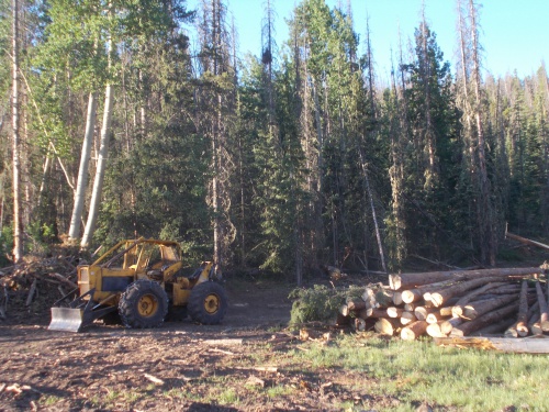 |
| There is logging along parts of the trail. |


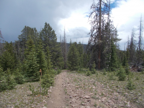 |
| That's Sargents Mesa up ahead! And my destination for the day! |


No comments:
Post a Comment