Friday, July 29, 2022

Day 125: Goodbye, Idaho! And hello, Montana!

August 23: It was a cold morning, but I got on the trail and hiking a little before 7:00am. After finishing breakfast, I had a mere 1/3 of a liter of water left. And, even worse, I wasn't aware of any reliable water sources between here and West Yellowstone a whopping 19 miles away. That wasn't a good way to start the day! I'd likely be very, very thirsty upon my arrival in town. But I still hoped I might find a water source somewhere before then.


Within 10 minutes of starting, I passed a hiker with their pants pulled all the way down to their ankles in a classic squatting position, butt in the air, and clearly doing a dump.

I didn't know who it was and it seemed like a bad time to introduce myself, so I simply shouted out, "Don't worry! I didn't see anything!" Which, of course, is code for, "Yeah, I saw everything! But let's pretend I didn't." Whoever it was quickly stood up, but I was already out of view behind some trees before they even realized I was there.

I kind of assumed the person was heading southbound on the CDT and that's why I didn't know who he (or she) was, and now I'll never know. It was the last potential southbounder I saw on the trail. (The last confirmed southbounder I met three days earlier.)

After less than a mile, I turned off the main red-line CDT to begin the legendary Super Butte Cutoff that would shorten my hike by hundreds of miles. It would be the biggest, longest alternate I'd do on the CDT, but it was necessary if I had any hope of finishing the trail this year. In any case, the wildfires on and near the trail ahead were another good reason to get off the main route. I'd be on this alternate route for well over a week. A week with no help from Guthook. I hoped I wouldn't get too lost along the way!

And a few miles later, I passed a sign welcoming me to the grand state of Montana! The main CDT stays in Idaho or on the Idaho-Montana border for hundreds of miles, but the alternate route I'd be following had me in Idaho for less than 24 hours.

Hello, Montana!

Fortunately for me, the weather was fairly cool, so I didn't need a lot of water, and the route continued to following relatively flat and easy gravel roads allowing me to hike quickly without breaking a sweat. But I did take sips of the little water I had as I watched the water level in my bottle dwindle lower and lower.

I passed a few puddles of water along the road, but they were completely brown with mud. I couldn't even filter that water if I tried. It would probably clog my filter in about 3 seconds. I supposed if I was desperate enough I might have tried drinking from it anyhow, but I wasn't, so I didn't.

And finally, I reached the edge of town--still with a little water left, believe it or not!

However, I was very thirsty and itching for a drink. I was also scheduled to meet Amanda in town, and now that I got a cell phone signal, I checked my messages and learned that Amanda wouldn't arrive for a few hours. So I needed somewhere to hang out for a few hours and headed to McDonalds.

I found these bear tracks heading into town, but I never saw the bear!
 

I was disappointed to learn that their dining room was closed due to COVID. I went ahead and ordered a quick meal anyhow--including the super-sized drink!--then took it to a shady area in front of the store where I laid out like a homeless person for the next few hours. While waiting for my meal inside, I did fill up my water bottles with clear, cold water as well so I wasn't entirely dependent on soda to re-hydrate. I would have liked to go to a park and rest quietly under a tree while laying out on some grass or sit at a picnic table, but I wanted to use the wi-fi signal at McDonalds more. So I hung out in front of the McDonalds, spread out like a homeless person camped in front of their store. I wondered if any of the employees would eventually tell me to get a move on, but they never did.

I caught up with emails and messages, watched some YouTube videos and killed the time. Periodically I got an update from Amanda about her progress, and finally when she reached the edge of town, we agreed to meet over at the post office a few blocks away. I needed to pick up my laptop which I had shipped here.

So we did that. After hours of waiting for her arrival, I was already ready for dinner and we headed to a local pizza place for a meal, the name of which I've long since forgotten.

Lodging was a bit more difficult. West Yellowstone is crazy expensive and very touristy, but Amanda had a vehicle which opened some options for us and she reserved a hotel room back in Idaho at Island Park. I didn't much care for all the extra driving, but it was considerably cheaper so I endured it!

And thus ended another day on the trail.....

Not a lot of water left for 19 miles of hiking.... This is the same water I had been carrying since Summit Lake--almost 40 miles between water sources!

Followed gravel roads pretty much the entire day!


This was a lovely old building I passed in West Yellowstone.

Wednesday, July 27, 2022

Day 124: The Zone of Death!

August 22: Of my three nocturnal visitors, one left early in the morning despite the rain. I never got his official trail name, but I called him The Postman because, you know, Neither snow nor rain nor heat nor gloom of night... ;o)

My other two visitors were a couple from Switzerland, but I don't remember their names and failed to note them down by the time I wrote my journal entries. We didn't chat much, however, since they stayed in their tents most of the morning and I stayed under my tarp because, you know, rain. They did have to come out occasionally to get water and go to the bathroom, so those were the short windows where we chatted.

By around noon, the rain had stopped and the sun started peaking out a bit.

The Swiss couple decided to wait out the rain with me. It rained a lot during the night and persisted well into the morning, but the latest weather forecasts I had checked while at Old Faithful called for no rain and clearing skies in the afternoon. I could wait. I'd be patient.

And I waited, and I waited, and I waited... The rain finally stopped by around noon, and I was on the trail and hiking by 12:15pm--nearly 26 hours after I first arrived at the campsite. I was definitely ready to stretch my legs! The Swiss couple were still in camp when I left, but were breaking it down and likely wouldn't be far behind me.

It was still cold and windy, even in the afternoon, but at least it wasn't raining!

A few hours later, I arrived at the Wyoming-Idaho border. Wyoming, at long last, was finally behind me. Hello, Idaho!

Hello, Idaho!!!! I couldn't help but notice that there was no warning that we were also entering the Zone of Death!!!! I think it deserves a mention.

I took a short snack break here, enjoying the idea of having the 3rd of 5 states now behind me. I was also in that thin, sliver of Yellowstone that actually overflows into Idaho. It's a strange bit of land that some people call the Zone of Death due to the fact that there's a legal loophole (allegedly) that would allow someone to get away with the worst of crimes, up to and including murder! I'm not aware of anyone ever trying to test that legal theory, but I had a hunch that if I wanted to make national news, I could murder someone in the Idaho section of Yellowstone and see if it worked. Of course, I had no intention of doing that.

More worrying, however, was if someone else had the idea to murder me! Was it really safe for me to be traveling around here? Maybe I shouldn't linger too long in the area.

The Zone of Death only lasted for an hour or two before I reached Yellowstone's borders and officially exited the park. I ripped up my permit in celebration. Okay, I didn't really do that. My permit was electronic and on my phone, but I was glad to be done with it and could now hike as much or as little as I wanted to each day. =)

The border for Yellowstone wasn't marked, but I knew I had left the park when I started seeing the official CDT signage again.

The Yellowstone border didn't have a marker to mark precisely where I left the park, but I did notice official CDT signage showing up. I'm assuming the CDT workers haven't been able to get permission to add CDT signage through Yellowstone due to bureaucracy--it's hard to get anything done in these larger, more popular parks. I never saw an official CDT sign the entire distance through Yellowstone.

But I could clearly see on my GPS when I left the park boundaries so it wasn't a surprise, and the trail I had been on quickly merged onto gravel roads that I followed for the rest of the day.

By the end of the day, I set up camp at the edge of a field shortly before the junction for the Super Butte Alternate that led through West Yellowstone. I never did see any hikers the entire day, but I half expected to see the Swiss couple pass by me by if they made a habit of hiking until 10:00 each night, but I never saw them either. In fact, I never saw them again. Maybe someone murdered them back in the Zone of Death?!

By the end of the day, I started conserving water. I was getting a bit low. Since leaving camp almost 19 miles ago, I hadn't passed a single viable water source. It was a particular long stretch, and looking ahead on my maps, I wasn't entirely sure if there would even be water available in the next 19 miles! This was one of the longest stretches of the entire trail without water, and I wasn't even in a desert. It seemed so unfair!

And thus ended another day on the trail..........


I passed a 2000-mile marker on the trail yesterday as well. Which is correct? Neither! Everyone did different alternates and I doubt no two people had the same mileage, but at least one person thought this was the 2000-mile mark.


Monday, July 25, 2022

Day 123: Biscuit Basin and the Widow-Makers

August 21: I woke up and hit the trail early. Weather forecasts called for rain--again--but it wasn't expected to start until the afternoon which left the morning for rain-free hiking, and I only had about 10 miles to do to reach my next (and last) required campsite. This was the campsite that I could, theoretically, skip completely. Just hike outside of the park and camp wherever I wanted. It wouldn't even be particularly hard to hike outside of the park, but it would have added an extra 10 miles to my day and there was no way I'd finish before the rain started. I hoped to get into camp before it started and just wait out the rain until I left tomorrow.

It was a cold and foggy morning....

So that was my plan. Although it wasn't raining in the morning, it did start cold and foggy. I explored some more of Yellowstone's thermal features around the Biscuit Basin area. Almost nobody was up this early in the morning and I had the area almost entirely to myself which was nice.

Leaving the Biscuit Basin, the trail climbed higher, eventually popping out above the fog, but the temperatures continued to stay cold. It never really warmed up.

The rest of the day's hike was easy and uneventful, and I reached my designated camp next to Summit Lake at 10:45am, all before any rain started.

The campsite didn't really have any good places to set up my tarp, however. My permit warned about dangerous, dead trees at the campsite, and looking around, I could see why they added that warning. Definitely a lot of dead trees around, and I didn't feel comfortable setting up camp under them. They're often called widow-makers because, well, you can imagine.

There were other locations, but they were exposed or prone to flooding, and since rain was forecasted, those didn't seem particularly wise either. Eventually I settled on a spot among some already fallen logs. It might flood if it rained long enough and hard enough, but at least it was somewhat well-protected from the dead trees which seemed like the bigger threat.

I wound up setting up camp among some logs and these trees. It wasn't an established place for tents, but the beaten down, well-used locations were either under widow-makers or too exposed for my tarp. You can see a little bit of Summit Lake in the background through the trees.
 

With nearly 12 hours before bedtime, I had plenty of time to kill. I started by sewing up some holes that had formed in the shoulders of my shirt. I read my Kindle, played on my phone, wrote postcards. The time seemed endless.

In the afternoon, wind gusts picked up dramatically, but I was pretty well protected from them under my tarp.

Money and Stranger dropped into camp. They had decided to hike through Yellowstone with no permits at all in the hopes that no ranger would catch them, and told me that they had actually camped on a park bench by the Yellowstone Art and Photography Center in Old Faithful Village last night--completely in the open! That was pretty audacious, I thought, but apparently nobody noticed. I told them that they were welcome to join me in my camp--I had a permit and this site was mine--but they wanted to push onward.

There were a few, light sprinkles in the afternoon, but nothing serious and I was a little disappointed that I had stopped so early. I could have easily have walked outside the park and set up camp and the rain wouldn't have been problematic. I felt like I wasted the entire afternoon by stopping. If it had rained, I'd have been glad to stop. But it didn't rain. At least not hard enough for it to really count.

The rest of the day passed on without anything happening, but long after sunset, at around 10:00pm, three northbound hikers showed up. The long overdue rain that had been expected had started, and they arrived looking like drowned rats from a sinking ship. I welcomed them to Camp Tortuga but suggested that they watch out for dead trees--they were everywhere! But since it was already so late at night, we didn't really stop to chat. Perhaps I'd get their details in the morning.

The thermal features of Yellowstone often move over time. In this case, a hot spot popped up in a parking lot that the authorities blocked off. One less parking place for vehicles!


Friday, July 22, 2022

Day 122: Geysers! Geysers! Geysers!

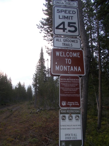
August 20: I woke up, yet again, to rain. Ugh. I was really getting sick of this rain stuff. Nevertheless, I had a solid 20 miles of hiking to do and plenty of sights that I wanted to check out, so I didn't linger particularly late and was on the trail and hiking by 7:10am.

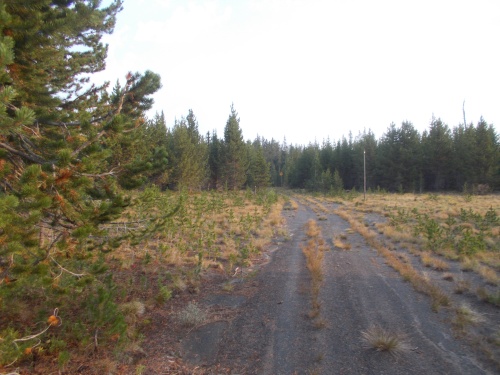
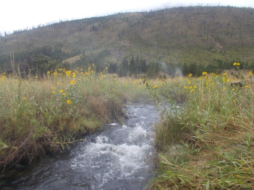
The trail followed around the edge of Shoshone Lake, and I found myself wading through knee-deep water at water crossings where the log bridges were in disrepair. At times, I worried about sinking deep in the mud and losing a shoe, so at one point, I re-laced my shoes making them especially tight. And I tried to hop over the muddier sections where I could. I'm happy to report that I did not lose any shoes to the sucking mud.

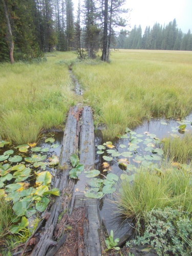
The bridges across the swampy areas had a lot to be desired. You can't tell from this photo, but this bridge is broken in the middle and if you put your weight on it, it'll sink two or three feet into the water.

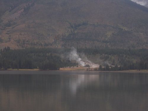
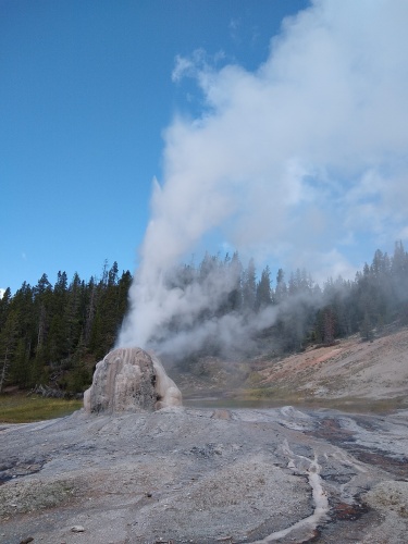
And then the trail headed through the Shoshone Geyser Basin--right through it! There was lots of bubbling water and steam and the occasionally small geyser exploding 5 feet high, and I had it all to myself. Despite the rain, I loved it. It might not be as visually spectacular as Old Faithful, but it felt much more intimate without the crowds--like it was my own private little event.

But I pushed onward. A little while later, the rain stopped--at least for now--and I put my umbrella away.

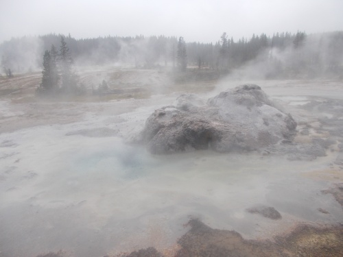
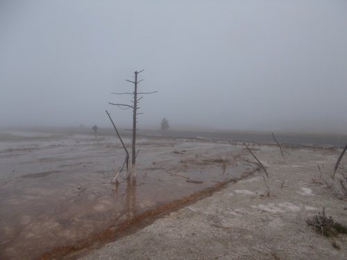
The Shoshone Geyser Basin looked like the end of the world was upon us!

A few hours later, I took a short off-trail jaunt to check out Lone Star Geyser which is my favorite of the geysers. The geyser erupts fairly predictably every three hours or so, and it's big enough to be fairly impressive. And, because it requires a hike to get to, there's never a large crowd. There are always some people around, but never a large crowd.

The problem I had was that I had absolutely no idea when the next eruption was scheduled to happen. I didn't know if I would have to wait one minute or the full three hours before the next one. There are apps and websites that will tell you when the last eruption happened and when the next one is expected, but I hadn't gotten a cell phone signal of any sort since I left Dubois 5 days earlier so I had no way to check what was happening before I arrived.

Although when I arrived, absolutely nobody was there, so I felt reasonably confident that an eruption wasn't imminent. If it was, at least a few people would have already shown up.

There is a register at the geyser for people to write in eruption reports: how long they lasted and any other details that someone thinks is pertinent, so when I arrived, I immediately flipped it open to check what the latest reporting sightings were. The last entry said there was an eruption at 9:45am, and it was 11:45am when I arrived, which meant I had about an hour to kill until it erupted again at about 12:45pm. Perfect! Plenty of time for me to cook one of my dinners for lunch. It was time for lunch anyhow and it kept me feeling productive while sitting around for an hour with nothing better to do.

I was a bit surprised, however, when the geyser started erupting at 12:02pm--I noted the time so I could write it in the register later. This was much too early to be a regularly-scheduled eruption, and I later read that the Lone Star Geyser usually has "minor" eruptions shortly before the main event. This was the minor eruption, but it certainly looked impressive in its own right! It lasted until 12:06pm--only about 4 minutes--and I quickly whipped out my camera to take photos and film it. I wasn't ready, though, and dinner was cooking and argh! I can't do all this at once!

But I had the minor eruption completely to myself. A show just for me. =)

This is just a "minor" eruption of Lone Star Geyser.

After the geyser died back down, I went about finishing my lunch. I decided to wait around until at least 12:45pm when the next "main" eruption was expected even though I didn't know about the "minor" eruptions and for all I knew, it was the major eruption. But I still needed to finish my lunch and clean up, and by the time I finished, I only had another 15 minutes to wait. I may as well wait! So then I pulled out my Kindle and read my book.

As the eruption time approached, so did a few small groups of people. They clearly knew when the next major eruption was expected--there were several small groups of people arriving within a half-hour window. It couldn't have been coincidence!

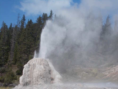
And at exactly 12:31pm, the major eruption started. A little bit earlier than expected, but there's always some variability in these things, and wow! This time, it shot twice as high in the air, probably 30 feet or more. The water just kept gushing and gushing out... for about 20 minutes in all, although growing less energetic as time passed. Eventually the geyser started just spitting out steam before finally going back to sleep, not to awaken again for another three or so hours. (Except, most likely, a minor eruption a half hour before the main event.)

Lone Star Geyser's main eruption!
 

I felt quite satisfied and rested, but it was time to continue hiking. I picked up my bag and headed back to the CDT and onward to Old Faithful Village.

My first stop in the village was to the post office. I had mailed food to myself here that would get me the rest of the way to West Yellowstone. I was disappointed, however, when I arrived to find that the post office was closed for lunch. So I had to wait around for 10 minutes before it re-opened for the day and picked up my package.

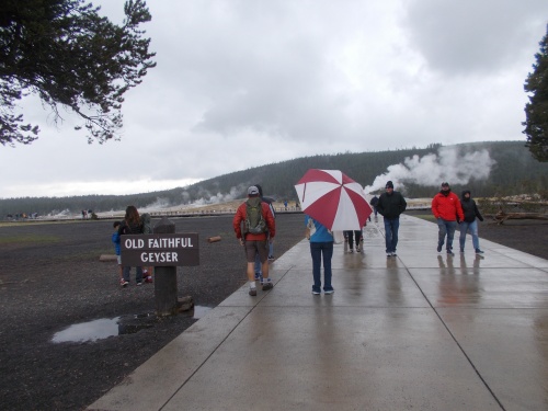
Rain had resumed by the time I reached Old Faithful Village.

I also tried to buy a sheet of postcard stamps, but the postal worker tried talking me out of them saying that he only had just 10 postcard stamps left. Just 10?! I figured I could wait until the post office in West Yellowstone in a few days. And he had absolutely zero international stamps available for purchase. *shaking head* Come on! Selling stamps is the one thing the post office is supposed to be good at! And in a location with as many visitor as Yellowstone National Park, you'd think they'd have boatloads of people trying to send postcards! Why didn't they have boxes of postcard and international stamps under the counter or something? I've never had so many issues with post offices as I have on this trail, and this just notched another poor score for me.

At least my food package had arrived without any trouble, and I stuffed my newly acquired food into my pack before leaving the post office.

Then I headed over to Old Faithful Geyser. I've seen Old Faithful a few times from previous visits and while it is spectacular, I would have been perfect happy to skip it because--OMG, the crowds! Old Faithful, albeit spectacular, is a horrible experience due to the massive numbers of people that watch it erupt every 91 minutes or so.

But I was working, and I needed photos and videos for Walking 4 Fun. So I'd tolerate the crowds. It was for work. It needed to be done.

I checked when the next eruption would happen. Old Faithful is so popular and iconic, you can find whiteboards all over the village with details about when the next eruption was expected, so I knew the next one was scheduled in another half hour or so. That was a great time to start looking for a seat if you want a front-row seat. If you try arriving at the last minute, you'll have a bunch of heads of all the people in front of you in your photos.

As the eruption time approached, hundreds and hundreds of people were drawn in like moths to a flame. They were loud, noisy and I felt positively claustrophobic. I hated it. I wanted to climb a trail to a viewpoint where I could watch the eruption without the crowds. (Such a viewpoint does exist--I've been there in previous visits--but it's much further away and I wanted close-up photos and videos for Walking 4 Fun.)

Old Faithful sometimes gurgled a bit, like it was gargling with mouthwash in preparation for the main event, and every time there was a gurgle, the crowd would "Ooooo" and "Ahhh!" thinking the main event was starting. I found it a little annoying. 

It started sprinkling, but I didn't take out my umbrella since it would probably piss off all the people behind me. It wasn't raining hard, though. I could live without using it for the time being.

And finally the eruption happened. Water shot a hundred feet into the air and the crowd gasp in seeming surprise. An Old Faithful eruption lasts only for a couple of minutes--relatively short compared to the 20-minute show that Lone Star Geyser put on earlier, but Old Faithful does erupt twice as often.

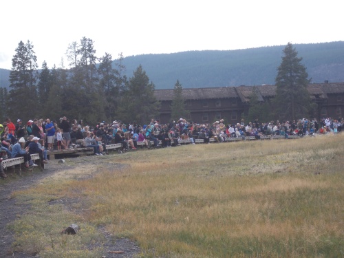
The hoards and hoards of people waiting for Old Faithful to erupt.
 

After it was done, the crowds quickly left. I overheard one person commenting to their companion that they had no idea that the eruption lasted so long. She thought it erupted for a few seconds before falling dormant again and was surprised that she could enjoy it for two whole minutes! Which I thought was a bit amusing since I thought the eruption was a bit short! I guess it's all about perspective.

Another person I overheard telling someone that now Old Faithful could be checked off their bucket list. Yep, check it and go home. Please! Now! Go! Go! Go! =)

For the first time in five days, I finally got a cell phone signal, so I found a chair to sit down and catch up with a few messages, emails and make some phone calls while I could.

And by the time I was ready to hit the trail again, over an hour had already passed. Old Faithful would erupt again before too long, and I decided to brave the crowds a second time for another photo shoot.

The main problem with the first one was that it was still cloudy with grey skies, and a white geyser against a grey background was kind of hard to see in my video. The skies had cleared considerably more over the past hour, however, and now there were large chucks of blue sky. I hoped maybe I'd be able to get a better video and better photos. *fingers crossed*

So I repeated the experience, still hating the crowds, but survived to live another day. And this time, the geyser showed up much better in my photos. It actually looked like a geyser now!
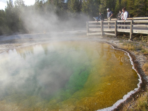
Morning Glory Pool

Afterwards, I dropped into the general store where I bought a drink and a couple of snacks. I used the restrooms and filled up with nice, clean tap water. I walked through the Old Faithful Inn and took some photos. Then... it was finally time to hit the trail again.

I followed the trail along boardwalks through all the thermal areas. I saw more geysers and hot springs, and bubbling pools, and steam rising in the air making the ground look like it was on fire. It was awesome.

There were still lots of people around, but nowhere near the massive crowds that cluster around Old Faithful during an eruption. Around the rest of the thermal areas, I felt like I could still breathe.

From one of the boardwalks, I watched Old Faithful erupt for a third time. This time, I was watching from the "back" of the geyser, which still provided some decent views without the crowds nearby, but even from this distance, I could still hear the crowds oooing and ahhing the spectacle. With a nice zoom lens, you could still even get really decent photos of it well away from the hoards of people.

I continued exploring the thermal features of the area until close to sunset at which point, it was time to set up camp.

Except... ugh... my campsite was located about three miles off trail. It was the closest available campsite I could book a reservation for. It was already near sunset now--it would be dark by the time I reached camp. *sigh*

And thus ended another day on the trail....

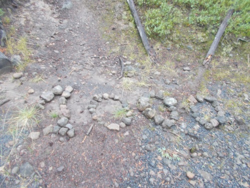
Early in the morning, I passed the official 2000-mile marker on the trail! Woo-who!
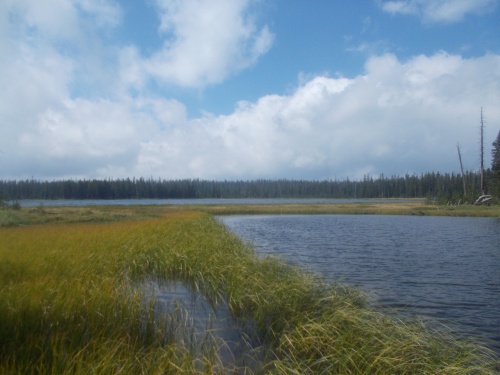
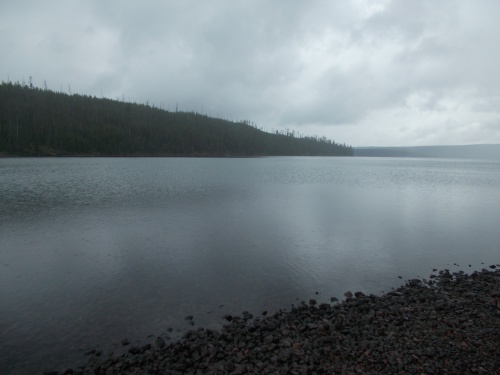
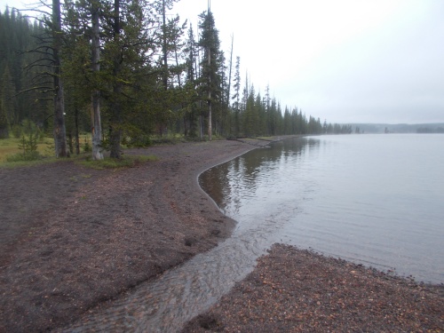
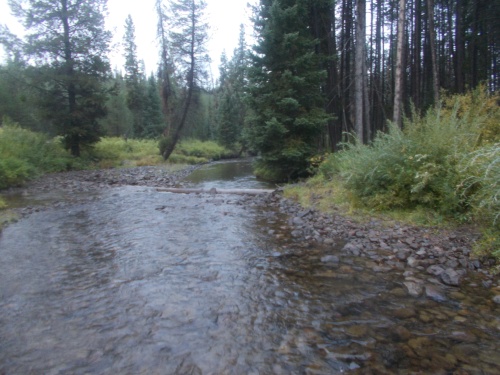
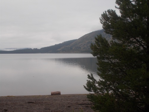
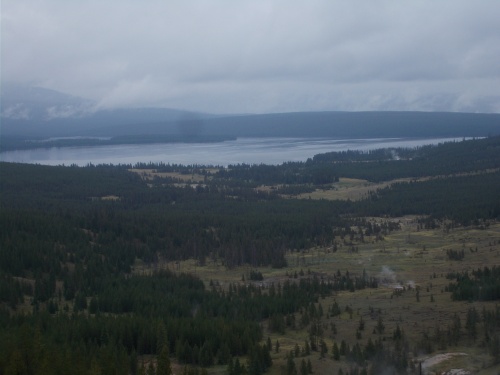


Shoshone Lake


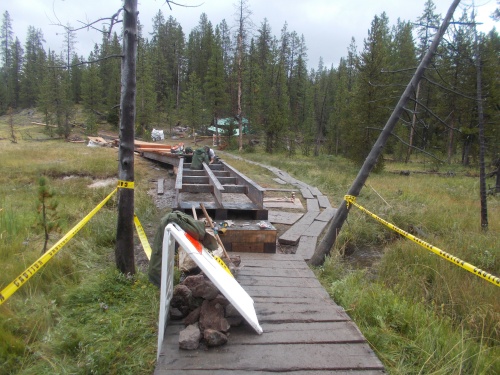
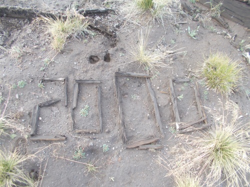
The trail was getting a new bridge installed along this section!


Wednesday, July 20, 2022

Day 121: Thermal Features and Shoshone Lake

August 19: The rain had finally stopped during the night, and I stayed high and dry under the cover of a tree. By morning, however, the rain had resumed and I left camp in the rain once again. Today's forecast predicted on and off rain all day long, which didn't sound good but--to be fair--it's still an improvement over "light rain all day."

In the morning, the sprinkle wasn't so hard that I bothered to take out my umbrella, but I did have to ford Surprise Creek seconds after leaving camp so my feet started the day thoroughly wet.


Surprise Creek wasn't much of a surprise since I had to ford it to reach my campsite last night. (My campsite was located a short way off trail.)
 

Several miles later, I arrived along the shores of Heart Lake where I got my first views of the thermal features that Yellowstone is most well-known for. Lots of steam shooting up into the sky, bubbling hot springs and small geysers.

Passing by a ranger station, I met a volunteer ranger and his friend who reported seeing wolves there just this morning. Ugh! I wanna see wolves! From a safe distance, of course....

With all the rain, the trails were quite muddy and the ranger suggested that I should keep my eyes open for wolf tracks on the trail. There would likely be some. Will do!

I continued onward and before long did spot what normally I would have thought were dog prints on the trail. But I doubted these were dog prints. I was pretty sure that dogs weren't allowed on these trails and even if they were, I hadn't seen anyone hiking on the trails which meant they couldn't have been hiking with dogs. They must be wolf tracks! I'm following wolves!

Wolf prints! But to be perfectly honest, they kind of looked like regular old dog prints to me.

I also spotted some bear prints. The wildlife was all around me, but I never did spot any wolves or bears. 

Throughout the course of the day, I did pass three other hikers. One was out for the weekend, the second one I assume was a southbound thru-hiker but we didn't stop to chat in the rain so I'm not 100% certain that that's the case, and the third one was, in fact, a confirmed south-bounder named Comet who I spotted taking a break along Shoshone Lake and we chatted for a few minutes.

I didn't know it at the time, but that was the last definite south-bounder I'd meet on the trail. I'd kind of miss them. I didn't really know them--hiking in opposite directions, we never had a chance to bond like I could with fellow north-bounders--but it was nice meeting up with people occasionally to chat for a few minutes at time and get information about the trail ahead. 

By around noon, the rain became heavy enough that I finally pulled out my umbrella. Unlike yesterday, I had to complete a full day of hiking--over 22 miles to reach my next campsite. It was terribly wet weather for hiking, but there wasn't much I could do about it. At least the rain would periodically stop for brief periods.

Late in the day, I had to ford across the outflow from Shoshone Lake, and I remembered this ford from one of my first backpacking trips ever. Back when I was just a boy, my dad took my sister and I for a one-night, two-day trek from the Old Faithful area through the Shoshone Geyser Basin and past this lake. I also remembered being horribly hungry because dad didn't bring enough food to eat, and I also remembered throwing up just before crossing this creek.

That backpacking trip 35 years ago was the only time I had ever been on this particular trail, but it was memorable. I was definitely feeling a lot better this time around! No nausea, and definitely plenty of food. I may have a bit more experience under my belt this time around, though.

Shoshone Lake

The rain started picking up again, though, so I didn't reminisce long and pushed onward. Ever onward!

I finally reached Moose Creek Meadow Camp at around 5:00 in the afternoon where I set up camp, and this time, I set up camp in an actual site meant for sleeping rather than the eating area. I set up my tarp as well since there were no large trees providing a dry spot to camp this time around.

Then I changed into dry clothes, cooked some dinner and read my Kindle before settling into bed for the night. Today's hike wasn't particularly eventful, but I was really looking forward to tomorrow because tomorrow, I'd be hitting the Old Faithful area. Tomorrow, there was going to be some pretty awesome thermal features to see, and I couldn't wait!


Heart Lake


The first evidence of the thermal features that Yellowstone is so known for!


Witch Creek is 90-odd degrees F and a great temperature for swimming in. (One of the few places where it's legal to swim in the heated water.) I didn't stop to swim, though. Too many miles to do today!


Marmot!


Looking back at Heart Lake


A sign of autumn's approach? Gotta get this trail done before winter hits!


I'm pretty sure a bear did this! But where are they hiding?!

The one good thing about all the rain--my feet have never been so clean during a thru-hike!