August 24: I wouldn't have minded taking a zero day, except the weather was too good and now that Amanda was around, I had a chance to do some slackpacking. Despite deciding to take the Super Butte Cutoff, I was a little concerned that I still might not make it to the Canadian border before the snow started to fly. At the very least, my days of decent weather were numbered. I couldn't be wasting them taking zeros on days when the weather was actually pretty decent!
 |
| I didn't know if this was really true or not, but I could believe it! |
So for breakfast, we grabbed a pretty standard hotel breakfast in the lobby, then Amanda drove me back to West Yellowstone to start the long road walk out of town. The next 16-or-so miles were all road walk, and it would be easy for Amanda to pick me up at the end of it, so that was the plan. She'd spend the day letterboxing and having fun. I'd spend the day walking along busy highways. I predicted that she was going to have the better day!
So she dropped me off in town, and I started hiking north along the busy Highway 191. I can't say it was particularly interesting or fun. It wasn't. It was monotonous and the vehicles loud. One sign promised that bison were on the road, but I never even saw those.
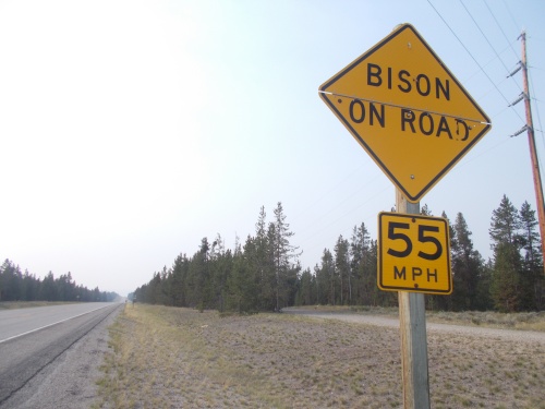 |
| It lies! I never saw any bison on the road.... Promises made, promises broken. |
I followed the highway for about 8 miles until reaching the junction with Highway 287 which I would follow for an additional 5 miles.
Along the way, Amanda drove by and gave me a small, cold Coke. She had found some letterboxes near town, but was now heading past Hebgen Lake--which I'd follow along the shore of for a bit--on her way to find some more letterboxes.
The day was hot, so a cold drink definitely hit the spot.
This new highway was also busy, but at least it wasn't as busy as the one directly out of West Yellowstone which made it slightly better. It also went near Hebgen Lake so the views were slightly better as well. But the walk still sucked.
And finally I reached the junction with a gravel road that I could follow for a few miles to the end of the road to the Red Canyon trailhead where Amanda was already waiting for me.
This was the furthest Amanda could drive, however, so this was where I had to stop for the day. Tomorrow, she'd drop me off again at which point I would be back on real trails--and I was looking forward to that.
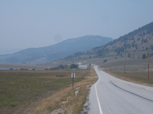 |
| Today was just one, long miserable road walk, and the skies were smoky from wildfires. |
On the way back, we spotted Money hiking down the road and pulled over to give him a cold drink and snacks. His plan was to road walk all the way to Butte--as quickly and directly as possible. That sounded... utterly awful to me. That was quite a long distance! The route I planned to take took me along actual trails and gravel roads--at least along large chunks of it--but it would definitely be longer and slower than road-walking all the way to Butte.
I wasn't even sure if I'd see other people on this route. Between Yellowstone and Butte, there were probably a hundred different route variations that hikers were doing. I don't think any two people I talked to were planning to do the exact same options. There was nothing on Guthook about these routes so everyone was making it up. Guthook tends to "standardize" the routes people most often take, and throwing that option out the window really shook up the hiker community. It definitely felt more like adventuring with fewer resources to tell us about upcoming campsites and water sources. I spent hours pouring over maps trying to decide what I was going to do. Most hikers I talked to seemed to be taking the Big Sky Alternate which led through northern Yellowstone and through the town of Big Sky. Money was the first person I knew of going this route. Even then, however, he was still following a different route than I planned.
Money reported that Stranger wanted to stay on the red line CDT, not wanting to take the 300-mile shortcut. It was a fact that impressed me. Impressive because I was already starting to feel a little behind and worried about finishing before the first snow covered the trail. I definitely didn't think I could finish in time if I wasn't taking this shortcut. I felt like Stranger was taking a risk by staying on the main CDT, but at least he still had Guthook to lead the way. And, of course, it's not the end of the world if he didn't make it to Canada before the snow pushed us out.
Anyhow... Money continued on his way, and Amanda and I headed back to West Yellowstone where we grabbed lunch at the Canyon Street Grill. Well, a late lunch and early dinner. Amanda was really excited about the "Totchoes" on the menu.
And then we headed back to the hotel for the night. All-in-all, not a great day of hiking, but definitely necessary to keep my steps connected. *sigh*


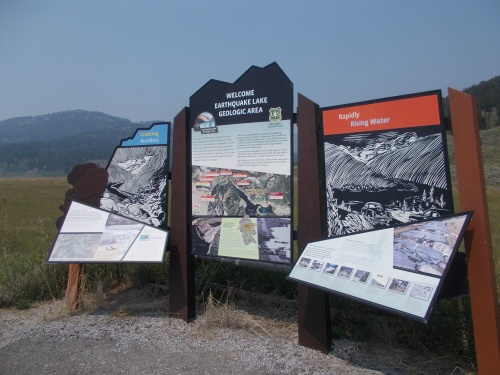 |
| This roadside sign tells about a huge earthquake that struck the area on August 17, 1959. There were 28 fatalities and was the largest earthquake to ever hit Montana in recorded history. |
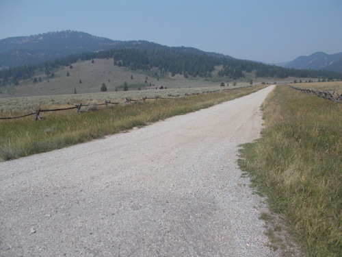 |
| It was a relief to finally get off the busy, paved highways and onto this quiet, gravel road. But I was only on it for about an hour before reaching the end and the end of the day's hike. |
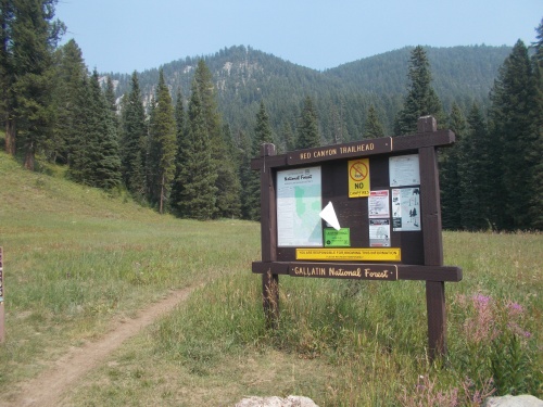 |
| The Red Canyon TH was the end of the line for me today. After this, there was nowhere that Amanda could drive to pick me up for the next 25-or-so miles. |


No comments:
Post a Comment