July 4: It was Independence Day, but on the trail, it was just another day. Perhaps a little more crowded with day-hikers and those out for a weekend backpacking trip, but otherwise, just another day. In this case, I woke up at around 6:00am, ate breakfast and took my time getting ready. That was, until around 6:30am when the mosquitoes woke up and started buzzing around. Argh!
After that, I hastened my departure and was on the trail and hiking a little before 7:00am, and once I got moving, the mosquitoes weren't quite so annoying.

The first half of the day was remarkably easy with lightly rolling hills, and even then it was mostly downhill.
I did stop for a break at a swinging bench along the trail. I remembered it from my Colorado Trail thru-hike, and it was relatively early in the day for a break, but I couldn't pass up the bench without enjoying it. That would have been criminal! And, somewhat surprising, the mosquitoes didn't swarm. In fact, they largely stayed away for the rest of the day. Oh, sure, there was the occasional mosquito buzzing around, but not in quantity. They didn't come with friends anymore! I couldn't figure out why they were so problematic yesterday but not today. The weather wasn't really all that different. The terrain wasn't that different. I just couldn't figure it out. They are mysterious creatures, indeed. Unpredictable and annoying, but also mysterious in their ways.
 |
| I remembered this swinging bench from my Colorado Trail thru-hike, and I enjoyed it just as much this time as I did then. =) |
After about a half hour at the swinging bench, I continued onward to Tennessee Pass, which is also where many thru-hikers hitch into Leadville since Highway 24 leads south directly into town. In fact, when I talked with other thru-hikers at the hostel, the question we asked each other most often was from where we hitched into town. It seemed like I was one of the few who came in from Twin Lakes. Most of the hikers I met hitched in from Tennessee Pass. I choose to go in from Twin Lakes, however, since it more evenly distributed the miles I had to do between Salida and Breckenridge, my other main resupply points. It wasn't even 50 miles from Tennessee Pass to Breckenridge--not worth the effort of hitching into town in my book. And anyhow, today was the 4th of July weekend. I really didn't want to go into town, even if I could somehow miraculously find lodging.
I did stop to check out the monument at the pass, however, in honor of a fighting group from WWII. I didn't feel like I was in a particular rush, so I didn't mind the slight detour and I could drop my pack while I read all the informational signs about the pass and the monument.
But then I was off again, this time following an old rail-to-trail system down the other side of the pass. A train used to cross over Tennessee Pass back in the day but had long since been rerouted through a tunnel under the pass and the old line had been turned into a hiking trail that the CDT now followed allowing for a very flat hike!
The CDT followed the track only a couple of miles before detouring off, and soon crossing the semi-abandoned line that still had tracks leading to the tunnel. (I looked up information online about the track afterwards, and it appears that it hasn't really been used for a couple of decades after some railroad mergers, but the railroad didn't want to sell the rights-of-way to a competitor. So the line still "technically" exists, even if it's not currently used, but there's talk about opening it up again as the alternative route the railroad uses is nearing capacity.)
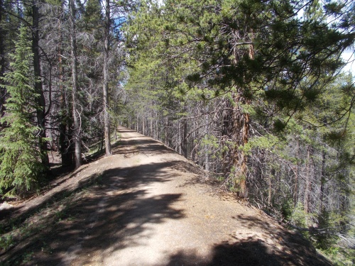 |
| I love these old rail-to-trail systems! So flat! So straight! So easy! =) |
Throughout the day, I'd been passing an enormous number of Colorado Trail thru-hikers heading southbound. It used to be I would stop and chat with a few minutes with every one I passed, but I finally put a stop today after passing over 30 CT thru-hikers. When I first met up with the CT, I would pass maybe one or two people each day, but this was prime CT thru-hiker season now! I just didn't have the time or inclination to chat with them all!
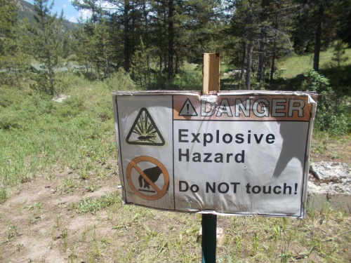
Anyhow.... pushing onward, I crossed over to the east side of Highway 24, following near the highway a few more miles until reaching Cape Hale, an old WWII training camp for winter and mountain warfare. The trail led down a short but steep slope before hitting the valley bottom where it levels out again. On the slope, I passed yet another CT thru-hiker heading southbound who told me that he found all sorts of bullets in the hillside in the last 30-40 feet during the last 20 minutes or so. He stuck out his hand full of bullets. Wow! That was a lot!
"I think they must have used this hillside as a shooting range," he told me. Certainly seems possible.
I took a photo of his bullets, not really interested in stopping to look for any myself, then we continued on our separate ways again.
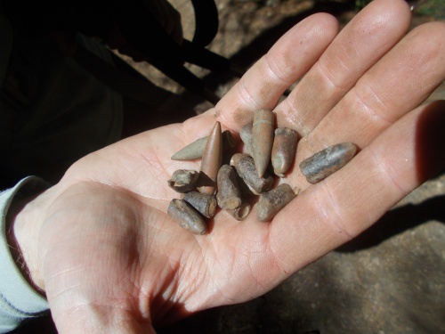 |
| Bullets from Camp Hale |
The trail then led through the abandoned Camp Hale and the valley bottom before finally climbing 2500 feet up to Kokomo Pass--the first real climb of the day. It was also the only serious climb of the day.
I had hoped to find a campsite somewhere on the climb up, but the trail was packed with other hikers who had already set up camp at all the best locations, so I kept going. I didn't really feel like camping with a herd of other people.
Twice during the day, I passed some hikers heading southbound suffering from major blisters and injuries. I was getting near the point on the trail where most of the CT thru-hikers had started maybe 5 days earlier and their feet had not hardened, and some of them were suffering greatly. Two of the people I passed, however, said their injuries and pain were enough to make them get off the trail and go into Leadville and asked how far it was to where they could hitch off the trail. I suggested to one that they didn't even have to go all the way to Tennessee Pass--the trail crossed the highway before then and she could hitch off from that point pretty easily. Most people preferred to hitch at Tennessee Pass only because it was closer to Leadville and there was a larger parking lot, but there was nothing to prevent her from hitching where the trail crossed the road. The other person looking to get off the trail hadn't even reached Camp Hale, though, and I suggested he could maybe get a ride from someone around Camp Hale where the trail followed near a gravel road.
But I kept pushing onward... all the way to Kokomo Pass! Which was a little problematic since it was above tree line and very exposed, and the trail would stay above tree line and very exposed for several more miles. I set down my pack to admire the views, then immediately thought, Screw it! Why not just camp here?
It was a very exposed location, but no storms were in the evening forecast. The wind was moderately strong, but looking a bit down the pass, I saw flat grassy areas that looked partially surrounded by rocks and vegetation that might help break the wind. And wow! What a great view! Yeah, this might be really nice.
So I scrambled downhill, off the trail, and looked for a place to camp. I found a workable place and set up for the night. Also a nice perk--I got a cell phone signal here which allowed me to get online and catch up with messages again. Living the good life! =)


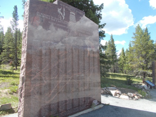 |
| Monument at Tennessee Pass |
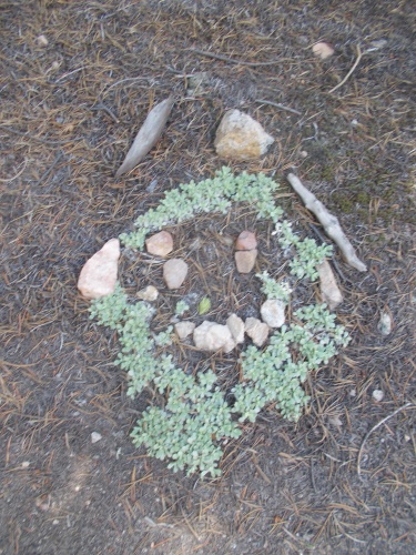 |
| Hiker art. Artist unknown. |


 |
| Unless you're looking for bullets, I guess. *shrug* |
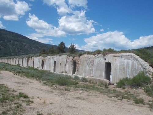 |
| Ruins at Camp Hale |


 |
| Cataract Falls |
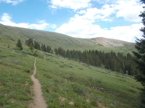 |
| Heading up to Kokomo Pass |
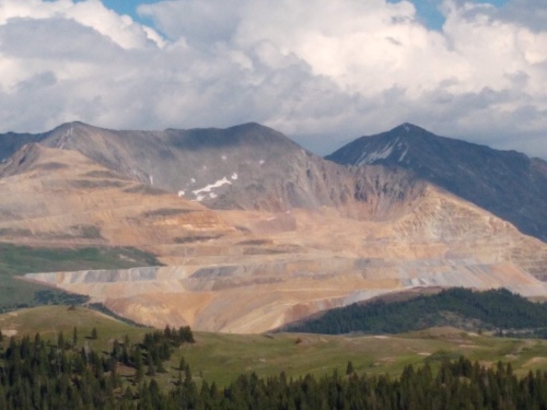 |
| I could see this distant mine from Kokomo Pass, and I'd be able to see lights on at it throughout the night. No idea what they mine here, though! |


3 comments:
Beautiful pics today. Love the falls.
Do you have a solar charger for your phone, or do you power up on zero days?
-di and her guy
I do power up on zero days, but I carry a power bank nowadays to recharge on the trail. More dependable than the sun! =) I just have to make sure whatever charge it holds can last me through to the next trail town.
Post a Comment