Monday, March 21, 2022

Day 69: The Mirror Lake Alternate

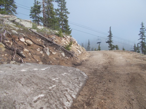
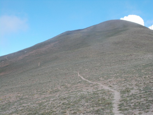
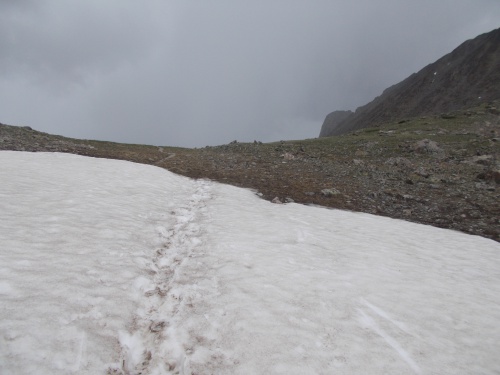
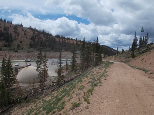
June 28: It was a miserable night--cold and wet. By morning, the rain had stopped and it was partly cloudy. Most of the hail on the ground had melted, but not all of it. The surrounding mountains looked like they were covered with a fresh, light layer of snow, but I assumed it was more hail that hadn't melted at the higher elevation. Later in the day, when I caught up with other hikers who had camped at higher elevations, they reported that it was actual snow rather than just hail.

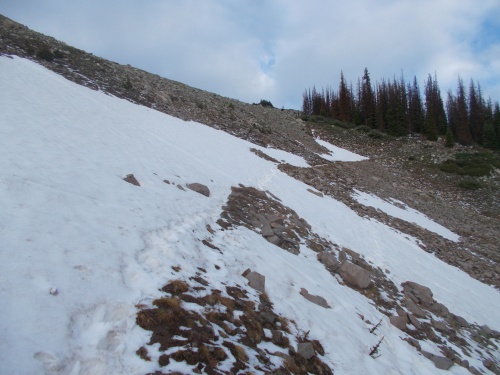
There was a bit of snow heading up to higher elevations!

It took me a bit longer to eat breakfast and break up camp, dealing with all the water intrusion problems and all, but I still got on the trail and hiking by 7:00am. I didn't want to linger too long since weather forecasts predicted on-and-off rain all day. I wanted to take advantage of the nicer weather at the moment while I could!

It was less than a half-hour later when I reached Cramps. I could tell that he had broken down camp and he appeared to be fiddling with something in his pack and I wished him a good morning at which point I realized that I had caught him with his pants down. Literally. He was doing a poop. Oops! Sorry about that. I'll continue on.... He told me later that he realized he was taking a risk by doing the poop so close to the trail along an exposed area but had figured the likelihood of anyone passing that early in the morning was near zero. Yeah, well... 'Twas a risk that did not pay off! =)

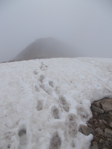
I pushed onward, rising in elevation and up to the light layer of snow. After going over the first pass, the trail descended back below the snow level, and when I reached a large bridge crossing a creek, I decided to stop and lay out my groundsheet and tarp to dry out in the sun while it was available. It wasn't long before another hiker arrived, Reality Check, who I had heard about but hadn't met until now. She stopped to dry out gear as well. Then Cramps soon arrived and joined the fun drying out gear as well.

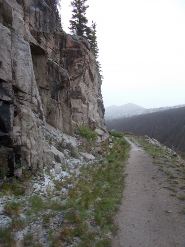
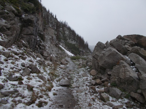
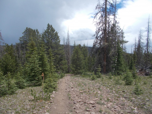
The scenery was absolutely gorgeous!

Outlaw also passed by, but he either didn't have any gear that needed drying or else didn't want to dry it then and only stopped for a couple of minutes to chat before continuing onward.

After about 15 minutes, my gear had largely dried and I packed up and headed out again. A couple of minutes later, I reached a gravel road and a decision: to take the Mirror Lake Alternate or stay on the main red-line CDT?

I decided to take the Mirror Lake Alternate. It was the low-level route, and given the chance of rain and storms later in the afternoon, I didn't want to be stuck on a high, exposed ridge. The views, allegedly, weren't as nice on the alternate, but--for me--safety is more important than a good view. Everyone else I talked to planned to stay on the main CDT, however, so it looked like I'd be hiking the alternate alone.

My path followed a gravel road over a 12,000-foot pass (and this is considered the "low" route!) before descending steeply down to Mirror Lake. The views were actually quite nice most of the way, and my biggest complaint was the dozens and dozens of ATVers that went by. Holy cow! Where did they all come from?! The people driving them were plenty fine and friendly, but the noise they created was a huge annoyance. Several of them stopped to chat and were shocked when they learned I had walked here from the Mexican border.

This gravel road was hugely popular with ATVers.

A bit past Mirror Lake, the route finally returned to a proper trail and the ATVs were no longer such a nuisance. Technically, there were still allowed even on the trail I followed, but motorized vehicles weren't allowed to be wider than about 30 inches or something which the ATVs didn't qualify for. Motorized bikes would have been allowed on the trail, but nobody seemed to be riding those--just the wide ATVs that couldn't go down this trail. I had peace and quiet again.

The trail climbed steeply again, heading toward another 12,000-or-so foot pass before descending yet again. This might have been the low-level route, but it certainly wasn't an easy route! By the time I reached the pass, dark clouds had swooped in and a thunderstorm seemed imminent. I picked up my pace. The trail leveled off near the top, but I wanted to start descending, and I was a little annoyed that the trail continued to stay so high for so long! I could feel little spits of rain in the air, just trying to wring moisture out of the air. I wanted to camp somewhere lower and better protected from the elements, so I pushed onward.

Finally the trail started descending, but then I ran into another obstacle in the form of blowdowns--a massively difficult blowdown with trees piled on top of other trees. My progress slowed to a crawl down the slope.

However, I noticed the trail switchbacked down the steep slope and by going off trail and directly down the hillside, I could reduce the amount of blowdowns I had to pass over. In some cases, the switchbacks were so tight and the trees so long, they often blocked the trail twice! The same tree, if I followed the trail, I'd have to climb over the same tree twice! Screw that.... I'll just cut down the hillside and not cross over the tree at all!

But it was still painfully slow and annoying. Fortunately, it didn't last more than about 15 minutes before I got through the worst of it and could continue hiking at a slightly fast pace since I could feel it sprinkling ever so lightly. It was only about 4:00 in the afternoon--a bit early to stop--but I didn't care. I wanted to set up camp and jump under my tarp while I was still mostly dry. I had already completed about 17 miles which was sufficient.

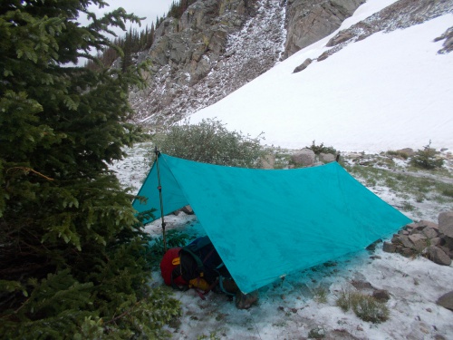
The trail reached Sanford Creek, where I filled up with water, then I followed the trail downstream until I found a good place to set up camp. Knowing rain was in the forecast, I paid close attention to where I could use trees to set up my tarp and make sure water wouldn't drain under the tarp, eventually settling on a slight slope just a couple of feet off the trail. It wasn't a designated campsite, but that didn't matter to me. What did matter was that I felt protected from the elements and that I shouldn't suffer from water intrusion problems.
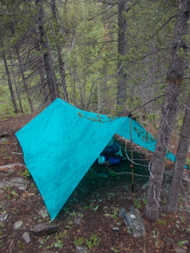
Setting up camp!

Within a half hour of setting up camp, it started to rain in earnest, but I was warm and dry under my tarp and didn't care at that point. =)

Another hour or two later, I was surprised when Skunkbear passed by my camp! I hadn't seen her since leaving Creede, and I would have sworn up and down that she had been somewhere ahead of me. There had been a brief lull in the rain when she passed by so she stopped a few minutes to chat and catch up, but she decided to push on a bit further to find a "nicer" place to camp. I couldn't blame her on that point. I had set up camp in a very unconventional location, on a bit of a slope, and I hadn't picked a location suitable for multiple people. I was just thinking about myself! As far as I had known, I was the only hiker on this alternate. But I was a bit sad to see her go. It would have been nice to have company during the night.

And that was that for the day. I read my Kindle, watched some Netflix, and just relaxed. Since I had set up camp at 4:00pm, I had plenty of time to rest and relax. It was kind of exhilarating to have so much time just to relax. =)


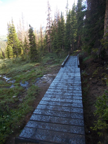
The boardwalks were slippery as snot! Definitely had to be careful walking across these. *nodding*
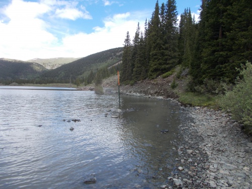
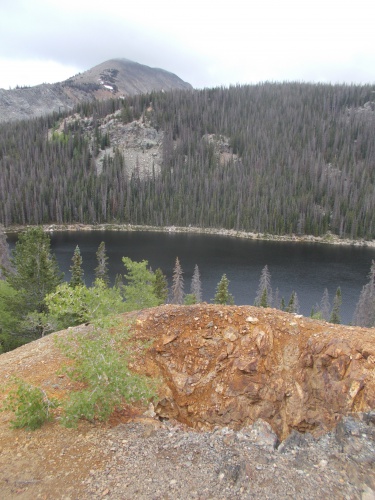


Mirror Lake

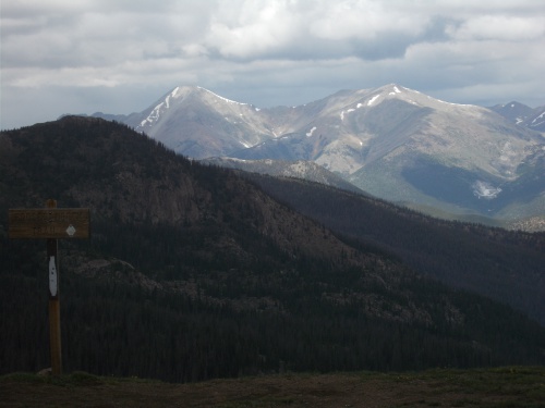
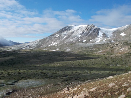
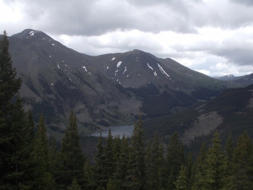
This is the view looking back toward Mirror Lake while nearing the second big pass on the Mirror Lake Alternate. The main CDT route largely followed the ridgeline of the mountains in the background.

Friday, March 18, 2022

Day 68: A brutal end to the day....

June 27: The weather forecast predicted decent weather in the morning and early afternoon but that rain and thunderstorms would strike late in the afternoon, so I planned to hit the trail early and hopefully knock out about 20 miles of hiking before the storm hit.

Out of Monarch Pass, the trail ran through this ski area.

I wanted to get a particularly early start, but I still needed to hitch a ride back to the trail. I thought about trying to leave as early as 5:00am, but I doubted there would be much traffic and who would pick me up when it was still dark outside? As much as I wanted an early start, there was no sense standing around in the cold for a couple of hours with no traffic driving by.

So I waited until about sunrise before heading out. I walked up to a busy junction where Highway 285 crossed Highway 50 and set my pack down to wait. I didn't stick out my thumb just yet, but only because there weren't any cars going by.

It was tempting just to take another zero day. Evenstar was expecting to get into town today, and Pez was already in town, but I had already had one zero day and this area is just expensive. Nope, can't let the grass be growing under my feet!

Every couple of minutes, a vehicle or two would drive by and I would dutifully stick out my thumb. Most of the time, they continued down Highway 285 (I was trying to get up Highway 50), but I'd stick out my thumb anyhow just in case they were planning to turn up toward Monarch Pass. I worried it might take awhile to get a ride given the low level of traffic this early in the morning, but fortunately, I only had to wait about 15 minutes before a truck pulled over and the driver asked where I was headed. "Monarch Pass," I answered.


"Hop in," he told me. "Just throw your pack in the back." I threw my pack in the back of the pick-up truck and got into the backseat of the vehicle which was occupied by two people: two mountain bikers on their way to Monarch Pass. They planned to do a long ride from Monarch Pass down to.... well, I'm not sure where, but they would follow a long section of the CDT. 

They told me that they had actually passed me earlier but had driven to the end of their bike ride to drop off another vehicle and had planned to pick me up on the way to Monarch Pass if I was still there trying to get a ride. So they had originally come with two vehicles and could make a largely downhill, one-way trip on their mountain bikes. Sweet!

At the pass, I thanked them for the ride and we parted ways. They were still pulling their mountain bikes out of their truck and getting set up while I headed across the highway and up the CDT.

The trail climbed steeply out of Monarch Pass, the skies were overcast and the thin air was cold, but there was no rain for which I was grateful. I pushed myself hard, wanting to knock out the 20-or-so miles I had wanted to get done before any storms arrived, but it was exhausting with my pack filled to the brim with food and water.

Near the high point of the day, the skies cleared up a bit and I got a bit of cheerful sunshine. It was great hiking weather, albeit a bit chilly! =)


It didn't last very long, however, and the clouds soon returned. The trail descended quite a bit, then started climbing toward the next pass--the second of the two passes I had hoped to get over today. I was about 20 seconds from the top when I heard the first thunder. Shoot! Of course! Wait until I'm at the high point! It was a very exposed location at the top of the pass--but at least it wasn't the top of a mountain. All the same, I wasn't particularly comfortable with this location in the thunderstorm. So close to the top.... I pushed onward.

Typically I like to take a break at the top of a pass. Admire the views, rest a bit, take some photos. I didn't stop this time, however, not in a thunderstorm. I wanted to descend the other side as quickly as possible!

The thunder only lasted about 15 minutes before taking a short rest, which gave me enough time to descend below tree level before the thunderstorm gained some steam and picked up again.

The trail had descended to an old railroad line that's now a hiking trail. I was excited about that--a rail-to-trail line is always flat, wide and easy! They're wonderful for walking, and I could move quickly. And I had no fear of lightning being down on these lower slopes surrounded by trees.

Soon hail started falling. A heavy hail, that begin to pile up on the trail like snow. I pulled out my umbrella and pushed onward. Near the trailhead for the rail-to-trail line, it warned that camping wasn't allowed in that area so my plan was to find somewhere to camp near the end of the rail-to-trail section a couple of miles away. At this point, I would have been happy to stop anywhere. I had made it over the two passes that I wanted to complete today and now that the weather was turning bad, I planned to stop at the first good site I could find. I just had to find the good site....

The last few miles of the day followed this old rail-to-trail system. You can see the hail started to collect at this point, but it hadn't gotten very bad. Not yet, at least....

I passed a few Colorado Trail thru-hikers heading southbound along the route. Until now, I typically only saw one or two of them in a day, but today it seemed like I passed a half-dozen of them. They were starting to get thicker! One of the hikers I found curled nearly in a fetal position under a tree with a bright red raincoat trying to stay out of the hail. He didn't look particularly comfortable, but told me he was fine and hoping for a break in the weather before looking for a place to camp. I wished him well and told him about potential campsites further in his direction, and he told me that there was space to camp near where the CDT left the rail-to-trail section. Sweet!

The hike became brutally cold as the hail continued. I walked quickly both to get to camp sooner and just to help keep me a bit warmer.

I finally reached the end of the rail-to-trail section where the CDT turned off and went up a steep hillside. Looking around, I didn't see any great places to camp. The ground was completely covered with hail, and the only flat place to set up camp was directly on the rail-to-trail which is compacted ground that's difficult to drive stakes into. Plus, the trees were too far off the trail to use them effectively for setting up my tarp. It was not an ideal situation.

But continuing further up the trail seemed like a bad idea as well. The steep slope led to higher and more-exposed locations. According to my maps, it would rise about 500 feet and cross over two more exposed passes.

So I reluctantly tried to make the best of a bad situation and began to set up camp right there on a pullout of the rail-to-trail. There was a tree I could use to anchor one end of my tarp, but I struggled to get the stake on the other side to hold my tarp up.

And the hail on the ground was problematic. It had turned into the consistency of a slushy, miserably cold and wet. Both of which were major problems for me since my groundsheet was no longer waterproof and I had no pad to sleep on.

This might be my worst night on the trail....

It might surprise you, but not having a waterproof groundsheet generally wasn't a big problem for me--even when it rains--because there's typically not much water on the ground between the surface of the ground and my groundsheet. My groundsheet would get wet, but it didn't get soaked. It was a minor inconvenience when I set up camp on wet ground, but once the tarp was up so new water wasn't being added to the ground and my body heat could work its magic, I'd often wake up the morning completely dry.

But this slushy-like hail just pooled water. Ice-cold water, no less! The hail that did melt couldn't drain properly since it was held in place by the unmelted hail. And without even a pad to sleep on, there was no way for me to escape it. It was a miserably cold and wet night.

I did throw pull out a couple of extra small trash bags I carried which I laid out under me like a groundsheet, and threw my pack over it for a little insulation, but it was miserable. Absolutely and utterly miserable. In hindsight, I wished I had stopped to set up camp somewhere near the trailhead--even if it was technically not allowed. If only I had managed to set up camp before the hail, I'd be totally fine. Stupid hail!

The thick layer of hail had formed a slushy-like substance that I was in absolutely no way prepared to sleep on! It would be the main cause for a miserable night in camp.

I was surprised when a few other hikers passed me a bit later in camp: Cramps, Blitz, and the hiking duo of Tick and Tock. I figured they'd probably set up camp somewhere nearby, but they all pushed onward, up to higher and more exposed locations. Where did they plan to camp?! I didn't know, but it wasn't my problem. =)

The hail and rain finally stopped shortly after I set up camp, but it was still brutally cold out and I had no way to keep dry and toasty warm camped on a slushy. So I spent most of the evening rubbing my hands together and shivering while trying to stay warm. Argh!

How can a day start so well and end so poorly?!


Occasionally, I still had to pass over small patches of snow across the trail, but none of them were particularly scary or problematic.


Bear Lake


Marmot!

This was the pass where I started hearing lightning mere seconds before reaching the top!

Then a brief window of nice weather shortly after descending the other side.

And then the hail started in earnest....

Wednesday, March 16, 2022

Day 67: The Salida Zero

June 26: I didn't plan to take a zero day, but when I saw the weather forecast called for "rain throughout the day," a zero day sounded especially appealing. I checked in with the front desk to inquire about extending the stay in the room by a day. It wasn't particularly cheap, but I'd pay extra if it meant I didn't have to hike in "rain throughout the day." The clerk working the desk was from Poland as well, so I got to try out a little Polish on her. She didn't seem particularly amused at my skills, though. Most Polish people I meet are shocked and delighted that I've been trying to learn their language.

Amanda took off, ready to head back to work, and left at 5:00 in the morning. Unfortunately for me, she took my laptop with her. It's not like I could carry that giant thing with me on the trail. My smaller laptop which I mail from town to town was already on its way to Leadville. Had I realized yesterday when I forwarded the package that I'd be taking a zero day today, I would have kept it and done some work, then mailed it out later this afternoon.

So once again, I was stuck in town without a laptop, but I could watch videos and surf the web with my phone--so at least I had that. And I spent most of the day just playing with my phone.


Late in the morning, I got a text from Pez saying that he had arrived in town, and when he texted again later saying that he was at the Walmart resupplying, I walked over to meet up with him for a bit. It was the first time we had seen each other since way back in Grants! He'd been far ahead of me almost the entire time, but I got a day ahead of him when I took the Creede Cut-off and he did not. 

I still kept in touch with Evenstar as well who expected to arrive into Salida tomorrow. She hoped we'd cross paths in town, but I wanted to get an early start to the day's hike tomorrow. Rain wasn't expected in the morning, but the afternoon was supposed to have rain and thunder. I hoped to complete the bulk of the day's hike before that happened which meant an early start. But Evenstar wasn't far behind me and I wasn't planning to rush down the trail so I still hoped she'd catch up soon.

At the Walmart, I ran into all sorts of other hikers! Most of them I knew in varying degrees including Sweet Tooth, Bugs, Outlaw, Cramps and Blitz. Others I didn't know at all (whose names I won't mention here because I don't remember them anymore).

Pez seemed most impressed with my beard and the hair on my head. "You were bald!" he accused me. "I barely recognize you!" I don't know why he was so surprised, though. I mentioned way back when we met on our first days on the trail together that I had shaved my head bald. 

His whiskers didn't grow in as thickly as mine, but they were definitely there as well. =)

Afterward, I started walking back to the motel to call it a day, but I only made it about half way when a pickup truck piled with thru-hikers pulled over and offered me a ride. They had offered me a ride from the Walmart but I turned them down. This was my one and only time to get out and stretch my legs for the day! But it was, admittedly, a pretty miserable road walk back to the motel and I caved in this time when they offered the ride. They had borrowed a pickup truck from the hostel they were staying, and on a rainy day like this, that's a valuable service indeed!

And the rest of the day I just watched videos on my phone again. All-in-all, kind of a boring day. BUT! I didn't have to hike in the rain which did look bad much of the day and I'm sure was even worse high up on Monarch Pass. =)

The pictures today are just random photos from other days on the trail because I took absolutely zero photos today! =)


Monday, March 14, 2022

Day 66: Monarch Pass and Salida

June 25: During the night, water froze on the rental car so Amanda had to defrost the windows before she could leave. I wasn't restricted by frozen windows, however, and got my earliest start to the day's hike yet and was on the trail and hiking at 5:45am. I had several reasons for such an early start.

First, there's the weather. Although the morning was frightfully cold, the weather was good. It was not expected to stay that way, however, with rain and thunderstorms expected in the afternoon. 


And second, my goal was to hike all the way out to Monarch Pass where Amanda could pick me up again from an easily-accessible location that the rental car could reach, but it was about 26 miles away. It would be my longest day yet! And unlike my other 20+ mile days that were largely over flat and easy terrain, today would be anything but flat or easy. 

And finally... I needed to make it to the post office before they closed for the day. My package with the laptop was there. I had given my ID and the receipt with the tracking information to Amanda in the hopes that she could go in and pick up the package yesterday, but they rejected it saying that only I could do it. I gave her my ID and tracking information just again and asked if she could check if they would at least forward the package for me to pick up later so at least things wouldn't be so time-critical, but I wouldn't know if that succeeded until after I reached Monarch Pass. I had to assume that it wouldn't work.

So I had a lot of reasons to start hiking even before the sun properly rose, but I still needed to take photos for Walking 4 Fun (and this blog) which limited just how early I could start. Fortunately, it was June 25th--not the longest day of the year, but pretty close to it!

I would also be slackpacking once again which would definitely help me move fast and efficiently.

From the car, I decided return to the CDT by passing near Soldierstone. Maybe get some photos of it in the morning sunlight. So I did then, then charged down the trail pretty much non-stop the entire way.

Soldierstone at sunrise
 

I took only three 5-minute breaks to eat a few snacks the entire distance. The first half of the hike was clear and sunny, but as expected, dark clouds threatened during the afternoon. A few drops of rain fell and I could hear thunder echoing through the mountains in the distance, and I all but ran down the trail! Fortunately, the thunder never approached closely and the rain never amounted to much. My biggest inconvenience was the brutally cold windchill, but hiking fast helped keep me warm.

The scenery was spectacular, especially along the high ridges above treeline, and I passed--for me--a noteworthy junction that marked the two route options toward the north for Colorado Trail thru-hikers. The trail splits there and many people hike that section as a loop, called the Collegiate Loop. When I hiked the CT, I took the eastern route, but now that I'm on the CDT, I wanted to take the western route to hit some new trail and new scenery. So although I was still on the Colorado Trail, it was a section of the trail that I had never done before. I looked down the steep slope where the other trail snaked off and remembered the slog getting up that hill from my CT hike. Memories.... But once I passed that junction, I was on new trail. I couldn't be entirely certain what would be ahead for the next few days.

But I didn't stop to rest and reminisce. I just didn't have time for that. I had to reminisce on the go!


I eventually made it to Monarch Pass, visible long before I arrived and obvious from the gondola going up the pass. And I managed to make it there just a few minutes after 3:00pm! It was a shocking distance to cover in such a short period of time over such rough terrain--even by my standards!, and I was quite proud of it. I'd never have made it that quickly with a full pack on, though. 

Amanda was already at the pass and told me that her visit to the post office had failed and that my package was still stuck there, but I had arrived with plenty of time to spare. It was a good half-hour drive into Salida from the pass, but I should have no trouble making it there before the post office closed for the day--thank goodness!

There's a gift shop and restaurant at the pass along with the gondola, so I stopped to use the rest rooms and take a quick look around but bought nothing.

The trail passed by the gondola at Monarch Pass. I didn't ride it, but Amanda had time to while she was waiting for me.

Then we jumped into the car and headed to Salida. Amanda told me about riding the gondola while waiting for me, as well as giving rides to a few other thru-hikers who were trying to hitch into Salida. Pretty much all CDT thru-hikers hitch into Salida to resupply from here. Amanda was a bit disappointed that they weren't so interested in all the snacks and drinks she had bought to give out as trail magic, though. With the restaurant and plenty of snacks at the pass, the main thing that hikers wanted was a ride into town. They just didn't need food. So Amanda wound up giving two or three of them a ride into town. There were others who also needed rides but she couldn't fit them all into her rental car with all the camping gear and trail magic still packed inside. When she returned to the pass, the other hikers were gone--presumably having found other rides into town.

So we drove on to the post office where my package was waiting for me. But I also didn't need the package. Amanda had brought my nice laptop from Seattle, so I didn't need the smaller, older model in the package, and I asked them to forward the package to the next trail town in Leadville.

This package was getting quite the tour of Colorado post offices.... It started in Pagosa Springs, went to Creede, then was forwarded here to Salida and was now being forwarded on to Leadville. And the last time I actually used the laptop that was inside the package was way back in Chama!

I was sure we would end up camping tonight since lodging was so expensive and most places were completely full, but Amanda had found a hotel for the night saying that she needed a shower before she left. She'd be leaving first thing in the morning to go back to work, so the plan was that she'd drop me off back at Monarch Pass near sunrise. My slackpacking days were over for now. The hotel room was still a bit on the expensive side, but at least it wasn't over $200/night which is what I was afraid would happen.

We stopped at Red Truck Pizza for dinner and I resupplied at the Walmart before calling it a night. I only had two days of trail dirt on me--practically still clean!--but I took a shower anyhow. It would, I knew, be my last one for awhile.....


This is one of the very few AT-style shelters you'll find along the CDT.

We're definitely not at the Mexican border anymore....

Monarch Pass

Made it about 26 miles to Monarch Pass by 3:00pm! It's amazing how fast I could go without a full pack!

Friday, March 11, 2022

Day 65: Soldierstone

June 24: With Amanda around, I wanted to take advantage of slackpacking opportunities as much as possible. The problem, however, was that there weren't a lot of locations along the trail where Amanda's rental car could reach. Pouring over maps and trailheads, however, it looked like we could meet up at Sargents Mesa a little over 20 miles up the trail. The risk, however, was that there was a blowdown or the road was too rough for a low-clearance vehicle. We had actually stopped at a visitor center yesterday to inquire about the road and the woman judged as a definite maybe. Not really recommended, but probably doable if Amanda drives slowly and carefully.


So my plan was to slackpack there. However, on the chance that Amanda was unable to drive up to the location, I'd start hiking down the gravel road in the direction that she was supposed to drive and just keep walking until I found as far as she could drive. Hopefully it wouldn't be far out of my way. Worst-case scenario, it could add an extra ten miles to my day's hike! But ideally, she'd meet me at Sargents Mesa and we'd just camp out at the trailhead there. Lodging in town was super expensive (well over $100/night) so camping for free at a trailhead seemed like a much better option.

To get the necessary mileage and give myself plenty of time to hike out in the event Amanda couldn't reach the trailhead, we woke up at 5:00am with the hope of starting my hike at Cottonwood Pass by 6:00am, but we missed that goal by about 15 minutes. Not the end of the world, though!

The trail was rugged with lots of ups and downs, but I made good time without a full pack on. An hour or two into the day's hike, I surprised Moonshine doing a poop. She called out to me before I saw anything and asked for me not to go any further until she finished her business, so I took the opportunity for a short break and a couple of minutes later, Moonshine was done and I continued hiking. She was sure that there weren't any other hikers behind her--at least not nearby--but hadn't expected someone like me coming in from Cottonwood Pass or hiking so fast!

The day started clear and beautiful! It wouldn't stay that way, though....
 

I'd never met Moonshine before, so we made quick introductions, but I soon outpaced her with my near-empty pack.

I also passed a Colorado Trail thru-hiker heading southbound who reported passing about 40 CDT hikers heading northbound in the last couple of days. Forty?! Where are they all?! I'm lucky to see just one or two each day!

Later in the afternoon, dark clouds started rolling in. Then came the storm. Rain! Thunder! Lightning! BOOM! Crash! BOOM! The worst of the storm seemed to be just a mile or two ahead of me, up on Sargents Mesa. I wondered if Amanda was enjoying the show. The rain, fortunately, stayed rather light for me and only hit me the last mile or so before reaching the trailhead.

The CDT doesn't pass directly by the trailhead. The trailhead was actually located maybe a quarter-mile off trail, but when I saw a small portable cooler with trail magic at the junction to the trailhead, I knew Amanda had made it and was at the trailhead. Yes! I had been a bit concerned that the vehicle might not make it and I'd have to hike who-knows how far back down the road.

When I found this cooler of trail magic at the junction with the CDT, I knew Amanda had successfully made the journey up the gravel road. That's the candy bar and two peanut butter cups I took out to eat during my walk to the trailhead. =)
 

I grabbed a candy bar and peanut butter cups out of the trail magic to eat right away but didn't linger long. I knew the car would have plenty more trail magic that Amanda couldn't (and wouldn't) hike up to the trail carrying.

I soon arrived at the car and quickly jumped into the passenger seat to get out of the rain. Amanda told me that the road up wasn't bad, but the hike to the CDT with the trail magic was a terrifying adventure since the thunderstorm came in heavy at the very point where she was most exposed. She said she took shelter by a log, lightning crashing nearby and even included a hard hail just to add insult to injury. And carrying a heavy cooler up the steep trail.

"I texted you to pick up the trail magic when you came down," she told me, "because I'm definitely not going back up to get it." I hadn't picked up the trail magic, though. It was still at the junction. In fact, I didn't even get a cell phone signal up here.

"No cell phone signal," I told her, pointing at my phone. Somewhat surprisingly, she actually did have a signal. Usually I'm the one who had a signal and she did not. "But don't worry, I'll go back and get it after the storm passes."

I also knew that Moonshine was behind me somewhere and would likely pass by at some point. She might want some of the trail magic. Although if it was still raining and miserable out, she might just decide to pass by it. It was in a pretty exposed location. There might be other hikers behind me that I didn't know about as well, and it was also possible that southbound Colorado Trail hikers could still pass by. So I was content leaving the cooler there for now.

Amanda also told me about Soldierstone. We were at the trailhead for this wonderful and amazing monument. I had passed by it during my Colorado Trail thru-hike completely oblivious to its existence and kicked myself for missing it when I was in the area. This time, I came with the knowledge of the place's existence. I wasn't going to miss it again. It was also another reason I encouraged Amanda to drive out to this remote trailhead: I thought she might find it interesting as well.

Soldierstone
 

So what is Soldierstone? It's a memorial for our allies in Indochina during the 30 years after WWII. There are memorials for our killed and wounded soldiers all over the place, for every war and battle the US ever participated in, but this was the first memorial I ever heard of that wasn't to honor our own soldiers, but rather those of our allies which--to me--makes it an unusually interesting monument.

And it's a little bit of a secret monument as well. It was created on the down-low, and the people who built it required that no signs or anything mark the location, and they didn't want it showing up on maps or pretty much anywhere. It was meant to be largely shared via word-of-mouth among vets.

Of course, this was before the days of the Internet. The Internet kind of outted the monument, but it's still a relatively unknown and hidden monument. No road signs mark the route, and even now, a search for Soldierstone on Google Maps just redirects to "Sargents Mesa". It won't show the precise location of Soldierstone--even though Google clearly knows about its existence.

If you'd like to read more about the monument, I'd recommend checking out The Story of Soldierstone which has a good write-up about the place.

Although I knew the monument was on Sargents Meas near the Colorado Trail and CDT, I poured over satellite imagery trying to figure out its precise location using what little information I could find about the place before heading out here. I didn't want to miss it a second time!

So Amanda had checked out Soldierstone first when she arrived and took a few photos before carrying the trail magic up to the trail and getting bombarded by the storm, and she shared those photos with me pointing out the direction of the monument.

Eventually, the storm had lightened up. Dark clouds were still in the sky, but the thunder and lightning had long since passed and the hail and rain stopped. Pockets of sun even peaked out! I took the opportunity to check out Soldierstone, but Amanda chose to wait in the car while I did my explorations.

The main part of the monument is a large block inscribed with words from various languages that our allies used, and a few ammo cans surrounded it with trinkets like old photos, miniature American flags, a few bullets and so forth.

It's a touching experience, and I had it all to myself.

Surrounding the main block were two or three dozen small plaques spaced seemingly at random around it. They were flat to the ground and required a bit of searching of find. Some were inscribed with a quote in English, but most were in foreign languages that I couldn't understand. Amanda and I did pick up a small booklet of sorts from the ranger station that had translations of each of the plaques, but I had left that in the car. I could look through it later.

I returned to the rental car for a bit, but as sunset approached, I walked back to the CDT junction to pick up the trail magic. Tomorrow I'd have an even longer day of hiking than today, and I knew I wouldn't want to take the time to pick it up in the morning before starting the day's hike. Nope, it was best to retrieve the cooler now.

And I was really surprised at how heavy and awkward it was to carry back down to the car! I had to give Amanda props for hauling that thing UP hill and leaving it there. All during a thunder and hail storm! Hard core!

I stopped to eat some of the grapes, another candy bar, and downed one of the sodas to make the load lighter, then carried the rest down to the car.

Amanda asked if any of the passing hikers had helped themselves, but I couldn't really tell. If they did, they hadn't taken or eaten very much. And there was only one person that I was certain had passed by.

Amanda seemed a little disappointed that she bought so much stuff to hand out as trail magic but had seen so few hikers along the trail.

"Well, look up! You still have more time to do some trail magicking!" =)

I had originally wanted to camp on the flat ground outside of the car, but it started raining again and it just seemed drier and warmer inside the car than out, so we decided just to sleep in the driver and passenger seats of the car for the night.

To occupy ourselves, Amanda played on her phone a bit while I read my Kindle. There wasn't much I could do with my phone without a signal, but later we watched a movie that I had downloaded from Netflix. (Fools Rush In, if you must know.)

And thus ended my 65th day on the trail.....


There is logging along parts of the trail.


That's Sargents Mesa up ahead! And my destination for the day!