Friday, June 17, 2022

Day 107: Llamas on the trail!

August 5: The morning was surprisingly warm. I had expected it to be quite cool given the relatively high altitude, but maybe the overhanging tree helped block in the heat around my campsite. In any case, it was surprisingly warm and I woke up completely free of condensation. It was a bit dark under the trees, but once I started hiking and got out from under it, it was fine.

The trail immediately headed steeply uphill toward Texas Pass, but it was the downhill side that I found troublesome. It seemed to shoot straight downhill without barely a switchback, and the trail was made of lots of loose gravel. I took baby steps down, slowly and carefully, and was glad when I finally reached the lake at the bottom.

There was a small bit of snow at the top of Texas Pass! Come on, man! It's August already! Why is there still snow on the ground?!

Also at the bottom, I spotted two llamas tied up in some grass. Llamas! Did Captain Jack and his friends rent some more?! No, they were behind me having gotten off the trail at South Pass City to resupply. I doubted thru-hiker rented these llamas at all. They probably were brought out by people who were out for a few days or a week or something. A large tent was set up nearby which I assumed probably held the llamas owners, but nobody was out and about to ask about the llamas so I just waved at them and continued onward. 
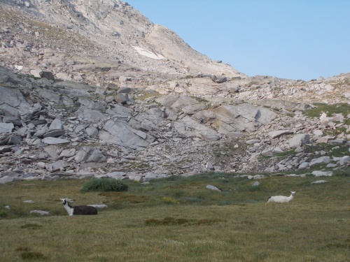
See the two llamas?

After that, the trail was mostly flat, over rolling hills. No steep climbs or drops. I had trouble following the trail a bit when I reached another lake. It was filled with social trails to all sorts of campsites and it was often challenging figuring out which path was the real trail. At one point, I walked up on a group of three campers and chatted with them for a couple of minutes asking if I was still headed in the correct direction, but even they weren't certain. They didn't seem too bothered with my intrusion, though, and were more fascinated about my hike. "You hiked in all the way from Mexico?!" Yep.

A few hours later, the Cirque of the Towers alternate route linked back with the red-line CDT and the hoards of people on the trail finally went away. The scenery was still gorgeous, but not nearly as dramatic as the sharp peaks along the alternate.

Coming in the opposite direction, however, the number of southbound thru-hikers continued to grow. Today I had 9 confirmed sightings when I stopped to chat and learned that they were definitely thru-hikers. In addition, there were 4 others that gave off that thru-hiker vibe, but we didn't stop to chat so those are just unconfirmed sightings. I had stopped to chat with every south-bounder I met, but I realized today that that was becoming unworkable. There were just too many of them passing by now!

They reported equally large numbers of north-bounders ahead of me as well. Actually, their reports were much higher than mine. Some of them said that they had counted over 50 north-bounders in the last couple of days. Which is oddly weird as I was one of them but hadn't seen any at all for two days now. From my point of view, north-bounders seemed like an extinct species and I was the last of its kind.

Early in the afternoon I had stopped for lunch and Little Red Riding Hood, or Red for short, caught up with me. She had camped somewhere near Lonesome Lake the night before so probably hadn't been far behind me all day. We wound up walking together for a couple of hours and chatting, during which I learned that she was interested in setting some FKTs (Fastest Known Times) for the PCT. Particularly, she had her eye on the Washington state section since she lived in Seattle.

"Wait! Really? Because the guy who has the FKT for Washington state is just a day or two behind me!"

Or at least he claimed to have the FKT for Washington. It's not like I tried verifying the information he told me anything, but I didn't have any reason to doubt his sincerity either. Then I started wondering if there was an "FKT club" for people to share suggestions and thoughts or compare notes. Or do they keep all their tricks for getting in huge miles each day secret so they might have more of an edge?

She just really likes traveling far and fast. On the PCT, she told me, she'd make bets with people and if she lost, she'd have to hike 20+ miles backwards on the trail, then catch up with her friends again. And each time she'd lose a bet, the distances would get longer and longer, although she said that she finally drew the line at over 50 miles.

I found this hilarious and crazy but oddly wonderful at the same time. She wasn't even trying to set any records--just doing long days because she liked it, I guess. She'd even done a couple of 60+ mile days along the way--which is nearly double the longest day I've ever done in my entire life. It was very interesting.

I also made sure to get her photo. If she starts setting FKT records all over the place and becomes one of those famous hikers, I wanted a photo to prove that I met her "before she was famous." I had actually met Anish during my first AT thru-hike, but she wasn't famous then. It wouldn't be until years later that she'd set new FKT records for the Pacific Crest Trail, the Appalachian Trail and the Arizona Trail and write a couple of books and give lots of speeches and featured in all sorts of hiking magazines. But I never thought to get a photo of her then and still don't have a photo of her on the trail. (Not that there aren't a billion of them already posted online, but none of them are my photos!) 

Anyhow, I said I wanted a photo of her in case she ever became as famous as Anish. I wanted proof that we had met, even if she doesn't remember. I did later see Anish at one of her talks, but she didn't actually remember meeting me. We had only chatted for about 5 minutes on the AT, though, passing me on the trail like I was standing still. I didn't really expect her to remember me. The only reason I remember her was because she was already hiking unusually long distances and it blew my mind when she told me her start date. We also crossed paths in the middle of the night on both of our second AT hikes, but in the darkness, I hadn't known it was her until long after she had passed by. But I digress....
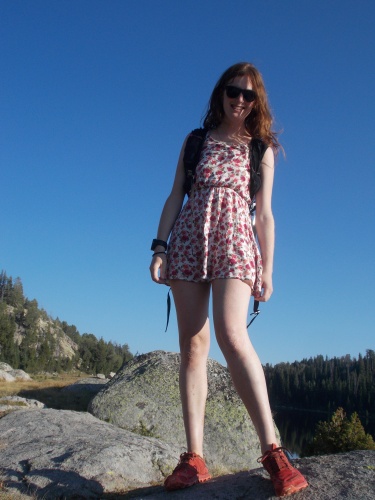
 

Little Red Riding Hood

I also asked her about her trailname. When I first met her, I had assumed she was called Little Red Riding Hood because of her red hair, but then she also had bright red shoes and just a lot of red gear in general. The actual answer turned out to be a more involved story that had nothing to do with the color red, although the specific details have long slipped my mind and I failed to write them in my journal.

We took a break by Sandpoint Lake. Red decided to take a dip in the lake, but I passed saying that the water was too cold. It just proved my point when I heard a splash and then her blood-curdling scream as she entered the water. It didn't sound pleasant, but after getting back out, she assured me that it felt great.

We wound up not continuing and set up camp near the edge of the lake, along with a couple of hikers who were out for a couple of weeks from Minnesota. Later in the afternoon, a northbound hiker caught up with us, Foxy, whose name I remembered seeing in registers before but I'd never actually met until now. She also had red hair, which is how she wound up with the trail name Foxy. Red like a fox. She was also young and quite pretty, so I imagine "Foxy" could have a double-meaning as well, but the official story was that her hair was red like a fox.

Later I joked that that works well because when she's old and has grey hair, she can still call herself Foxy--she'd just be a grey fox instead of a red fox. =) 

The trail seemed surprisingly packed with red-headed women today.

I considered hiking on a bit further. Initially when I started the day, I planned to go further, but I enjoyed the company of other people and just didn't want to go on and camp alone. I'd been feeling a bit lonely out here and it was nice having a few other people around. Not the hoards of people at Lonesome Lake, though. That's a bit too much! So I decided to stop and camp with the other four hikers nearby.

And thus ended another day on the trail.....


Looking back in the direction of Jackass Pass


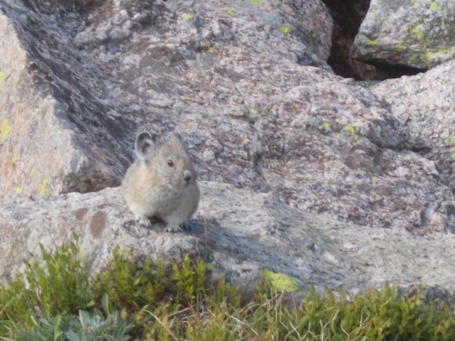
Pika!

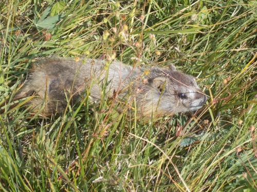
Marmot!


The late afternoon brought in some ugly clouds.

Wednesday, June 15, 2022

Day 106: Cirque of the Towers

August 4: I was up and hiking by 6:30am. The morning was surprisingly chilly and condensation was a small issue, but I still found it surprising how dark it was so late in the morning. At least it gave me more time to sleep in during the mornings.

It wasn't long before I reached the Bad Blowdowns. Hundreds of fallen trees had fallen over, and my progress slowed to a crawl as I bushwhacked around and through them. It didn't take long before I lost the trail completely and just had to follow my GPS tracks.

Today, the blowdowns would be bad. Very, very bad, and it was just beginning!
 

Almost immediately, I ran into two other CDT hikers, a couple of south-bounders! They said they were from Switzerland so I wished them a good morning in Swiss-German ("Gwita morka!") and compared trail notes.

I assured them that they were almost out of the really bad blowdowns, but they assured me of the complete opposite--I still had a long way to go. They had come up from the Cirque of the Towers alternate, and cut the corner where the CDT normally intersects with the alternate. 

This was the same alternate that the hiker I met in Rawlins made me swear to take before he let go of me, and I had every intention of doing just that. By all accounts, the main red-line route was essentially impassible. One Guthook comment I read left by a south-bounder was pretty amusing. He'd read the comments from the north-bounders and figured we didn't really "know" what we were talking about. They had seen some pretty bad blowdowns in Montana and figured this couldn't be any worse than they had in Montana, but this south-bounder who tried it anyhow admitted to being "humbled" and urged his fellow south-bounders not to dismiss the warnings. They were real. It was bad. It would rip up your legs and could take you all day to go 5 miles. It was dangerous and to be avoided, and he had learned his lesson the hard way, but that they could learn from his mistakes.

However... the alternate didn't avoid all of the bad blowdowns. I was still in the middle of it, after all. But some hikers had noticed the alternate intersects with the CDT at a right angle, and it was possible just to bushwhack cross-country between the two trails making the overall route a bit shorter. The blowdowns were still bad, but there was less that would have to be traversed. And my new Swiss friends informed me that someone had actually set up small, rock cairns along this alternate of the alternate. They were only a few inches tall, however, so you really had to keep your eyes open for them and they'd help get around the worst of the blowdowns.

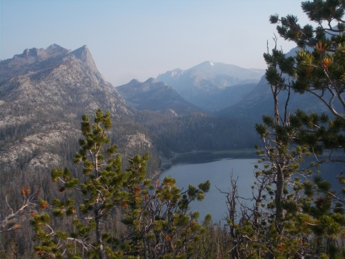
The trail for the Cirque of the Towers alternate was along the left side of that lake. And in this case, the best way to it was directly down this mountain and cross-country through the trees.
 

So we parted ways, and I started following the small cairns down a steep hillside filled with blowdowns. Through gaps in the trees, I could see a lake near the bottom of a valley, and I knew the Cirque of the Towers trail passed by the left side of it, so I just had to aim toward the lake.

It probably took me over an hour, but I finally reached the edge of the lake and largely got out of the blowdowns. I still needed to bushwhack a bit around the edge of the lake to the other side then find the trail there, but I was able to move a little faster now. Just a little, though. You can't go fast where there is no trail.

There were some muddy areas with stagnant water that I had to get around, and I had to backtrack a couple of times when I followed social trails to dead ends where found myself surrounded with impossible-to-pass boulders, but eventually I made it around and found the actual trail again. It was a time to rejoice! The worst was finally behind me!

Or so I thought....

Once I hit the bottom of the valley, the blowdowns largely stopped and the route became a bit easier.
 

I took a break near a creek at around lunchtime. Ate some food, rested, and I rinsed my socks with the creek water. I didn't wash my socks--I never do that on the trail--but my socks had been feeling sticky and gross and I figured a good rinse would do them well. They were wet afterwards, but it felt like pure bliss after that. What a different just a rinse can do. I went ahead and soaked my feet in the creek as well since my socks were going to be wet anyhow.

The trail largely followed a pretty creek upstream. At first it was easy going, heading steadily uphill, but continued to grow steeper and steeper the further I went, eventually crossing over a big pass before the trail crashed steeply downhill into the next valley.

Later in the afternoon, I passed another south-bound CDT hiker. Three in one day! They were getting thick now! We stopped to chat for a few minutes. Mostly, she had concerns about how the trail looked up ahead after hearing all the same horror stories that I had, and I told her that yes, it was as bad as described, but fortunately the really bad stuff was pretty short if she took the same cutoff by the lake that I did and followed the little cairns.

Her name was Sprout--the third Spout I'd now met on the CDT. Then she told me that she was running a bit low on food, having only a day's worth left, and was trying to make it to the next town before she ran out completely. I wasn't sure she'd be able to make it to town in just one day. It might be possible, but it would be a challenge. I did, however, have plenty of food and even a little extra and offered to give her some.

For some reason I still don't quite understand, I had grabbed a package of mashed potatoes from the hiker box in South Pass City which I didn't really need. I think I grabbed it under the theory that it was better to have too much food than not enough, but now that the really bad section of blowdowns was behind me, I was less concerned about the extra food and heavy weight. And I also had an extra bag of Skittles that I really didn't need. Between the two, I probably lightened my load by a whole pound, which pleased me greatly.

Sprout seemed a little concerned. "Are you sure you don't need this?" 

"Definitely!" I assured her. "You'd be doing me a favor and lightening my load by taking them off my hands. I have plenty of food still to get me to the next town."

Then we continued on our separate ways.

This alternate route was truly spectacular! Difficult, but spectacular!
 

Near Big Sandy Lake, the trail must have approached near a trailhead because the number of weekend backpackers absolutely exploded! It seemed like there were hundreds of people around, but it probably was no more than a few dozen. By my standards, however, it felt pretty crowded.

At one intersection, I noticed a woman coming up a side trail. She had a total thru-hiker look about her: an extremely small and light pack, seemingly hiking alone and wearing a short skirt which didn't seem like the traditional gear most weekenders would wear or could be purchased at an REI. The only reason I had my doubts if she was a thru-hiker was the fact that she was coming in from the wrong direction. A north-bounder like me would be coming up from behind me on the trail, and a south-bounder would have been coming toward me from the trail on the right, not the one on the left that she was following. Unless, perhaps, she had taken a wrong turn and was returning to the trail?

I wasn't sure, but I didn't worry about it too much either way. When she reached the trail, she turned north-bound on the CDT, the same direction I was heading, and we passed each other a couple of times as we both ascended the steep climb over Jackass Pass. She complained about being winded from the altitude. I complained about being winded because it was hard. =) But she flew over the trail much faster than I was hiking, but I would catch up when she stopped to chat with others we would pass on the trail.


Eventually, we started chatting with each other and she introduced herself as Little Red Riding Hood. She was not, in fact, thru-hiking the CDT, but my gut feeling about her being a thru-hiker held true in the sense that she had thru-hiked the PCT before. She had a thru-hiker look because she was a thru-hiker--just not currently thru-hiking. She had taken a few weeks off work to do a little backpacking, however, and wanted to go somewhere where there would be thru-hikers and heard this area of the CDT was pretty amazing.

She also had what sounded like a British accent so I asked where she was from. I was more than a little surprised when she told me Seattle.

"No way! So am I!"

So then we talked about Seattle a bit. =) I did ask about the accent, curious about how she ended up in Seattle, and she had spent a great deal of time in the United Kingdom. I don't remember all the nitty gritty details, but as I recall, I think she had some sort of duel citizenship, perhaps because one of her parents was American? I'm not really entirely sure about that, however, so don't quote me. She said that in England, however, they think she has an American accent. I guess her accent lies somewhere between the two, which seemed fitting given her situation.

Anyhow, we continued on at our own paces, and eventually she out-distanced me.

I finally made it up to the top of Jackass Pass--I love the name of that pass, btw. I might use it more often than is strictly necessary. ;o)

Jackass Pass, the name is real! I swear I didn't make it up! The climb up is a pain-in-the-jackass, though.
 

And found it a little disheartening to see the trail descend so steeply back down toward Lonesome Lake--which was anything but Lonesome. Signs said that camping within 1/4 mile of the lake shore was prohibited, but that didn't stop seemingly a hundred people from camping just outside that limit. And this time, it was not exaggeration. I didn't count all of the people in all of the campsites that I passed, but it would not surprise me if they numbered over a hundred.

Two people I passed told me that they were guides for a NOLS course and that there were NOLS participants all over the area. Last I had heard from Evenstar, she was taking a NOLS course and was heading to somewhere in Wyoming and on portions of the CDT. Once the course started, her cell phone was taken away. Against the rules (or something), so I hadn't gotten any updates for a couple of weeks, but it was quite likely that Evenstar was somewhere in the area so I tried searching the faces of all the groups I passed. 

I never did find her--it was kind of a long-shot anyhow--but she did text me later that she had run into a few CDT hikers during her NOLS course that she knew from earlier on the trail. Just not me!

I was hoping to camp with Little Red Riding Hood for some company in the morning. I figured she was probably camped somewhere around Lonesome Lake, but I never spotted her. Probably camped far enough off trail that I couldn't see her. Oh, well. Another night by myself wasn't the end of the world.

The hoards of people camped near the lake did bother me, however, so I followed the trail to the far side of the lake hoping it would be less crowded. Unfortunately, however, there weren't any campsites available that were a quarter-mile away from the shoreline. I really did want to follow the rules!

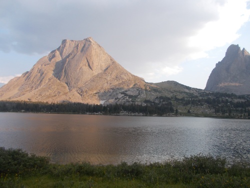
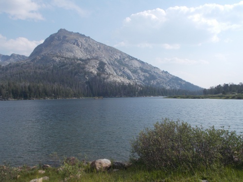
Lonesome Lake

So I kept following the trail where it left the lake, heading up toward another high, steep pass. I did not go far, however, before I found a small space between a tree and a boulder where I thought I could fit. I wasn't strictly certain that I was at least one-quarter mile from the shoreline, but it was probably close. I feared, however, if I kept going further, I might not find anywhere else available to camp. The hillside was just so darned steep! The only reason this tiny piece of ground was so flat was because it was behind a boulder that seemed to prevent erosion above it that caused it to level out, but the space was maybe six feet long and a few feet wide--about the size of a coffin, actually. I could make it work, though.

No rain was expected during the night so I didn't have to worry about setting up my tarp, and the branches of a large tree hung over the site which would probably protect me from condensation in the morning. It was a bit cramped, but it would do.

My goal for the day had been to do 20 miles, but I failed. I pulled a measly 18.1 miles according to my GPS, but I was completely exhausted and set up camp perhaps a half-hour before sunset. It was a tough day. Not just because it started off with all those blowdowns, but the terrain was far more rugged than I had anticipated. The steep ups and down and ups and downs. This alternate was listed on Guthook, but it didn't show the elevation profile of the trail so I hadn't realized how rugged the terrain really was. 

When I checked my GPS, I was astonished to see it had recorded about 5,000 feet of elevation gain and another 4,000 feet of downhill travel. That's a lot of elevation change in a single day. *nodding* And only in 18 miles, no less! But at long last, my day was finally over, and I was so ready for it to be over.

After sunset, I could see the headlamps of all the hikers camped on the other side of Lonesome Lake. Kind of like fireflies from my point of view as their headlamps flickers through the trees. =)

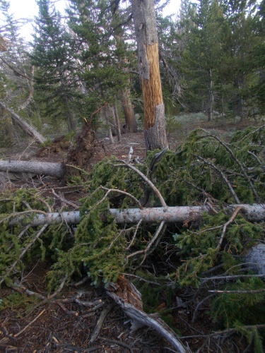
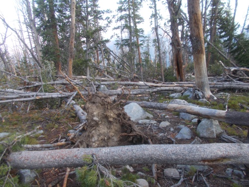
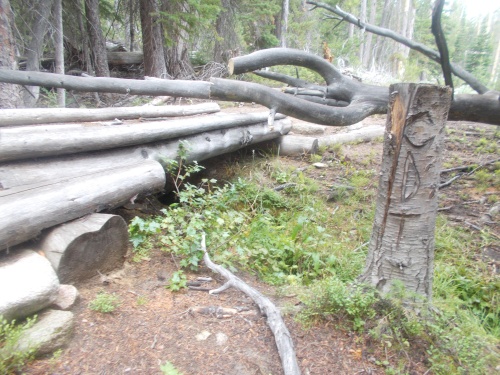
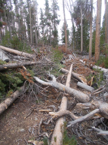
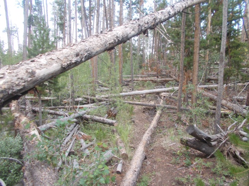
I'll share a few more photos of the blowdowns in the morning to give you a sense of what it was like, but in the really worst areas, I needed both hands available to climb over and around the blowdowns which meant that I couldn't get photos. I could only get photos of the "easy" blowdowns!


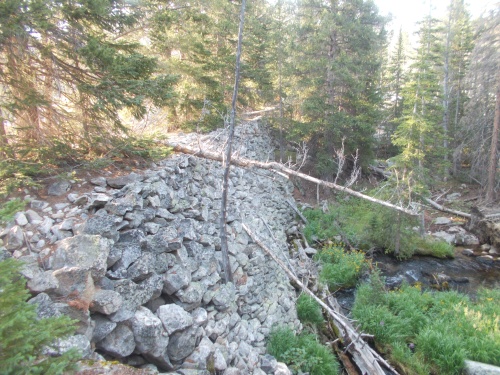
I'm not sure what this dam was doing here, but it made a convenient place for me to cross the river coming out of the lake.


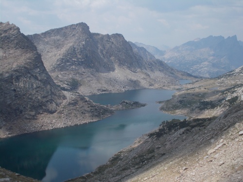
Such gorgeous views! I absolutely loved them! But dang, this trail is tough!


Big Sandy Lake


Monday, June 13, 2022

Day 105: The Calm Before the Storm....

August 3: It sprinkled ever so lightly during the night, but by the time I woke up in the morning, my tarp was completely and totally dry. Dark clouds, however, continued to hang over the morning.

I was looking to get another early start today but wound up not getting onto the trail until about 6:30am, and for the first time, I realized that I was losing daylight. A month ago, starting at 6:30 meant the sun was up and the light was good. Although there were dark clouds blocking direct sunlight, it was still surprisingly dark, and I realized my 6:00am starts were now a thing of the past.

There's definitely a hiker ahead of me somewhere!
 

Almost immediately, I started hitting the blowdowns. I knew they were coming, and they pretty much lasted the entire day. I didn't try counting them, but I figured they had to number over a hundred. Most of them weren't particularly difficult to get over, under or around, but they were a definite nuisance. But this wasn't the bad stuff I had been hearing horror stories about. No, the really bad section I didn't expect to reach until tomorrow.

The day stayed generally overcast the entire day with occasional short but brief sun breaks. At one point during the afternoon, a moderately hard rain started, and I decided to try waiting it out. I threw my tarp over a couple of logs and sat under it for an hour or two, reading about Lucas Davenport hunting down more criminals on my Kindle.

The rain finally stopped, the clouds parted, and the humidity suddenly shot way up making me feel more wet than I ever did from the rain, but the clouds soon returned and the temperatures cooled down to more comfortable levels.

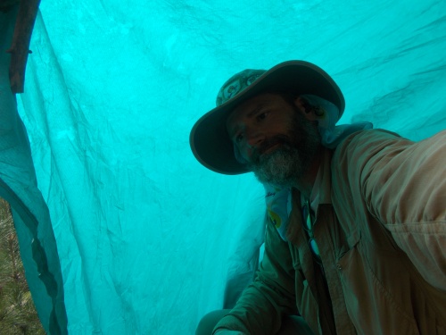
Staying dry on a rainy afternoon.

I caught up with a couple of hikers: Price and someone else whose name I now forget and failed to note in my journal. They complained bitterly about the fallen trees and the fact that they had already lost the trail once today. They had stopped for a short break and were puffing weed when I caught up, seemingly in no particular hurry. They even asked me if we were on the correct trail when I arrived, as if I was a day-hiker familiar with the area and not also hiking the CDT.

"Well," I told them, "as far as I know, we're still on the correct trail. But if you did take a wrong turn, I did too!"

Comparing notes, it seemed likely that we might wind up camping by each other tonight. I wasn't planning a particularly long day of hiking wanting to find a good place to camp just before the really bad blowdowns started. I didn't want to get caught in bad blowdowns when the sun was setting! So I only needed to do about 21 miles today. Easy peasy, and they seemed have a similar plan.

But I never saw either of them again. Did they get lost? Lost on the trail? Lost in a cloud of smoke? I didn't know, but they struck me as very unambitious and not too worried about hitting their targets. Not sure what they would do when they started running out of food, though. Or pot for that matter. But they seemed like they were plenty happy taking their time and weren't in distress, so I wasn't worried about them.

At one point late in the afternoon, I reached the top of a small hill with a view and noticed a black dot moving across a distant meadow. But what was it?! A bear?! A moose?! Frustratingly, I couldn't tell. I pulled out my monocular but even magnified 6x, I still couldn't quite identify the moving dot. It was definitely a big animal if I could see it from this distance, though. Theoretically, it could have been a cow, but it didn't seem to move like a cow. It seemed like it had more of a lopey gait that a bear or a moose would use, and it bugged me to no end that I couldn't tell what it was. After a few minutes, it moved behind some trees and I lost track of it. I'll never know for certain what it was I was now. *sigh*

I wound up stopping for the day near Larson Creek, a couple of miles inside a wilderness area and a couple of miles before the bad blowdowns were expected to start. The campsite was in the trees--I had hoped to stop somewhere with a bit more of a view, but it would do fine. No rain was expected during the night so I didn't bother setting up my tarp.

All-in-all, not a particularly eventful day.

Definitely a bit wet in the morning.

CDT carving, so I'm definitely still on the right trail at this point!

Blowdowns were definitely problematic today, but this isn't the bad stuff I was hearing about.

More blowdowns, but still pretty easy to get through.

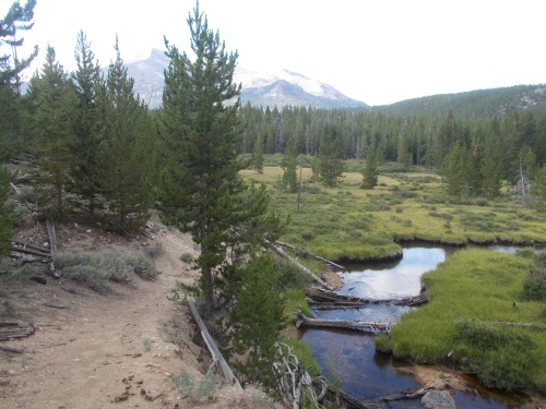
It was definitely nice to get access to more regular water again, and much better water too!


Friday, June 10, 2022

Day 104: The South Pass City Resupply

August 2: I woke up and hit the trail at 6:20am. There was a bit of condensation on me when I woke up, but nothing particularly problematic. I did, however, want to get an early start to beat the heat of the day.

I followed the trail a short ways to a gravel road that crossed Sweetwater Creek, after which the route on the map seems to show the trail wandering pointlessly and even cross-country at times. The terrain was almost completely flat, and it seemed baffling to me that the trail would wander around so much. Maybe it was avoiding private property or something, but nothing I could figure said that was illegal to follow the gravel roads in the area, so I decided to make my own route and follow the gravel roads along a more direct and less-wandering route.

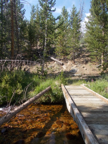
The trail crosses Sweetwater Creek over this bridge.


I continued following markers for the various historic trails through the area, and caught up with Tumbles, Janis Joplin, Captain Jack and Twain near a post marking the old route of the Pony Express.

The morning warmed rapidly, though, and it wasn't long before I was sweating bullets, but otherwise the hiking was uneventful.

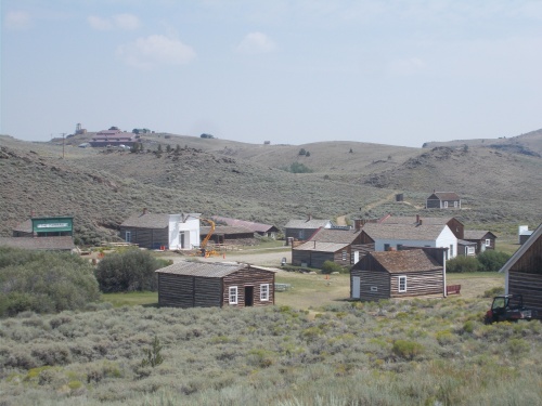
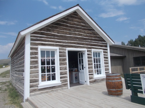
It was at around noon when I arrived in South Pass City and reconnected with the red-line route that I left shortly after crossing Sweetwater Creek. It was originally a station on the Oregon Trail but didn't become a ghost town until after gold mines in the area closed. Now the entire city--what's left of it, at least--is on the list of National Registers of Historic Places.

Fortunately for hikers like me, there's a small visitor center that accepts packages, and I had thoughtfully sent a food drop for myself here. There are no other services here--just the visitor center and adjacent restrooms, so most hikers seemed to prefer hitchhiking a ride north to the town of Lander. I don't like hitchhiking to begin with and much preferred to do a "walk-by" instead. Anyhow, I had taken a double-zero in Rawlins not long ago. I didn't need to get off again so soon!

The other boys: Tumbles, Janis, etc. were already there when I arrived into town and were piling into a car having gotten a ride in just a few minutes. They offered to make space for me to squeeze in, but I passed assuring them that I didn't want to go into town to resupply. I was happy with just picking up my package. So they drove off, and I headed into the visitor center. 

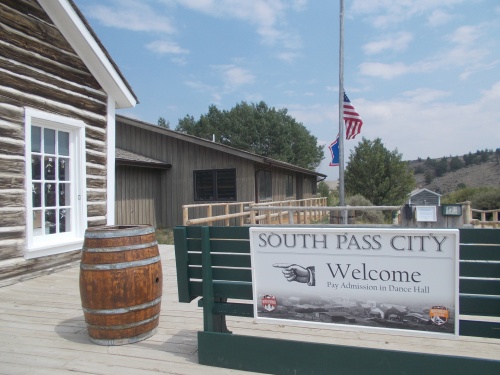
The historic ghost town known as South Pass City is quite interesting!

I picked up my package, along with an ice cream sandwich and creme soda as a treat for myself.  I wished they had something a bit more substantial. A real meal! A burger with fries or something, but in terms of stuff that could be consumed, it was more like a candy store than even a basic convenience store. If I had to actually resupply food from their selection, I'd have positively starved. 

Behind the visitor center was a picnic table where I ran into a few other hikers including Spreadsheet, his wife, and Plant. They had just gotten back from Lander, getting their stuff together to push on northward. There was also a section hiker who was heading southbound, looking to complete the section of the CDT through the Great Divide Basin.

I planned to take a good, long break. There was an outlet where I could charge my devices, and a wi-fi signal from the visitor center that allowed me to get online from my phone. My phone had no cell phone service here, but I did get that wi-fi signal!

While my devices were charging, I also decided to take the opportunity to cook myself a dinner. There was plenty of clean, clear (and potable) water from the restrooms, and I didn't know if there would be water where I camped tonight. May as well do my cooking near water!

I spend a couple of hours hanging out, but I did not plan to stop for the night! So about two hours later, I finally packed everything up and headed out. During the couple of hours I was there, dark clouds rolled in threatening rain. It didn't rain, not yet at least, but temperatures cooled dramatically for which I was grateful.

I picked up my food drop at the visitor center in town.

I pushed onward a few more hours for the day, not running into anymore hikers for the rest of the afternoon. A few miles beyond the town, the terrain started changing, and the changes were remarkably fast and dramatic. Trees started becoming more and more common. The flat, featureless terrain started developing folds and creases. And, just ahead, was the Wind River range. 

The mountains were legendary among thru-hikers. Many have told me that the Wind River range was their favorite section of the entire trail, and the mountains loomed large on the horizon and grew increasingly higher with each passing mile.

But I felt a little trepidation for this was the section that I had been warned was absolutely socked in with blowdowns. Thousands and thousands of blowdowns. I'd heard the horror stories, and now it was my turn to navigate this otherwise spectacular piece of land.

For the time being, however, I stopped at around 6:00pm. It was a bit early, but I had already done over 20 miles for the day and I didn't really want to deal with blowdowns until tomorrow. Plus, it looked like it might rain at any second and I preferred to have camp set up before anything started.

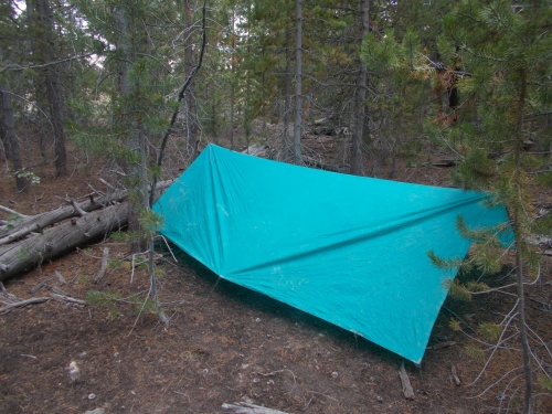
So I set up camp in a thicket of trees--great for setting up my tarp! And although there was a small creek the trail would pass, I decided to camp well away from it to hopefully avoid bugs. I felt that this time of year, bugs could be bad. Out in the open plains, they weren't bad, but now that I was getting into the mountainous areas and out of the Great Divide Basin, I figured they'd likely be worse. 

So I set up camp and dived under my tarp, cozy as a bug in a rug. The sun set, but it didn't really rain. Not yet, at least. Maybe later in the night.... Mostly, I just had several hours to lay back and relax, read a book and enjoy being among some trees again. 

So nice to camp in the trees again! Hello, my friends! And soon to be enemies... =)


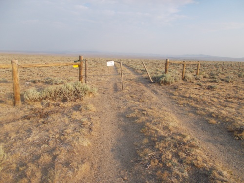
Always the occasional fence to get through, just to keep us on our toes!

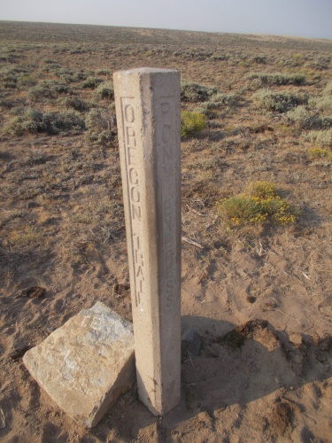
Still following the posts! This one marks the Oregon Trail and Pony Express.

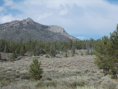
The famous (and infamous) Wind River Range is starting to come into view....

Taking a break!

Hey! Look! Trees are starting to show up!


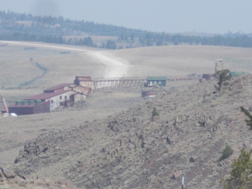
What could they be mining? I heard there were even tours of the old mines, but I didn't have time for that. *sigh*

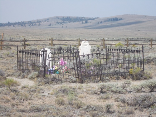
It's not a large cemetery....


I honestly can't remember the last time I've seen a flag not at half-staff. I swear they're at half-staff 99% of the time nowadays, and I had absolutely no idea why this one was half-staffed.


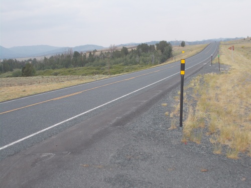
Crossing the highway that leads into Lander.