Showing posts with label trail towns. Show all posts

Friday, August 12, 2022

Day 131: Town after town after town.....

August 29: I slept well in the dugout and nobody ever bothered me during the night, but I had a long day of road walking ahead so I didn't linger particularly late and was up and hiking by 7:00am.

I stopped at a gas station on my way out of Ennis, filling up with water from a spigot outside.
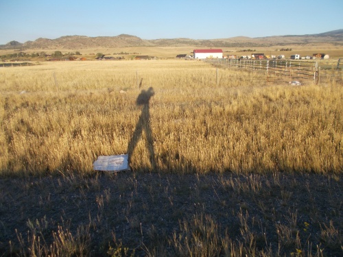
Heading out of town at the break of dawn...

From here, I had a few different options to continue my hike. The most scenic option was likely through the Tobacco Mountains to the west, although I had heard of some other hikers somewhere out there who had been heckled by locals saying that they were on private property while walking down a public road--a scenario that I preferred to avoid (especially after my own run-in with accidentally entering private property). It actually seemed safer to stay on busy highways than remote, country roads--something I never thought was possible.

So I decided to stay on the highway, heading north out of town. Looking at maps, I knew it was going to be a brutal day of hiking. The highway was busy and paved the whole way, and there was nothing in the way of trees for shade on another very hot, sunny day. At least there was a decently wide shoulder to walk on.

My biggest worry was where I might camp overnight. Maybe if I was lucky, I'd find another ball field with a dug out. That worked out really well for me last night! I definitely added ball fields as new possible stealth camp location in and near towns.

The one nice thing about walking along the road is that I'd be passing through several small towns, some of which had services that hikers could make use of such as water or food.

The first town I reached was McAllister. There weren't really any hiker services available, although I did see a restaurant. It was closed when I walked by. I assume it was because it was early in the morning but for for all I knew, it might have closed permanently. This didn't seem like a particularly bustling community.

At the edge of town, the route into the Tobacco Mountains turned off the highway and I spotted two hikers and their dog getting dropped off on the side of the road. I didn't recognize them, and they were too far away to talk to, they started walking into the mountains so we never actually crossed paths. I never did find out who they were.
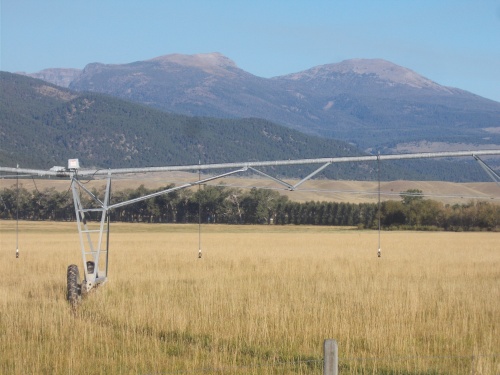
Hiking through farm country now. Those are the Tobacco Mountains in the background, which I decided not to follow a route through.
 

I continued down the highway, eventually reaching the town of Norris. Norris boasted of a Sinclair gas station, where I was happy to stop for a lunch break. Inside was an air-conditioned bliss. I bought lunch--which consisted of a hot dog, extra-large soda and Zingers--and threw out the little trash I had, charged my devices and used the restrooms. I couldn't get a cell phone signal in town, however, and the wi-fi didn't appear to be working so mostly I read my Kindle after finishing lunch. In all, I stopped for an hour or two for a good, quality break.

But it was time to push onward, and I reluctantly left my air-conditioned haven for the brutally hot road walk. Waves of heat radiated from the road and it felt hotter than ever. Ugh.
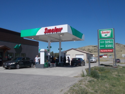
I spent my lunch break at this gas station convenience store. Heaven on earth! =) (And aren't y'all missing those gas prices back then?)

For a little while, I was able to walk on the dirt next to the road, but that path eventually faded off into nothing leaving me walking on the asphalt once again.

A couple of hours later, I stopped for a short 5-minute snack break on the side of the road, during which I was attacked by what appeared to be a swarm of flying ants! Thousands and thousands of them! There was absolutely nothing for the first couple of minutes, then thousands of these flying ants descended in biblical proportions. What the heck was happening?! They flew up the openings at the bottom of my pants, in my beard, and down my shirt. I fought them off by putting on my head net and tucking my pant legs into my socks--the best I could do for the time being--then then they faded away as mysteriously as they appeared. Five minutes after the swarm started, they were completely gone. It was bizarre and baffling.

I finished my snack, then continued onward down the road.

Near the end of the day, I was approaching the town of Harrison and ready to look for a  place to camp. I hoped I'd find another ball field in town, although when I had checked Google Maps, I didn't see anything that really jumped out at me. I planned to look for somewhere in town to stealth camp, then if I couldn't find anything, walk out of town and stop at the first hidden place I found. In this wide-open terrain, however, that might be miles away.
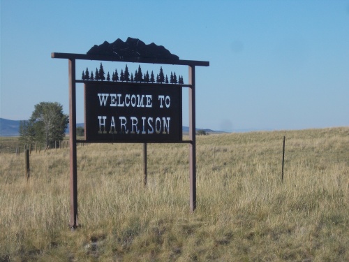
The last trail town for the day....

At the edge of town, I saw a car drive by, then make a U-turn and head back my way. I wondered if they were going to ask me a question, if I was the reason for the U-turn. She pulled over next to me and asked if I was hiking the CDT.

Yep, she had come back for me. She introduced herself as Angie and said she had a lot in town where I could camp for the night if I was interested. Heck, yeah! She gave me directions to the location, not more than about a 10-minute walk away. She never offered to give me a ride which I actually liked. It's like she already knew that I wanted to keep my steps connected. I'm sure a lot of hikers would have been perfectly happy to skip 10 minutes of a miserable road walk.

I found the location a little while later. She showed where I could camp and where I could get water from a hose, and I quickly set up camp, glad for this fortuitous turn. It wasn't an ideal place for camping--basically right there in the front yard in plain view of anyone who happened to be passing by--but it was quiet and a couple of blocks off the main road through town.

We chatted for a bit, and I told her about my particularly long day yesterday after getting chased out of private property that I had accidentally wandered onto and she asked me more specifics about exactly where I was when it happened. So I described it, and she told me that she actually knows the owner of that property and pretty much everyone thinks he's asshat. Well, not in those words, precisely, but she wasn't surprised that he'd be such an ass about the situation.

Around 10:00 at night, there was a local guy wandering around the neighborhood looking for a lost dog. He didn't seemed surprised to see me camped in the front yard of this property--I guess I wasn't the first hiker to stay here--but he did ask if I had seen a stray dog wandering by. I told him I hadn't, and he continued his search.

It was a couple of hours later, when I was woken from a deep sleep by what sounded like a pack of warthogs--or at least some sort of hogs--killing a dog not far away, perhaps just on the other side of the railroad tracks where I was camped. The dog sounded frightened and hurt, and the horrible noise echoed through the neighborhood for about a minute before dying off and silence once again lingered in the air. The whole event send shivers down my spine, though, and I remembered that guy looking for his lost dog and wondered if I had just heard the death cries of his poor pet.

It didn't exactly inspire a lot of confidence in myself, either, knowing there were blood-hungry hogs running around nearby. Although I suppose if they were feasting on a kill, they'd have little reason to come after me. All the same, I checked that my bear spray was still readily accessible then tried to go back to sleep.....
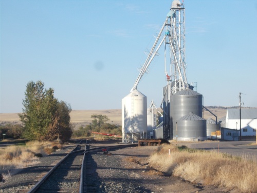
I camped near these tracks, and during the night, it sounded like something absolutely horrible happened around them.


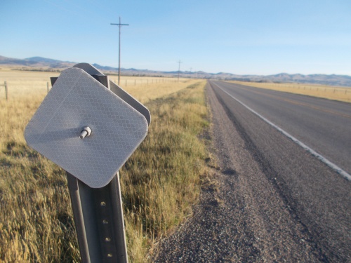
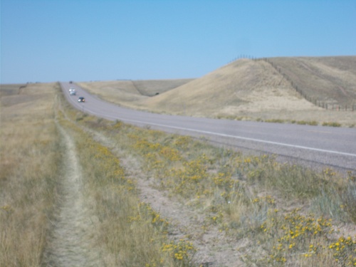
This was pretty much my view the entire day.

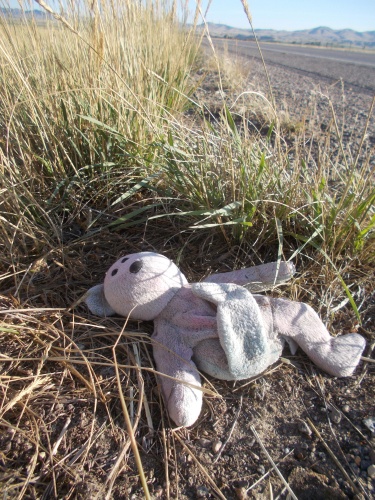
Somewhere out there, a kid is crying.

Did I mention what a brutally hot day it was today? With pretty much no shade the entire way?


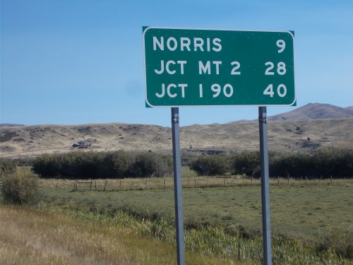
Norris would be where I'd stop for lunch. The junction with MT 2 I hoped to reach tomorrow. And I-90 I hoped to reach the day after that. I had a lot of road walking ahead....


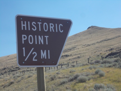
It almost looks like the sign is pointing to the top of that hill, doesn't it?


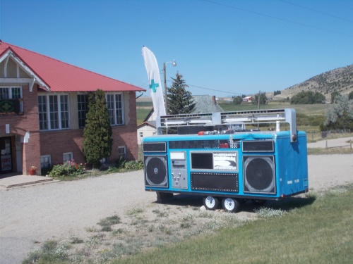
That is definitely the biggest boom box I've ever seen!

Out of Norris, I did have this small trail off the road I could follow. I also noticed footprints ahead of me, so I know I wasn't the first thru-hiker to take this route.


Monday, April 11, 2022

Day 78: The Breckenridge Zero

July 7: Upon waking this morning, I headed down to the lobby of the hostel where I got a pancake and sausage breakfast. Yum! =)

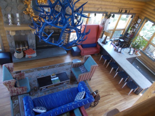
The lobby of the hostel was spacious and comfortable! Not sure about those blue antlers, though...

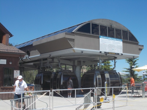
Then I walked into town and rode the gondola since it was free. The gondola went up a hill through a couple of stops before I got off and wandered around a bit. There were paid activities in the area, but I skipped them all. Mostly, I just wanted a free ride on the gondola. That was my activity! And if I had been lucky, maybe spot a moose or something down on the ground, but that never happened. Still, there were some nice views.

After looking around to see what there was, I returned to the gondola for the ride back to town, at which point I looked for a few letterboxes in town. Found two, failed once.

Riding the gondolas!
 

I headed over to the post office to see what I could do about my package sitting at the Leadville post office, but they told me that I had to call the Leadville post office directly to deal with the problem. They gave me the number that went direct to the post office, however, so I didn't have to deal with their generic customer service number.

While leaving the post office, I ran into Haiku and Prada at a bench outside going through packages they had just picked up. It was good to see them again! The last time I had seen them was way back in New Mexico, so I joined them for a bit and we got caught up on each other's adventures. =)

We eventually went our separate ways, however, and I finally tried giving the Leadville post office a call, but the line was busy. I wound up calling about a half-dozen times over the next several hours but the line was always busy. What the hell was going on there?! Did they deliberately leave their phone off the hook so people like me couldn't call?

In the meantime, I decided to go to the local Subway for lunch. I kind wanted to go somewhere a little fancier, but I already felt like I was spending too much money and decided to go with the cheaper option.

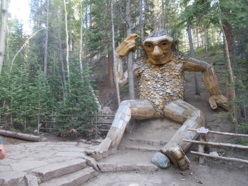
Later in the afternoon, I finally walked out to the Breckenridge troll which I had heard about and wow! What a creature! The thing was massive, and I was particularly impressed with how it's giant hand wrapped around the trunk of a tree like it was a hiking pole, as if it were actually interacting with the environment around it. The whole thing is pretty interesting and clever and well worth a visit!

The Breckenridge Troll is real!

After getting back to the hostel, I tried calling the Leadville post office... still getting a busy signal. So then I tried logging into their website and using the tracking number to look it up and see if I could deal with the problem there, but that webpage wasn't working either. Argh!

Unable to call or deal with the problem online, I finally just gave up. Well, maybe I'll give them a call in the morning, but I wasn't even sure where I wanted the package sent at this point. For now, I'd just let the package keep collecting dust at the Leadville post office. Worst case scenario, they'd eventually they'll return it to the sender which had my Seattle address. 

But overall, a pleasant day in Breckenridge and a nice break from hiking all day! =)

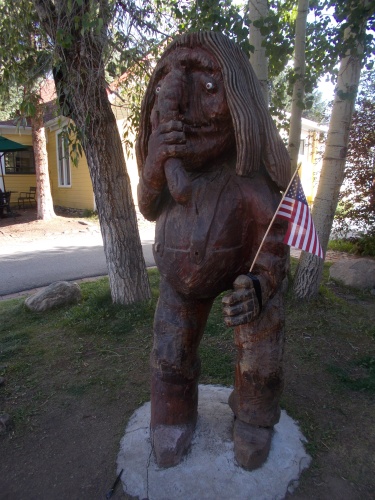
Apparently, Breckenridge is home to more than one troll, but this one wasn't nearly as impressive!

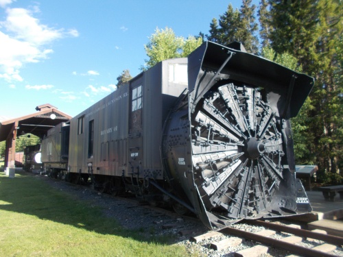
This train car was used to snowplow railroad tracks.

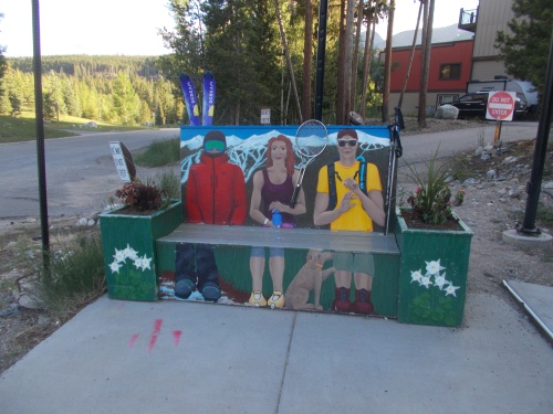
Some skiers wait for the bus.

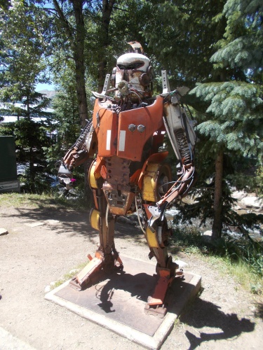
Watch out for the terminator. He might be hunting giant trolls!


Friday, January 24, 2020

Day 39: The Gold Miners

August 23: I took my time getting packed up and ready in the morning for, once again, the post office didn't open until 8:30am and I needed to mail my laptop ahead. Then I left town struggling under the weight of 12 days of food.

One disappointment I had leaving town was that I had never been able to contact Gypsy. He had offered to hike with me through the Pasayten Wilderness--a destination I was now heading toward--but I had never heard back from him again. I was hoping even as of this morning I might still get a last-minute call and work something out, but it never happened. I assumed that the fact it took me over a week to get his email with the proposition meant he gave up on me and had already headed into the wilderness himself and he hadn't replied to my calls or emails because he had been out of the reach of cell phone signals the whole time. Nope, it seemed that I'd be hiking through the Pasayten Wilderness alone. Maybe I'd get a signal on my phone up the trail and something could still be worked out, but it seemed unlikely at this point. If I saw Gypsy at all on the trail, it would probably be him hiking back out back to his vehicle!

You can lead a horse to water... but that's not what's happening here!

The trail followed some roads a short way out of town before reaching the trailhead for the Similkameen River Trail where I ran into a group of PNT trail supporters who were discussing future plans for installing a halfway marker on the trail. They were a friendly bunch and seemed excited to see an actual thru-hiker on the trail--I'm sure they've seen them before, but it had a feel like they had spotted a rare creature on the trail.

The Similkameen River Trail is a rails-to-trail route following alongside--no spoilers here--the Similkameen River. The PNT only overlaps it a short while, however, which I found disappointing. After a couple of miles, the PNT goes onto a paved (but not especially busy) road for the rest of the day. The road also follows more-or-less alongside the Similkameen River so I could see the rails-to-trail on the other side of the river for most of the day and it looked loads more comfortable to walk on than a paved road. Unfortunately, it appears to dead end not going all the way through to the small cobble of buildings called Nighthawk. The trail supporters I talked to said they hoped someday to extend the trail to Nighthawk which would then become the PNT. I'm not entirely sure why it's not done already because the trail looked great as far as I could tell. Maybe they hadn't gotten the official right-of-way at a key place on the trail. The river trail also goes through a tunnel in the mountain and maybe the tunnel is dangerous or needs repair before it can be opened to pedestrians. I'm not sure, but it was a little disappointing to see the trail and know I can't (or at least I'm not supposed to) use it.

Similkameen River Trail treailhead

By the afternoon, a light sprinkle started which was a little problematic for me because in the haste of packing back in Republic, I accidentally packed my umbrella with the duffel bag that Amanda took home. I had no umbrella! And there was no rain in the forecast so I didn't even bother to look for a replacement when I was in Oroville. It proved to be a challenge to take photos with my camera while keeping the camera dry! I sat down under a tree for protection against the rain hoping it would pass quickly and when there was a break, I resumed walking.

But it started up again. Eventually, I just started getting wet. It was impossible for me not to. Ugh. I wore a rain coat and stored my camera under the coat to keep it dry, then used one hand to provide cover for the rain when I took it out for a photo. It wasn't a perfect system, but it allowed me to keep taking photos. I took a lot fewer photos, however!

A couple of hours into the day's hike the trail passed a dam on the river creating a long, narrow lake behind it. Then just past the lake where it became a river again, I noticed a boat on the river. It was a dredge! I totally recognized the sluice box on the back as water and dirt ran through it and emptied back into the river leaving a small trail of dirt washing downstream. The dredge didn't have anyone on it, but it was running and it appeared that someone with a wetsuit was underwater sucking up the river bottom with the large pump running on the dredge.

It's a gold-mining dredge in action! See the bubbles in the water to the right of the dredge? I think that's where there's a diver scouring the river bottom with the pump on the dredge, then the tailings coming off the sluice box are streaming out from the dredge. I really wished I had my 300mm zoom lens here--I could have gotten a much better photo!

Then I noticed another dredge further up river. And another. There were dredges everywhere! How much gold was in this river anyhow?! Not all of the dredges were in use. About half of them were stopped and resting onshore seemingly abandoned although I'm sure they weren't truly abandoned. I had a million questions running through my head about how they got into this business, how successful they are (or aren't), do they need to file permits to do this, how long they've been out there and more! I couldn't really talk to any of them, however, with them being underwater or next to a noisy pump far out in the river. In all, I counted 14 dredges. Not including the one that went past me in the back of a trailer during the road walk.

I neared Nighthawk--a town that used to be big enough to host a post office until 1970. A large sign describing the history of the old mining town also says the entire townsite is now private property--perhaps one of the reasons the rail-to-trail doesn't quite reach it.

That's Nighthawk on the other side of the road. Today, there are absolutely no public services available.

As I approached the town, the rain started coming down relatively hard and once again I stopped under a pine tree to take cover. I sat on the side of the road for the better part of an hour before the rain diminished enough that I picked up on moved on.

I decided to cut the day's hike a little early due to the bad weather and set up camp alongside the river about 1.5 miles past Nighthawk. It was a nice, out-of-the-way location and almost immediately upon setting up camp, the rain stopped and even the sun popped out. Sometimes, I think nature just hates me. *shaking head*

I hadn't made it far today--a mere 15 miles--but I was okay with that. I got a late start out of town, the weather was miserable, and my pack was a monstrosity and tortured me with the 12 days of food it carried. And since I needed to camp at three specific campsites nearly two weeks in the future, I planned for shorter days that I knew I could make rather than more moderate days that I might have preferred but would have increased the changes I couldn't make it to my assigned campsites on time.

So I didn't expect to do a big mile day and I knew that tomorrow, my pack would be a couple of pounds lighter after eating a diner and breakfast out of it. I should make it a big dinner and a big breakfast as well. I needed to get my pack weight down! All good reasons to stop after a short day. =)

The rest of the evening I mostly spent reading my Kindle under my tarp and relaxing.

My home for the night!
The old Oroville Depot is now a museum.
The Similkameen River Trail was wonderful to walk on, but the PNT got off it much too soon!
The trail passes a gold course, and I found this golf ball on the road. I left it there. I picked up golf balls last time the trail went past a golf course but this time, I was hiking out of town--and my pack was already far too heavy with 12 days of food in it.
Still in cattle country!
You can see the Similkameen Trail on the other side of the river--entering a tunnel. I really wanted to hike through a tunnel!
There's a dam on the river, but I couldn't get a good photo of it from my vantage point on the road walk.
And the dam created this long lake.
It's not hard to figure out where a lot of the gold miners set up camp!


The view from my campsite was pretty nice!

Wednesday, January 22, 2020

Day 38: Bikes, Trains and Border Runs!

August 22: I had decided to take a zero day today. No hiking! It hardly seemed like I had been roughing it. But still, Oroville was the last trail town I'd be enjoying for the next two weeks and I felt I needed at least one rest day before continuing the march to the Pacific Ocean.

The Canadian border was so close, I had to drop by!

I knew I was close to the Canadian border--the entire Pacific Northwest Trail was close to the border!--but I hadn't realized exactly how close it was until I ran a Google search for places to eat in Oroville and it showed a McDonalds 7 miles away. I'm not a huge fan of McDonalds, but the result was surprising. Why is there a McDonalds in the middle of nowhere? Oroville was the big city in this area--if there was a McDonalds, why wasn't it in Oroville? The location for the restaurant was listed as Osoyoos--a town I had never even heard of but was apparently only seven miles away? How could there be a town big enough for a McDonalds only seven miles away that I had never heard of?

So I had it list show the route from Oroville to Osoyoos which is when I realized it was over the border. In Canada. There's a town over there! I didn't know about it because it was in another country!

The Canadian border was a mere 4 miles away, and I had a sudden urge to spend the afternoon going to the McDonalds in Canada just to say I did! OMG--that would be so funny to blog about! If I can hike 20+ miles a day with a full pack, I could easily make a quick 7-mile jaunt to the Canadian McDonalds with no pack and another 7 miles back. Even better, I knew I didn't have to walk it. I could ride a bike! When I checked into the motel, Clyde showed me two bikes that were available for thru-hikers to use to get around town. He never suggested I could use it to bike to Canada--but probably only because he never imagined a thru-hiker would want to bike to Canada in the first place!

And then I discovered something else: a brochure in the front office. Those racks of things to see and do in the area included a brochure for the "Osoyoos Desert Model Railroad" attraction with 45+ running trains. That sounded cool! So I googled information about where it was and it was another mile or so past the McDonalds. That was totally doable. I could check out the model train museum, stop for lunch, then head back to my motel in Oroville. On bike! It would be an adventure!

The main highlight I planned to hit in Osoyoos was the Desert Model Railroad attraction.

I'd also be biking into Canada's only desert! Yep, Canada has a desert, and this was it. I was going to ride a bike into the Canadian desert to see a model train set and get lunch at McDonalds. It would be fun. I can't make this stuff up! I'd been carrying my passport this whole trip just in case I wanted to dip into Canada at some point. It's finally time I used my passport!

I went into the front office where I chatted with Clyde a bit and told him of my idea and he said he might have something for me to use. He came back with an electric bike. It was his bike which normally thru-hikers didn't get to use, but he thought it might be more comfortable for the longer ride into Canada than around town like most thru-hikers do. I wasn't sure how I felt about an electric bike because I had never used one before, so Clyde explained how it worked and told me to take a quick ride around town to give it a try and see if I'd want to use it for the ride into Canada.

So I did. I rode it around the block a couple of times and could really feel the power kick up with each push of the pedals. Wow! This was fun! I was sold. I'd ride the e-bike into Canada!

He said the tires were a little low and suggested stopping at Les Schwab to fill them up with air, so that's what I did.

Then I started peddling my way to Canada!

9mph was a pretty good speed for me going up a slight hill and against the wind. I waited for a break in the traffic before I took this photo because I was afraid I'd crash the bike trying to ride with one hand and take a photo with the other and preferred not having cars nearby that would hit me if I careened into the middle of the highway.
The route wasn't great. It was along busy Highway 97 and there was a lot of fast-moving traffic, and I didn't have a helmet to wear which I found even more unnerving. If I were on foot, I'd call the route flat and easy, but on a bike there was a definite uphill to the peddling! Even worse, the wind was going against me so even though the electric bike was helping, I still had to put a lot of effort and power into the peddling to push against the wind and uphill climb. My speed almost never broke 10 mph at the fastest--but it would have been even slower on a regular bike or (gasp!) on foot! It was a lot of work! I quickly learned that electric bikes (at least this one) doesn't do the work for you--it just helps.

When I reached the border, I stopped briefly to take photos of the US-Canadian border. I hoped that photos weren't breaking any rules. I didn't see anything that said no photography was allowed, but the powers-that-be often don't like photographs at security-enhanced areas. But without definitive signs prohibiting them, I took photos.

I looked for signs or something that might direct pedestrians or bicyclists through a separate area from the cars but saw nothing and pulled up with my bike behind a car whose driver was being interrogated by a border patrol agent.

I waited for all of about 30 seconds before the car drove off and I peddled to the agent asking if this was the right place for bicyclists. I was surrounded by vehicles and probably stuck out like a sore thumb being the only person on a bike.

He said I was in the right place and asked me the standard questions about where I was going, how long I'd be in Canada and the last time I had been in Canada. Off the top of my head, I couldn't remember exactly when I had been in Canada last. "March or so?" I answered. "I flew into Toronto earlier this year, but I don't remember exactly which month it was."

Then he waved me through and I was in Canada! I did it! I rode a bike into Canada! I had now traveled into Canada on foot (at the end of my PCT hike), by car (a couple of times), by boat (for my West Coast Trail hike), by plane (when I flew into Toronto) and now by bicycle! I'm pretty sure I've entered Canada using more modes of transportation than almost anyone else on Earth! Just need to check off riding in on a train, horse, submarine and spacecraft and all the boxes will be checked. =)

It was official: I made it into Canada!

I now traveled through Canada's only desert to the train museum at the west edge of town. I locked the bike to a gate and entered the facility which felt slightly busy. I paid for a ticket and entered the rooms with the miniature worlds which were absolutely amazing! The level of detail was incredible and dozens of trains were running throughout the exhibit. I spent over an hour looking at all of the animations and trying to figure out how to get photos that really captured the essence of the place. The photos don't really do it justice, of course--they never do--but it was particularly difficult here because the lights weren't the brightest and there was a panel of glass (or maybe plastic) that separated the exhibits from the people so all of my photos tended to have low lights reflected in the glass.

The model train sets were absolutely amazing!

The trains ran through all sorts of terrain. Through mountains, past a circus, movie theaters, wildfires, and even past a nude beach that gave me a laugh when I realized it was actually a nude beach. At first glance, I thought it was a regular beach. =) Absolutely a wonderful place, though!

On my way out, I bought a few postcards of the trains then headed off to lunch. I altered my original idea of going to McDonalds, though, since I was never a big fan of it and instead passed the McDonalds to stop at the nearby A&W restaurant. I couldn't remember the last time I had eaten at one of those--perhaps 30 years ago? I wasn't really sure how I'd like their food, but at the very least I couldn't go wrong with A&W root beer! =)

So I ordered and enjoyed my meal, glad I chose it over McDonalds. Then I stuck around to write some of the postcards I had just purchased at the at the model train place. I really wanted to mail them from Canada as well so I got on the wi-fi connection at the restaurant and looked up where there was a Canadian post office. Just a 5 or 10 minute ride down the road. I could do that!

Lunch at A&W! Yeah.... I would do that again. *nodding* =)

So I biked to the post office, purchased stamps and mailed the postcards. And... that was that. I did everything I planned to do (and then some). Time to go back to Oroville!

I peddled back. The traffic lined up to get through the border station was a lot longer on my way back and three or four cars were in each lane of traffic. I picked a lane with three cars and waited my turn. Again, I was the only person not in a vehicle and I sensed everyone else looking at me wondering who this freak was that was riding a bicycle.

Eventually I got my turn with the border patrol agent and he asked me the usual questions about where I'd been, what I had been doing and where I was going. He asked me what I had in my pack (it was mostly empty, but I carried anything I considered valuable that I didn't want to leave at the motel like my laptop, camera, journal, etc.) and I offered to open it up and show him but he said that that wasn't necessary--just tell me what's in it. So I did and he eventually waved me through.

See the border cleared in the distance all the way up the mountain? It's faint from this far away and in the dry grass, there was nothing to clear so you can't really distinguish the border there, but it's still deforested all this way!

The ride back to Oroville went a lot faster than the ride out since now both gravity and the wind were going in my direction. I raced down the road, often at speeds at up to 25 mph and almost never below 15. Clyde told me that the e-bike will turn off at speeds above 20 mph so when I hit 25 mph, that was purely on my own with no assistance from the bike.

I arrived back in Oroville about a half hour after leaving the post office. It was an exhilarating day! One of my favorite zero days ever!

Back in town, I went on with my usual preparations. I did laundry, then grocery shopping and arranged a permit for getting through the North Cascades. I didn't get exactly the schedule I had planned out last night, but now my plan to hike non-stop from here to the town of Concrete over the course of 15 nights and 16 days of hiking. I dreaded how much food I was going to have to carry, but was glad I sent a maildrop from Eureka, MT, so at least I had 4 days of food waiting for me at Ross Lake Resort. I just had to carry food for 12 days! But still... ugh.

For dinner, I headed to a Mexican restaurant near the motel which I enjoyed quite a bit then called it a night. Tomorrow... back to the trail!

I enjoyed the decor of the Mexican restaurant
And more of the model trains because I took a lot of photos there!