September 24: I slept in a bit late this morning mostly because I had such a short day of hiking, I was in no particular rush.
The day's hiking was relatively flat and easy compared to the last few days. No major passes to cross over or anything like that.
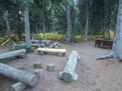 |
| This is the common area of the campsite with the bear boxes on the left. |
A couple of hours into the day's hike, I reached the junction with the Pacific Northwest Trail which was a particularly special moment for me. Upon reaching this junction, I had connected my steps with the PNT, which connected with my steps from the PCT, which connected my steps all the way back to Mexico. Mexico to Canada and back to Mexico again. It's a huge distance, and I've covered it all, on foot, under my own power.
I still had to hike a couple of more hours to reach the Chief Mountain trailhead and the official alternate end of the CDT. Typically, thru-hikers have used this terminus when the snow is bad or there was some other issue about getting into Canada along the main route, but this year, almost everyone started or finished here just because of the COVID restrictions that didn't allow us to go into Canada.
There's a small parking lot at the trailhead, but I continued beyond that. I needed to touch the Canadian border. This was a border-to-border trail, and I wanted to step right up to the Canadian border to make it official.
 |
| This trailhead not only marks the end of the CDT, but also the beginning of the PNT. I like that the PNT marker is about 4 times bigger than the CDT marker. (I feel like the CDT marker deserved to be smaller since it's just an "alternate end" to the trail rather than the "main end", but this IS the official beginning of the PNT.) |
At the trailhead, I found another thru-hiker named Chimney, who told me that he had actually arrived late yesterday afternoon and after several hours of trying to hitch a ride without success, wound up spending the night at the trailhead, and--so far--had been unable to get a ride back to town today either. Several cars full of hikers had arrived at the trailhead this morning, but so far, nobody had left it. Additionally, since the border crossing was closed due to COVID, there was no through traffic. The only possibility for rides were from people who drove out to this trailhead and just this trailhead.
It sounded like I might be here awhile before I got a ride out. I knew that was a possibility, though, and made sure to carry plenty of food so I could spend the night at the trailhead if I had to. I didn't want to, though. My hike was done!Anyhow, I walked out onto the main road, where I found two older women looking over the border into Canada, standing next to a line of orange construction cones preventing vehicles from driving over.
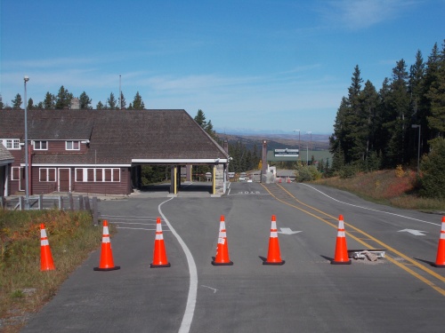 |
| The building on the left is on the US side of the border. The building further out on the right side of the road is the Canadian customs and immigration building. And the border is somewhere between the two. Clearly, vehicles were not meant to cross the orange cones, but I didn't let them stop me from walking past them! |
Normally, this border crossing would be open for vehicles, but again, because of COVID, this particular crossing was closed.
I walked up to the ladies and asked if the cones were the furthest we could legally walk, but they weren't sure. They seemed scared to continue past them, however. Looking around, I didn't actually see any sort of signage that prevented people from walking through the cones to the border, so I plowed through the cones and continued onward.
I passed the building where the US customs and immigration officers usually worked from. It was empty and closed, but I saw cameras around it. I felt certain that I was being watched, but I didn't think anyone would care if I just walked up to the border, touched it, and walked back, so I kept going. For all I knew, however, there could have been a team of border patrol sent out to tackle me, but they had to get here first.
I could see the structure that the Canadian border agents used, so the US-Canadian border obviously was somewhere between the two buildings, and I wondered how I'd recognize exactly where it was. What would happen if I accidentally walked too far into Canada?
As I got closer to the Canadian building, however, I noticed the distinctive border marker on the side of the road. That was the Canadian border. In fact, I could even see where the road changed to a slightly different shade of black, then also another border monument on the other side of the road.
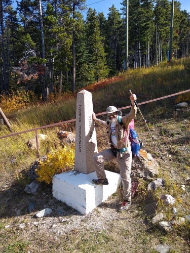 |
| I pose at the border monument, the newest person to join the Triple Crown Club. =) |
I took lots of selfies of myself and some videos, and when I looked back, I noticed the two women who had been standing by the cones approaching me. I guess when no border agents jumped out of the bushes to arrest me, they felt it was safe enough to walk to the border themselves.
Which worked out well for me since it meant that I could get them to take photos of me at the border and didn't have to rely on selfies. If only I had my tiara, though. *sigh* The tiara would have been perfect for this moment. I was officially the newest member of the the Triple Crown club. =)
While I was goofing around at the border, Chimney suddenly scored a ride from some hikers just returning to the trailhead. And while chatting with the two women at the border monument and telling them that I needed to hitch a ride back to town, they offered me a ride!
I must be good luck. The minute I showed up, both Chimney and I got rides--and from different people no less! At least I wouldn't be spending the night at the trailhead like Chimney did
My ride only went as far as St. Mary's, however, so they dropped me off on the side of the road and I walked out to the road leading out of town to start hitching the rest of the way to East Glacier. As I arrived, I saw Chimney come out of the nearby store and head toward me. Looks like we were both trying to hitch to East Glacier together now.
Our luck held, however. Well, my luck held. Chimney had been trying to hitch since yesterday afternoon. I'm the one that got a ride in less than 5 minutes! Chimney was clearly black and I wondered if that made it easier for me to get a ride, but its entirely possible it could have just been rotten timing on his part.
In any case, within 60 seconds of my sticking out my thumb, a vehicle pulled over and we were offered a ride. Sweet! That was much easier and faster than I had any right to expect! =)
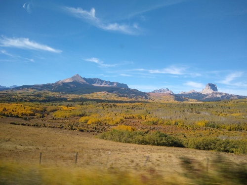 |
| This is the view toward Glacier NP during the drive back to East Glacier. |
Originally, I had assumed I might be sitting around the Chief Mountain trailhead for potentially hours and my plan was to eat lunch there. I never got a chance, however, nor did I get a chance to even eat a snack in St. Marys before we got a ride. I was getting pretty hungry. By the time we arrived in East Glacier, I was positively starving!
But before I could eat, I rushed over to the post office. They had a laptop with my name on it, and now I was in town to enjoy it! I was a little stunned that I made it to town before they closed--I didn't think there was a chance of that happening, but my rides came so darned fast! So I rushed down to the post office, arriving about 15 minutes before they were scheduled to close, and asked for my package.
But it wasn't there. WHAT?! Where the hell was it?! I had called the Butte post office nearly two weeks ago now. I asked the desk clerk if she could check where it was. I had the tracking number in my wallet and pulled it out. She came back telling me that it was still in Butte.
What the heck is it still doing in Butte?! It literally hadn't moved at all since I called them and they assured me it was on its way! I remember the woman I talked to on the phone even put me on hold to verify that my package was sitting there before confirming that she'd forward it to East Glacier.
Clearly, I would not be using my laptop anytime soon. The last time I had seen the laptop was in West Yellowstone. I didn't imagine that I'd basically hike through the entire state of Montana and never see it. Just like Colorado! Basically, I never got to use my laptop in two out five states the trail went through. Well, technically, I didn't use it in Idaho either, but seeing as I was in Idaho for less than 24 hours, it didn't seem fair to count that.
Well, it wasn't the end of the world, but I told the woman that if the package somehow did arrive for me here, to please forward it on to me in Seattle. I'd have to call the Butte post office again and see if they'd forward it to Seattle. Or maybe I should just wait and let them return it to the sender. It had been in that post office for about a month now. They were bound to return it to the sender sooner or later.
In any case, I headed back to the hostel for the night. I finally got to eat some lunch. I also got a phone call from the four women I met on the trail a few days earlier asking if I was still trying to hitch a ride back to East Glacier. I know I gave them my number for just that purpose, but I was still a little surprised they made the effort of calling. They had just finished their own hike and weren't sure if I was on the side of the road somewhere still trying to hitch a ride. I assured them that I had already made it into East Glacier--the two hitches into town went remarkably efficiently. I was in St. Marys for less than 60 seconds before getting a ride!
Back at the hostel, on my phone, I checked the Amtrak website for a ride home. There's a train station right there in East Glacier, and an Amtrak route that would take me from East Glacier direct to Seattle on the Empire Builder. Amanda had called and let me know that she was off for a few days around this time and could drive out to pick me up, but I told her not to worry about it. I wanted to ride the train. I've really enjoyed riding the train in the past. There's lots of leg room, and gorgeous scenery. It really was the best way to travel from East Glacier to Seattle, and I was looking forward to it. I had even arrived early enough in the day to catch the train that passed through tonight at around 6:30pm.
The price of the last minute ticket, however, was $230, but if I waited until tomorrow night, it was only $106. Since the price of the hostel was $15, I decided to purchase the ticket for tomorrow night and save over a hundred dollars.
It didn't quite work out like I expected.... I should have paid the $230 and left tonight. It would have simplified so many things.... but I had no way of knowing that at the time. But that's a story for the next post! For now, I had finished the trail. I was a Triple Crowner! And my days of sleeping outside were now over.
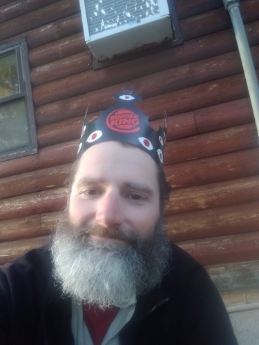 |
| Back at the hostel, I did find this Burger King hat, so I took a photo of myself wearing it. The one prop I used to mark my completion of the Triple Crown--but I still regret not having my tiara at the border. And... this beard could now be chopped off! I wouldn't need it anymore.... =) |


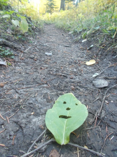 |
| I continued to leave more leaf people on the trail in my wake.... |


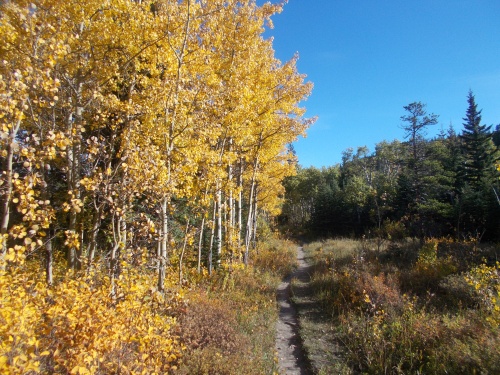 |
| I just love the yellow aspens at this time of year! |


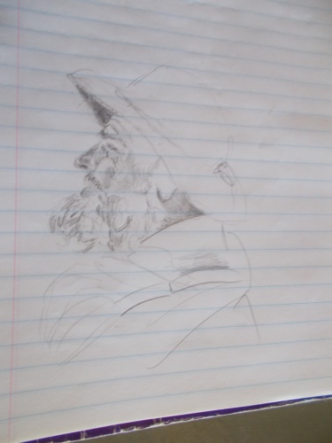 |
| One of the other hikers at the hostel sketched this photo of me, but now I forgot who it was and didn't think to write down his name! |


5 comments:
👑👑👑
Congratulations! That's quite an achievement. I've really enjoyed your blog and photos.
That drawing - I thought you were vomiting! It looked like food spewing out of your mouth. Apparently, it's your beard!
Have you hiked any place that will end up on W4F in 2022?
Maybe....
Well that’s intriguing!
Congratulations👏 on finishing your hike!!! I've enjoyed all of your posts.
Jaxx
Post a Comment