August 1: I woke up to a fair bit of condensation. I had known that was a possibility, but I didn't even bother to throw a tarp over myself to protect myself from it since I was already still wet from the night before. I could live with a little condensation. I still needed to finish drying out my sleeping bag which I planned to do later in the day anyhow.
The early morning was sunny, but cool and comfortable. I knew, however, the oppressive heat would return by the afternoon. I wasn't looking forward to it! So I started hiking early, trying to get as many miles in as early as I could.
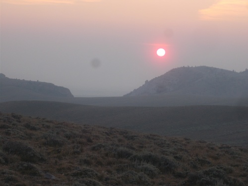 |
| Notice how red the sunrise was due to all the smoke and dust in the air? |
It was only an hour or two later when I arrived at a trailhead water cache, and there I found Janis Joplin, Twain, Tumbles and Captain Jack with all their gear spread out and drying. They had clearly suffered from the same condensation that I did. I had assumed they camped here during the night, but they told me that no, they actually camped earlier but stopped at the water cache to dry out their gear. That surprised me a bit. Already, the humid heat of the day was starting to arrive, but it was still early in the morning. It was just going to get worse later in the afternoon. That's when I wanted to take a break!
I picked up some water and chatted for a few minutes, but then pushed onward.
Another couple of hours later, I noticed a hiker in the distance that seemed to be coming in my direction. Why was there a hiker going in the opposite direction? Could this be... a south-bounder?! I had assumed I would run into the first south-bound hikers on the trail somewhere in Wyoming. Actually, I had assumed that I'd see most (if not all) south-bounders in Wyoming. Just a matter of when they started at the Canadian border, so even though I knew they were getting close, I still managed to be surprised when I finally ran into one. At least a possible one. I'd have to ask to be certain.
When he got close enough, I made a joke about, "Hey, you know you're going the wrong way, right? Canada is that way," I said, pointing northward.
But no, it was an official south-bounder! He introduced himself as Austin. I wasn't sure if that was a trailname or a real name--it could go either way, really, and I didn't ask. I also didn't think to ask when he started the trail, but he did say that he started at the Canadian border. The thought had occurred to me that if we combined our miles, we'd already be done with the trail! =)
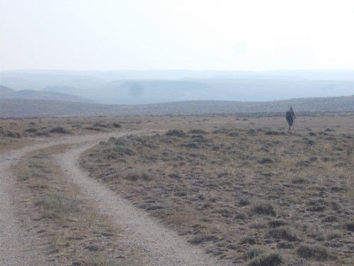 |
| Austin walks southbound, on his way to the Mexican border. |
I suspect I left no impression on him, just another face among the hundred or more north-bounders that he had already passed, and we continued on in our separate directions. Although this was the first south-bounder that I had seen, it didn't necessarily mean that he was the very front of the them either. It's possible I could have passed by others in Rawlins, or even on the trail itself if we had taken slightly different routes, and not even noticed. It made me happy to see a south-bounder, though. He had already hiked from Canada to this point, so it was definitely possible! Not that I doubted for a second it wasn't possible, but it somehow left more real. Like it was confirmation that Canada really was at the end of this route. =)
Somewhere along the way, I noticed concrete posts periodically along the side of the trail. The precise wording on them varied. Some of them said Oregon Trail, but others also said California Trail--an offshoot of the Oregon Trail that led into California. Another read Seminoe Cutoff, which I can't say that I was familiar with, but it sounded like another variation of the Oregon Trail. Later in the day I'd also pass posts that marked the route as the Pony Express and the Mormon Trail. All sorts of interesting historical routes flowed through this barren landscape, and I imagined what the scene must have been like then.
The actually scenery probably didn't look much different, but the conditions were certainly very different. Those migrants would probably think I was crazy for wanting to walk through this desolate landscape for... fun?! But I had the advantage that I could easily quit if I wanted to. Walk into town, jump into a bus or train or something and be back in a big city in mere hours. Enjoying air-conditioned buildings, making phone calls to talk instantly to people all over the world, and access to fruits and vegetables that were grown on the other side of the planet.
I also wasn't particularly concerned about dying of dysentery. Although I did wonder how often people really did die of dysentery out here and how much of that was popularized by the Oregon Trail game. =)

There were two water sources for me to fill up with, nice cold water from deep underground. In both locations, I ran into the group that included Janis Joplin, Twain, Tumbles and Captain Jack. I really needed to give the whole group a name to make it easier to refer to them later instead of a series of 4 names, but I couldn't think of anything.
Janis I had heard about--it seemed like everyone on the trail had stories about Janis and when I finally met him myself, I joked that it was official--he had now met every single person on the CDT so he could quit if he wanted to now.
Janis set the Fastest Known Time (FKT) for completing the Washington state portion of the PCT, which was about a week or something. The idea of covering about 500 miles in just over a week seems crazy to me. Definitely not my cup of tea! But I was curious about people who do stuff like that so I asked him about it. Originally, he had trained to set the FKT for Oregon but that didn't pan out due to wildfires at the time so he changed to Washington. "Does that mean you have to go back and set it for Oregon?" And he said he'd been thinking about it.
"Well, if you have the FKT for Oregon and Washington, obviously, you'd have to set it for California after that!" Yeah, well, duh. =) He won't have the record for the entire trail, but he could still have it in sections for the entire trail. But the California section is longer than Oregon and Washington combined, so it's really a whole different beast.
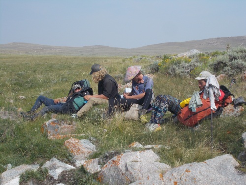 |
| From left to right, Captain Jack, Twain, Tumbles and Janis Jopin. |
I thought I might run into Sweet Tooth and Bugs taking a break at one of the water sources, but I never wound up seeing them the whole day. They had finally out-distanced me, perhaps never to be seen again. (Not by me, at least.)
At one of the water sources, I took a long break to pull out my wet sleeping bag and ground sheet and finally, after three days, my gear was dry! Completely and totally dry! It was such an amazing milestone.
Except for the two breaks at the water sources, I hiked nearly non-stop. Nothing more than 15 minute breaks for a snack occasionally. The afternoon heat and humidity was brutal, and I even used my umbrella at times to shade myself. I made good time, however, and over the relatively flat and easy terrain, managed to push nearly 30 miles, stopping just before the trail crossed Sweet Creek, in a lush meadow next to the creek.
The meadow was nice with thick, green grass--a nice change from the hard, barren ground from the last few days.
The others camped somewhere ahead of me, although I figured they probably didn't go much beyond where the trail crossed the creek. After that, water was scarce again. So I wound up camping by myself and called it a night.
 |
| Camping on this nice, green grass was a luxury! |


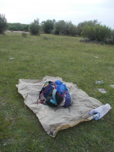
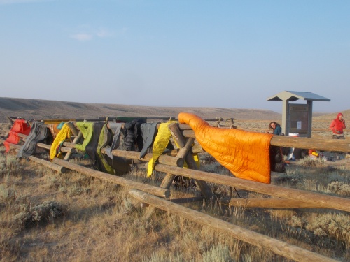 |
| The boys are drying out from the condensation in the morning. |

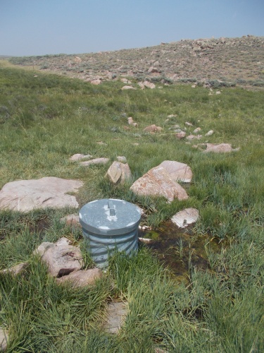 |
| The good drinking water is in the pipe! |


2 comments:
I seem to recall mention in other trail journals of a set of bocci balls at one of the water holes in the Great Basin. Did you come across this?
Nope, I have no idea what you're talking about. Sorry!
Post a Comment