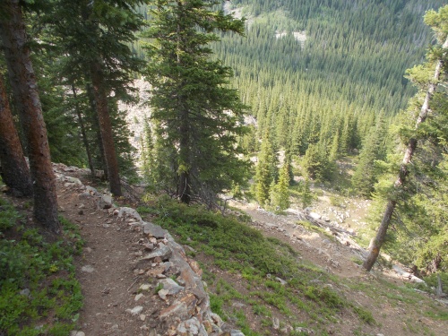
July 10: It was a beautiful morning, and I was up and hiking by 6:30 once again. The trail immediately started climbing toward Stanley Mountain before leveling out above tree line along a ridge that was like hiking through rolling hills.
IB Tat was still in his tent when I left, but he was awake and filming himself making coffee. Apparently, it was the "signature" shot for the beginning of all of his videos. He had mentioned that he tried to stop doing that, but a bunch of his followers complained that he didn't show the shot of him making coffee. "I have to do it now," he explained, "but I really don't want to." I don't think he minded making the coffee for himself--he just was tired of filming it every morning.
 |
| I had a few blowdowns to deal with until getting above tree line. |
The views were awesome, although there was a distinct haze in the air that grew thicker as I pushed through the miles. There was definitely a wildfire somewhere, but I had no idea where these fires were located. It could have been nearby or from another state entirely. I had no way to know! But it definitely hurt the views regardless.
It wasn't more than about 10 minutes past Stanley Mountain that I ran into the first day hikers who had hiked up from Berthoud Pass. It was surprisingly early in the morning for them. They must have started hiking in the dark to have reached this point so early in the morning, but I didn't really think much of it at the time.
But then about 15 minutes I passed another set of hikers. And another. They were a heck of a lot of day hikers--particularly this early in the morning--and out of curiosity, I started keeping a count of them as well as a count of how many dogs went by.
In the next several miles, I wound up passing a whopping 62 people and 7 dogs! It was a steady stream of them coming up the trail with no end in sight. This was obviously a very popular hiking trail! It was a Saturday which probably contributed to the numbers, but holy cow! That's a lot of people! I figured Berthound Pass was just another pass like any other pass on the trail, but after passing such a huge number of people, I knew it must have been massive and I wondered about the possibility of trail magic. Hope springs eternal!
Eventually, the trail reached the end of the ridge line and started the steep descent toward the pass. At this point, I started passing an increasingly large number of people stopped to rest on the trail, gathering their breath for the climb up the steep, switchbacked trail. I stopped occasionally to chat with them at times. Some people stopped to ask if the climb was worth it, and I assured them it was or pointed to the top where the trail leveled off and said that it gets easy once they reached that point. A couple of the people seemed like they were on the verge of death and I seriously wondered about their safety. They were way out of their element! The healthier-looking people who still looked like they were having fun I'd sometimes joke about, "Save yourselves! There's nothing up there except smoke-filled views!"
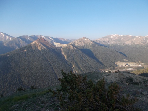 |
| That's the Henderson Mine in the distance, as seen once I got above tree line on the climb to Stanley Peak. |
I'd also ask passing people if they knew where the smoke was coming from, but nobody seemed to know. Although one person said they figured it must be a campfire from a nearby campground.
One thing I knew without a shadow of a doubt: It wasn't a campfire. Unless the campfire got out of control and started burning an entire forest! This was obviously someone who had never seen smoke from a wildfire before. Campfires just couldn't generate that much smoke! Nope, wherever the fire was, it was a large and probably uncontrolled fire.
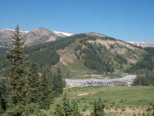
I could see the giant parking lot from high on the mountain, and it grew increasingly large and busy the nearer I approached.
At the pass, I made use of the available pit toilets--the foulest-smelling toilets I'd see on the CDT--and threw out my collection of trash. I took a break as well, finishing off the Pringles I carried for no other reason than I wanted to throw out the container while there was a trashcan nearby.
I also got a cell phone signal, so I extended my break by making some phone calls and checked messages.
Then I filled up with water from a spring that seemed to come gushing out just downhill off the side of the parking lot. It was great water, but I'd have had absolutely no idea it was even there if it hadn't been mentioned on Guthook. It was very well hidden!
From this pass, a lot of thru-hiker choose to hitch north to the small town of Winter Park, but I carried enough supplies to keep going. I'd just spend more money there, and these Colorado towns were expensive! I knew IB Tat planned to hitch a ride into town in the hopes of getting online and uploading his newest videos from a wi-fi connection at McDonalds, but he hoped to get back on the trail without spending a night there to avoid that expense.
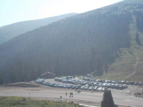 |
| The massive parking lot at Berthoud Pass! And look at all the smoke in the air! |
All prepped and ready to continue, I started the long climb up toward Flores Peak--which was also incredibly busy with countless hikers. Having grown tired of counting people on my way to Berthoud Pass, I chose not to count them on my climb to Flores Peak--but there were easily just as many people on this side of the pass.
Flores Peak marked an interesting milestone for me as well: It was my first 13,000-foot peak on the CDT and therefore the highest point thus far for me on the trail. Almost every other thru-hiker had already crossed over one or more 13,000-foot peaks. The high point of the Colorado Trail was a 13-footer, but I missed that when I took the Creede Cutoff, and the high point of the entire CDT was a 14-footer, but I missed that by doing the Silverthorne Alternate. So for me, it was a new high point of the trail, but it was uneventful for almost every other thru-hiker on the trail.
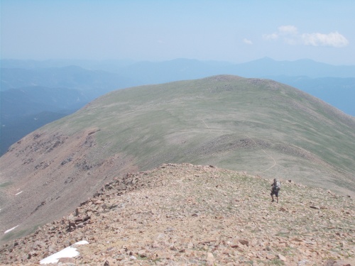
I stopped for a break behind a U-shaped windbreak built out of rocks about 0.6 miles from the summit. I was surprised to find it open given the sheer volume of people on the trail, but I suspected most people wanted to stop and enjoy the top, and at this point, they were so close that they didn't want to stop.
The wind was brutally strong, however, so I decided to stop early and make use of the windbreak while I could and where there weren't crowds of people stopping. I sat around for the better part of an hour enjoying the views, eating snacks and reading my Kindle. But eventually, I knew I had to keep going and going I got.
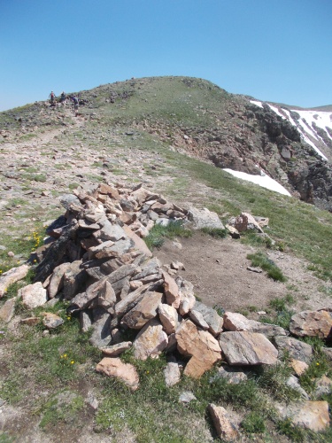 |
| I stopped for an hour-long break at this wind break, about 0.6 miles before the top of Flores Peak (seen in the background). |
I soon reached the top which was crowded with a couple of dozen people and my plan, originally, was to power through them and leave them behind. I wasn't inclined to mingle with such a large group of people, but then I noticed a bright, yellow jacket in one of the wind breaks and said, "PEZ!!!! What are you doing here?! I thought you were behind me!"
He was as surprised to see me as I was to see him since he too thought I was ahead. He had run into IB Tat who had reported that I was ahead, and it quickly became obvious that he had blown past me while I was taking a break at the wind break 0.6 miles down the trail.
So now I took off my pack and joined Pez to chat for a bit, sharing our war stories since we last saw each other a few days ago.
Pez then whispered to me, as if he didn't want anyone else to hear. "I'm not impressed with these views." Then went on to explain that it wasn't just the smoke in the air, but rather the mountains didn't seem as dramatic as those he had already passed through. "It's kind of boring and underwhelming," he told me.
I understood where he was coming from. He wasn't wrong. That's the problem with truly spectacular views.... it makes everything else feel a bit boring by comparison. If this was his first view of the CDT, Pez would be shouting out how amazing it was! Now.... not so much.
I sometimes have to remind myself that these "boring" views are actually quite awesome in their own right. Better than looking at cornfields in Iowa--that's for sure! (No offense to Iowians out there, but even they go to other states to travel!)
Pez told me that he planned to take an alternate route across a series of five 13,000-foot peaks to the north that would reconnect with the mainline CDT. I looked at the route on my maps and decided that it wasn't for me. It cut off a few miles, but it looked to be difficult cross-country miles. I wanted to follow a real trail, even if it was longer. Pez, after growing a little bored by the scenery, was anxious to get on with his hike and use alternates to speed up access to more interesting areas.
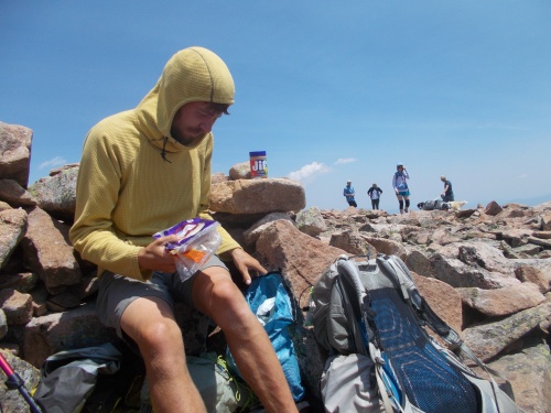 |
| I was surprised to bump in to Pez at the top of Flores Peak since I thought he was still behind me on the trail! (And a few of the hoards of day-hikers in the background.) |
So we wound up parting ways again. He'd probably get ahead of me since his route was shorter, but going off trail, he'd also be hiking slower. I probably wouldn't be far behind him when the two routes met up again.
At the summit, IB Tat passed by us, which surprised both Pez and myself. His visit to the Winter Park McDonald's must have been a record in how fast he hitched down to town, got his YouTube videos updated, and hitched a ride back to the trail. IB Tat chose not to take the alternate, but he hiked much faster than I did and I didn't try to keep up. I watched him grow smaller and smaller as he quickly outdistanced me.
The trail descended and descended, down and down from Flores Peak. Much of it was over large, blocky rocks that I couldn't walk over very quickly, though. Half the time I felt like I wasn't even on a proper trail anymore and wondered if Pez had the smarter idea to take the alternate. But eventually I got through the really bad section and a proper trail opened up again that was a delight to walk on.
Additionally, after leaving Flores Peak, the trail was completely empty of other day hikers. Absolutely none of them continued on beyond Flores Peak. It was nice to have a bit more solitude on the trail once again, although I wouldn't have minded the company of another hiker or two.
It was about 5:00 in the afternoon when I reached a tent by a small creek. It was IB Tat, already set up in camp. He said I was welcome to join his site, but the weather was still good, I was enjoying the day's hiking and felt like hiking some more! I just didn't want to stop! =)
It was, however, the last reliable water for several miles and not knowing if I'd keep hiking as far as the next water source, I filled up with enough water so I could dry camp between water sources. The mosquitoes weren't especially bad, but there were a few and perhaps a dry camp would help keep them at bay as well.
I wound up hiking for a couple of more miles, climbing another 1,243 feet higher according to my GPS: extra mileage and elevation gains that I wouldn't have to worry about tomorrow. I chose a nice camp, just off the side of the trail not far from Loch Lomond. I could see Loch Lomond, perhaps a mile in the distance, and shook my head. I'd seen the real Lock Lomond in Scotland, and that was no Loch Lomond, the largest loch in Scottland.
I imagined it was named by some homesick Scottish settler back in the day. "It's the biggest loch we got, so let's name it Loch Lomond." This lake didn't even look big enough to hold a Loch Lomond monster. (It's not as famous as the Loch Ness monster, but allegedly there's also monster in Loch Lomond.)
The ground for my campsite was a bit uneven but not terrible, but I was camped well away from water sources and with a light breeze at this location, the mosquitoes largely stayed away. All-in-all, a pleasant stop for the night! I had checked the most recent weather forecasts when I had a signal earlier in the day, and no precipitation was expected for the night, so I laid out my groundsheet and cowboy camped for night.


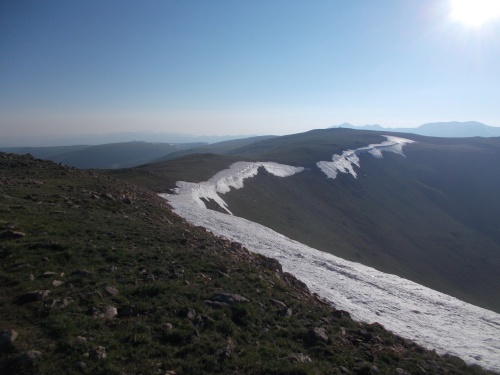 |
| I really enjoyed this ridge walk, despite the 62 people and 7 dogs I'd pass along the way! (The trail, I'm happy to report, stayed to the left of the snow cornices, so that snow was not an issue.) |
 |
| So much smoke in the sky! |

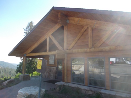 |
| The foulest-smelling pit toilets of the entire trail were in this structure. *nodding* |
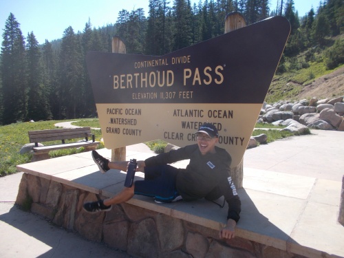 |
| I wanted a photo of the Berthoud Pass sign, and this day hiker wanted to be in my photo. So presto! =) |
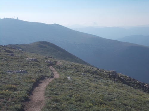
 |
| Looking back toward Berthoud Pass. You can see the trail I came down on the other side. Beyond that first hill, the trail continued toward those snow-covered mountains in the background. |

 |
| That's IB Tat quickly outdistancing me on our hike down from Flores Peak. |
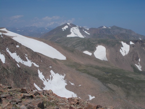 |
| Pez planned to follow an alternate route along this ridge and over these peaks. |
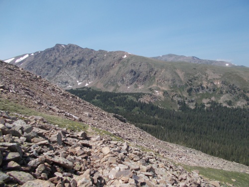 |
| The route I followed looped around, down low to the trees, before climbing back up again. |
 |
| The downhill was quite steep at times. Notice several switchbacks further down the slope? |
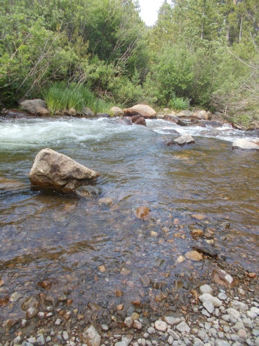 |
| Filled up with water while I could! =) |


No comments:
Post a Comment