 |
| Woke up to this view in the morning. Yes, I thought, it's going to be a good day. That's Lake Tahoe in the background. |
After an hour or two of hiking, I could see a radio tower nearby and was looking down on the north side of Lake Tahoe and was able to get a signal with my cell phone, so I gave Amanda and my mom a call to give them an update on my progress. While talking with my mom, GQ hiked past me--surprising since I thought he was ahead of me. He passed my campsite the evening before, so I know he was ahead of me at that point. He must have camped somewhere far enough off the trail that I passed him and didn't know it.
 |
| The helicopter buzzed over me on this ridge. |
The ridge walking was wonderful not just for its views, but also for it's relative flatness and lack of snow. Even the ski area we went through had no snow. Once again, the trail went down a steep slope, this one covered with a sizable layer of snow and I briefly lost track of the trail. I started following footprints straight down, then stopped about halfway down. I can't explain it, but the footprints felt wrong. It seemed like there was a change in the footprints, even though I couldn't really identify exactly what it was. I looked toward the bottom of the steep slope, hoping to see a sign of the trail, but I saw nothing except for the footprints in the snow. Looking up, I could see what appeared to be a switchback to the trail perhaps 20 feet away. At that point, I knew I was still on the trail, and it looked like it did go down the slope, but it still bothered me. It just felt wrong to keep going down.
 |
| Views of Lake Tahoe in the background. |
The trail didn't go down the slope, however. It flattened out and started climbing again, gently. It seemed like the trail was heading in the right direction, however, but I was still uncomfortable that I might be hiking in the wrong direction. I hoped to see a trail marker to definitively confirm that I was on the right track, which, as it turned out, I was, but it would take nearly a half hour before I could be 100% certain that I was. I don't know where those footprints going down the snow led, but whoever made those, I thought, were probably quite lost.
 |
| It wasn't until I found the PCT symbol on this tree that I could be 100% certain that I was still on the right trail. |
After a good half-hour or so, we were packing up and getting ready to leave when Shroomer showed up behind us, thrilled about how excited he was to see us and confirm that he was actually on the Pacific Crest Trail. Then he proceeded to tell a story of misery and hardship, following footprints through a snow down a steep slope. At the end of the snow, he had trouble finding the trail, but valiantly plodded on, bushwacking and getting more and more lost with every step.
Finally, from a distance, he could see what looked like a trail far up on the ridge and figured that must be the PCT, so he started bushwacking towards it. When he saw someone up on the ridge, he hollered out, and someone hollered back. I thought back to when I was walking along that ridge, and I vaguely remembered a faint shout far down the valley. I hadn't bothered to reply (surely it wasn't meant for me!), but now I knew--it was probably Shroomer I had heard, and it very well could have been me he saw on the ridge.
 |
| The insects seemed to be getting larger. This one landed on my pack. |
"That was the most lost I've gotten lost on this entire trip," he told us. "Even in the High Sierras, I never got lost this badly."
Shroomer pulled out his cell phone and tried to call Little Engine and Plain Slice, to find out where they were on the trail. They didn't answer their phone--most hikers, obviously, don't leave them on for very long on the trail even when there is cell phone coverage since there's no way to recharge such devices--so he left a message about getting horribly lost for two hours and was probably far behind them.
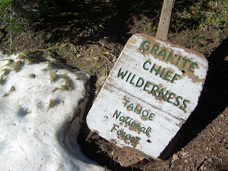 |
| Some of the signage has seen better days! |
I laughed. I couldn't help it. It was those footprints in the snow. That could have easily have been me had my instincts not told me to stop following those footprints in the snow. I still don't really know what set off my alarm bells, but I'm glad I listened to them.
Near the end of the day, I pushed on to a ski hut--Bensen Hut--hoping the enclosed interior would protect me from the mosquitoes that would likely come out in force during the evening. The hut was beautiful and warm, and I laid out my gear on the upper floor for the night. Shroomer camped out in one of the beds on the bottom floor, and Little Engine and Plain Slice decided to camp in their tent outside. They spent the evening inside chatting away with the two of us, though. GQ and Fully Loaded pushed on to do a few extra miles before stopping for the night.
 |
| I found this letterbox along the way--the first person to find it in six years! Thanks Old Blue, but I think the box needs to be replaced! |
 | ||||
| Benson Hut, my home for the night. I slept at the window there on the second floor. =) It was so warm inside, I left the window open all night long. |


2 comments:
Aha, you fixed AQ to GQ by the time I could comment. :-)
I'm surprised more people don't have solar chargers on their hikes. I know the objective is to pack light, but our charge is really small and works quickly.
Good thing you trusted your instincts. That hut is cute.
I was going to ask you if you found very many letterboxes along the PCT. What a neat surprise to find one so old and not found for such a long time.
Hike On!
~Twinville Trekkers
Post a Comment