Friday, April 8, 2022

Day 77: Four trail towns in ONE DAY!!!! The insanity!

July 6: I slept well despite the traffic from Interstate 70. Today I had a short walk into Frisco, at which point I could catch the free bus into Breckenridge and call it a day. Easy peasy! No need to rush, so I didn't get on the trail and start hiking until a little after 7:00am.

Pez had texted me the approximate location where he had camped, a few miles up the bike path, and I found him breaking down the last of his campsite about an hour later, and we walked together the rest of the way into Frisco.


Pez had reported seeing a pine martin since I last saw him--one animal I had not yet seen. But on the other hand, he had yet to see a bear or a moose which disappointed him immensely. "Don't worry," I told him. "It's still a long way to Canada. You'll almost certainly see both before finishing!"

The walk into town was quick and easy, and at the edge of town Wi-fi caught up with us as well. I hadn't seen Wi-fi since the morning I took the Creede Cutoff which seemed like years ago, so it was good catching up with Him. Him and Pez had yet to meet, though, so I made introductions.

Pez was anxious to resupply and camp somewhere just outside of town to save money, so we headed to the Walmart to do that. I intended to take a zero day in civilization tomorrow, however, and didn't really need to resupply. Not at the moment, at least, but I was happy to pick up snacks and a cold drink for later. =)

Wi-fi didn't have much to buy and said he was going across the street to eat at Wendy's, and we said we'd drop in and meet with him after we finished shopping.

In the Walmart, we also ran into another thru-hiker named Chocolate Chip. I first met him back in Leadville at the hostel, but he had already forgotten my name by the time we crossed paths again. I was a little surprised to run into him, however, since he had hitched into Leadville from Tennessee Pass and was a couple of days ahead of me on the trail. Clearly, I had caught up despite my not doing big miles!
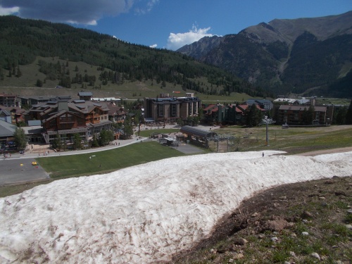
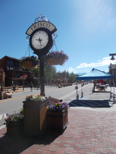
Frisco!

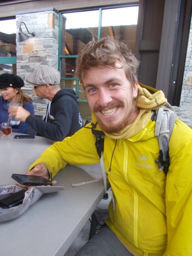
I picked up some snacks and drinks, then headed over to Wendy's to meet up with Wi-fi. I didn't order anything--it was still too early for lunch in my book, and I could eat later. Just hung out with with Wi-fi for a bit, who told me that he planned to walk into Dillon where there was an REI to replace his shoes. He had gotten new shoes 200 miles earlier and they were already falling apart, so he planned to get them replaced. The problem with Dillon, however, was that it was in the opposite direction of the main red-line CDT. For me, however, who intended to take the Silverthorne Alternate out of town, it wasn't terribly far out of my way, so I said I'd join him and we could walk over together. Pez wanted to go to the REI--he had certainly heard about the chain by now and wanted to see one in person, but he had no intention of walking off trail to go there. To get to the main redline CDT, he needed to hike south out of town toward Breckenridge--a completely different direction. So Pez and Chocolate Chip decided to take the free bus over there.

So we all parted ways. Pez and Chocolate Chip taking the bus to REI, while Wi-fi and I planned to walk.

It was a few relatively pleasant miles largely following nice bike trails and along the shores of the Dillon Reservoir and over the Dillon Dam. Relatively uneventful, but it gave Wi-fi and I plenty of time to catch up with each other's stories of the trail.

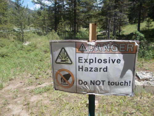
Wi-fi checks out the signage along the bike path while heading toward Dillon.

When we arrived at the REI, I didn't really need anything. My gear was holding up well, my shoes were fine, so I decided to sit outside and wait, offering to keep an eye on Wi-fi's pack while he was inside taking care of his shoe exchange. We wound up arriving there almost precisely as Chocolate Chip and Pez had arrived as well. I was the only one who didn't go inside, though.

I sat in the shade under the covered area at the entrance of the store, keeping out of the hot sun. I hadn't been there for more than a minute when I heard someone say, "Kurwa mać!" My head snapped up. That was Polish! A Polish curse, in fact. Although, I realized, it was possible that it might be some other Slavic language. They can often sound similar, but it was definitely a Polish curse which grabbed my attention.

And it came from a woman getting out of a car that had just stopped in front of REI and I realized it was the same woman from the hostel that I met a few days earlier! "Hey!"

And she joked... at least I think it was a joke... that she thought it was me she had seen walking through the parking lot then threw out the Polish curse to see if I would look up which would confirm it. "Only someone who knew Polish would have looked up," she told me.

"Well, it worked! It's definitely me! And it was definitely hearing the Polish that got my attention!"

So we started chatting for a bit, and she had more questions about my learning Polish. While chatting with her, Wi-fi and Chocolate Chip had come out. Wi-fi needed something out of his pack and I introduced them to each other, also telling her that Wi-fi had been to Poland as well but didn't really know any Polish. "What?! You've both been to Poland?!" She was shocked to be meeting so many Americans who had been to Poland.

Chocolate Chip piped in: "I've been to Poland too." 

"What?!" He was from Israel, and I hadn't known he'd been to Poland as well, but he explained that he had Polish roots but his ancestors had escaped to Israel, and so had gone to visit Poland a few years back. The Polish woman seemed in shock. "Nobody ever visits Poland! How is it that all of you have been there?! That is so awesome!" Her mind seemed in shock.

Her boyfriend was still in the car, trying to encourage her to get back in. "This isn't a parking spot," he tried to insist. "We really need to move!" and eventually the Polish woman got back in the car and they continued on their way.

Wi-fi went back in the store to continue his shoe exchange, and Chocolate Chip and I kept chatting a bit longer. He noticed my Jordan Trail t-shirt and asked if I had really hiked the Jordan Trail. "Yep! Awesome trail!" 

He expressed an interest in doing it, but explained that some people in Jordan didn't care too much for Israelis and wondered if it was possible for him to do. I didn't know about that. I can't say that I heard anyone in Jordan wishing death or ill-well to Israelis, but it's not like I brought the topic up with everyone either.

Then I mentioned that while hiking that trail, I had heard about the Lebanon Trail which really sounded appealing to me and Chocolate Chip's eyes about bugged out. "You can go to Lebanon?!"

"Well, yeah.... I mean, the past year maybe it wouldn't have been a good idea." The country seemed to have destabilized badly in the past year.

"But you can actually use your passport and just go there?"

"Well, yeah."

"I can't," he told me. "I live just a few miles from the border, but they would kill me if they found out I was Israeli! They would literally kill me," he insisted, and I believed him. "Well, at least some of them would. I can never go to Lebanon."

Wow. I hadn't really thought about it, but there are a lot of places that Israelis really can't travel to safely in the Middle East.

Wi-fi eventually came out with new shoes. Pez bought some gear, but I don't remember what. I don't think he really needed any gear, but mostly wanted to check out the store. I got tired of sitting around doing nothing, however, and decided to start making my way to Breckenridge where I had already made a reservation for a hostel when I was back in Leadville.

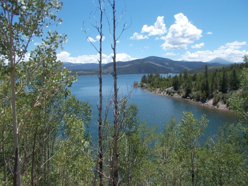
The Dillon Reservoir

That town, however, was well off the trail from where I currently was, but with three free short bus rides, I could get there. So I found the bus stop that would take me from Dillon to Silverthorne, then switched buses to ride from Silverthorne to Frisco.

In Frisco, before boarding the third and final bus, I stopped at Taco Bell for lunch.

They had a wi-fi connection there, so I pulled out my smartphone and got online checking, among other things, the tracking number for my laptop. Could I get to the Breckenridge post office in time to pick it up? But there was no rush. According to the website, my package was at the Leadville post office "waiting for pickup." WTF?!!! I had literally walked into that post office and told them to forward it to Breckenridge when it arrived, and now it was sitting in Leadville collecting dust?! ARGH!  

Another trail town. Another missed connection. I couldn't believe it. That laptop had now been to Pagosa Springs, Creede, Salida, Leadville as well as spending some serious time in Denver since I had last used it. When was I ever going to see it again? I didn't have high hopes that it would arrive in Breckenridge in time for me to make use of it. *sigh*

Then I headed to the bus stop for the last leg to Breckenridge. In hindsight, if I realized I was going to walk all the way into Dillon today, I would have preferred finding a closer hostel, but I remembered Breckenridge and the hostel from the Colorado Trail thru-hike and knew I'd enjoy it there. The riding the buses part wasn't particularly fun, however.


While waiting for the bus to Breckenridge, a local who was also waiting for the bus struck up a conversation with me. I immediately pegged him as a meth head--mostly due to the severe lack of teeth in his mouth--but he started telling me that the pyramids in Egypt had been built by aliens. As in, actual aliens. From outer space.

"Ohh.... I see...." A crazy meth-head. Even better. =)

I think he sensed my skepticism, however. "No really! And there's proof!"

"Really?" I asked, a little curious where this was leading.

"Yes! No mass graves. They've never found any mass graves."

I must have had a confused look on my face, because then he elaborated. "There's no way an ancient civilization could have constructed such a massive structure that wouldn't have killed hundreds or thousands of workers, and if that many workers died, where are the mass graves?"

"Ahh, yes! Of course! That's a good point!" I said enthusiastically. "Where are the mass graves?! That's what I want to know!"

So yeah, the pyramids were clearly built with alien technology. That's obviously the most logical explanation for the lack of mass graves. The beauty of this logic was that I couldn't really refute it. I had absolutely zero proof that his theory was wrong. Privately, I didn't really buy into the theory, but admittedly, I couldn't refute it either.

Then he changed topics and asked if I had seen the troll. "Troll? What troll?"

"The troll of Breckenridge!"

Oh.... that troll. "No, I haven't seen that yet."

"You definitely need to stop there and check it out. It's worth going a bit out of your way for," he assured me.

I actually did have a vague memory in the dark corners of my mind about a giant troll in Breckenridge, but I had forgotten about it. I didn't learn about it until after passing through on my Colorado Trail thru-hike but then hearing about it later and kicking myself for missing it, and here I was, about to do it again!

I assured him that I'd definitely check out the troll while I was in town, but then the bus showed and we boarded. I was happy the conversation finally ended, but I have to admit that I did find it very interesting and--in the case of the troll--actually a nice reminder!

The bus dropped me off in Breckenridge, then I hoofed it over to the Bivvi hostel where I checked in and hung out for the rest of the day, doing what I could do with my smartphone online, but still annoyed not having my laptop.


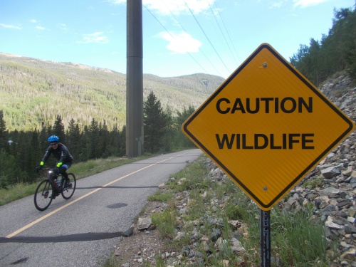
I prefer to call them "bicyclists," but who am I to judge? =)


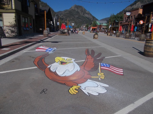
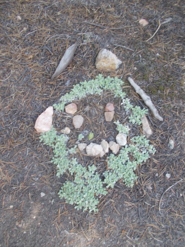
I just love this sort of artwork with the forced perspective!

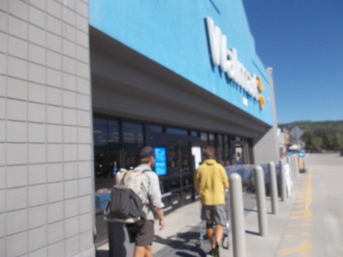
Pez and Wi-fi head into Walmart


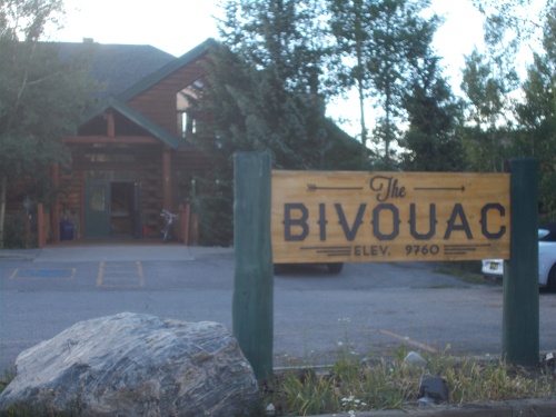
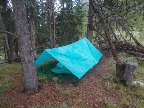
Home, sweet home. For a couple of nights, at least!

Wednesday, April 6, 2022

Day 76: The Copper Mountain Storm

July 5: It didn't rain during the night, but I did notice a lot of condensation started to form. Even before I went to sleep, there was a bit of condensation forming, so I threw a tarp over myself like a blanket, but it was absolutely soaked through by morning and I was feeling pretty wet. I needed to dry out a bit!

But that, I figured, could wait until later in the day. For now, I woke up and got ready, hitting the trail at 6:20am. The morning was had plenty of blue skies and sun to enjoy!

 
For the first hour of the day, I saw absolutely nobody. It was too early in the day and people weren't up and about yet, but after passing over Searle Pass, I started passing masses of people. In the second hour of the day, I probably passed no less than 30 people on foot and on bike. I couldn't go for 5 minutes without running into someone. It was simply astonishing--the number of the people on the trail. Everyone seemed to be heading up from Copper Mountain, though. It seemed like I was the only person heading down to it.

The trail headed steeply downhill after Searle Pass, toward the Copper Mountain ski resort. At this time of year, there wasn't much skiing going on, but I knew there would be restaurants and other services and I was anxious to enjoy them and hiked nearly non-stop until I arrived at around 10:30am. I used the restrooms, threw out my trash and toured the area to checked out the facilities.

There were all sorts of activities for tourists going on. They had those carts one could ride down bobsled-like courses, an American Ninja Warrior-type of contraption one could navigate, and a roller-coaster type of contraption that the trail actually passed under on my way to the resort. Some of the ski lifts were running allowing people to get up the mountain without the effort of a hike, and the place was full of visitors!

I eventually stopped at Downhill Duke’s to eat. They had an outside patio and allowed me to enjoy the views while I dined. They opened just as I arrived and I was the first customer to be seated. I ordered a burger and a Pepsi, which were very good but seemed a little pricey for what I got.

I'd end up spending most of the day at the Copper Mountain ski resort.

At the resort, I had phone service and I texted Pez who, as it turned out, was only a couple of hours behind me. I knew he was behind me on the trail, but I hadn't realized he was so close behind me, so I decided to wait around at the restaurant for him to show up. I read my Kindle and relaxed to kill the time.

During the couple of hours of waiting, dark and menacing clouds drifted in. I wondered if Pez would make it before the thunderstorm struck. I wasn't too worried about myself. I'd just move somewhere inside or under cover if rain started. No big deal for me! Not while I was in civilization, at least! =)

Pez did beat the storm, and he joined me on the patio ordering a drink but no food to save money.

We chatted for a bit, but then the rain finally arrived and we moved to a covered area on the patio and continued our chat. Later, during a lull in the rain, we moved to the patio of a closed restaurant (many of the businesses weren't open during the summer season) that was covered and get a bit more space from the crowds at the restaurant that was open.

It was there that the storm really let loose! Thunder! Lightning! And rain of biblical proportions!

"It sure is nice not to be hiking in that crap," I told Pez. He agreed. =)

The afternoon thunderstorms tended to pass relatively quickly, and I decided that I was going to hang around Copper Mountain until it had passed. Pez decided that it wouldn't be a bad idea to wait a bit either, so we wound up chatting for a few hours in all. It was a lot of fun catching up. Except for a brief chat when we saw each other at Walmart in Salida, we hadn't really connected since way back in Grants, New Mexico.

Pez checks out information on his phone while service is good. Just look at all the hair on his face! Hardly looks like the same person I met my first day on the trail! =)

Pez tried to wait out the rain, but eventually decided to keep going when it softened a bit. He had miles to do! I mean, I had miles to do as well, but I was already rethinking my original plan. The main CDT route goes up and over a big mountain pass which I remembered well from my Colorado Trail thru-hike 4 years earlier. It was a pain-in-the-ass climb, but it did have wonderful views at the top. The problem was that with this storm, there were absolutely no views from the top. It seemed like a waste of a time.

But there was also an alternate route, the Silverthorne Alternate, that I had wanted to take instead. It covered areas that I had never seen before--always a plus!--but it also got me off the main route which was annoyingly packed with way too many hikers for my taste. The Silverthorne Alternate would lead through the town of Silverthorne--thus the name--and reconnect with the main CDT a few days later. And by that point, the Colorado Trail would have split off toward Denver so the huge hoards of people on the trail should be much diminished. So I had my eyes set on the Silverthorne Alternate. Distance-wise, it was marginally shorter, but not enough to really matter. Pez wanted to stay on the main route, though, so we planned to part ways out of Copper Mountain.

However.... my plan was needing some rethinking. I had spent so much time at Copper Mountain, there was no hope I'd reach my original goal along the alternate route. And in huge a thunderstorm no less? Over a 12,000' pass? That's a hard no, but thanks. =)

The rain came down in buckets! It was a hard rain that lasted for hours!

But looking through Guthook, I noticed someone had left a comment that there was a bike path that lead directly from Copper Mountain to Frisco, through the same valley that Interstate 70 passed. It definitely wouldn't be as scenic as the official CDT or the Silverthorne Alternate, but it had several advantages. It was basically flat the entire way and well-protected from high winds and thunderstorms. And it was quite a bit shorter than either of the other two routes. In fact, it was so short, I could probably hike the last bit in the dark and make it to town in time to find lodging. I wouldn't even have to spend the night outdoors tonight!

I called the hostel in Breckenridge to ask if it was possible to move my reservation up a night. The 4th of July weekend was over. It was Monday and I hoped there might be a free bed for the night, but alas, it was not meant to be. They were booked full. I checked lodging options in the area but most places were full and the ones that weren't were way outside of my budget. Nope, I'd definitely have to sleep outside tonight.

But it meant I could get into town pretty early in the day tomorrow, and now I didn't have do any more miles today. I wondered if I could just camp out on this patio under the overhang? I'd probably be bothered by the authorities, though. Naw, I'd just go to the edge of town and find somewhere to stealth camp in the woods.

So Pez hit the road, and I continued to wait out the storm. The rain finally did stop at nearly 6:00pm. This was definitely more than the usual afternoon thunderstorm--it had rained for hours and hours and hours. And a heavy rain it was for most of that time. The clouds never went away, but at one point I could see a brief view of the ridge that the main CDT followed and I hoped it would stay clear long enough for Pez to enjoy it. It would be a shame to do that ass-kicking climb and not have any views to enjoy.

After the rain finally stopped, I continued on to the edge of town to set up camp in the woods at the base of these mountains which (at the time) I thought Pez was currently climbing up.

After the rain finally stopped, I headed out, passing through the rest of the Copper Mountain resort and connecting with the bike path heading out of town, then found a flat place to camp a few minutes walk away from the Conoco station at the edge of town. It occurred to me that I could drop by the convenience store there in the morning and buy something for breakfast in the next morning. I didn't really need anything, but I could splurge anyhow. =)

It was close enough to I-70 that I could hear the traffic from the highway all night--my only complaint about the site--but I knew that would be the case pretty much anywhere I stopped to camp along this bike path since it basically paralleled the highway all the way into Frisco.

Although the rain had stopped, the trees were still dripping with water and the clouds looked like they could resume the storm at any time, so I set up my tarp. I'd covered a measly 13.9 miles according to my GPS. It was a pathetic showing, but I didn't have to actually hike in any rain at all which was a major accomplishment for the day! Poor Pez, though. He left in the thick of it.

After setting up camp and the sun had set, I pulled out my phone and texted Pez about my location. (We hoped to meet up in town tomorrow.) He soon replied that he had reached the bike path and decided to change his own plans and would take the bike path into town as well. What?!

As it turned out, he was camped maybe an hour up the bike path from where I camped. Well shoot! If I had realized that, I'd have made the extra effort of walking a couple of miles further and camping with him. He tended to sleep in late in the morning, though. I'd likely catch up with him as he was packing up camp. We could still hike into town together. In hindsight, he could have waited out the rain too.

And with that.... another day was done. Most of the day was pretty rotten for hiking, but I was thrilled to death to have avoided all the bad weather. I felt very fortunate in that respect. =)

Home, sweet home! At least for the night. =)


Monday, April 4, 2022

Day 75: Bullets! Bullets everywhere!

July 4:  It was Independence Day, but on the trail, it was just another day. Perhaps a little more crowded with day-hikers and those out for a weekend backpacking trip, but otherwise, just another day. In this case, I woke up at around 6:00am, ate breakfast and took my time getting ready. That was, until around 6:30am when the mosquitoes woke up and started buzzing around. Argh! 

After that, I hastened my departure and was on the trail and hiking a little before 7:00am, and once I got moving, the mosquitoes weren't quite so annoying.


The first half of the day was remarkably easy with lightly rolling hills, and even then it was mostly downhill.

I did stop for a break at a swinging bench along the trail. I remembered it from my Colorado Trail thru-hike, and it was relatively early in the day for a break, but I couldn't pass up the bench without enjoying it. That would have been criminal! And, somewhat surprising, the mosquitoes didn't swarm. In fact, they largely stayed away for the rest of the day. Oh, sure, there was the occasional mosquito buzzing around, but not in quantity. They didn't come with friends anymore! I couldn't figure out why they were so problematic yesterday but not today. The weather wasn't really all that different. The terrain wasn't that different. I just couldn't figure it out. They are mysterious creatures, indeed. Unpredictable and annoying, but also mysterious in their ways.

I remembered this swinging bench from my Colorado Trail thru-hike, and I enjoyed it just as much this time as I did then. =)

After about a half hour at the swinging bench, I continued onward to Tennessee Pass, which is also where many thru-hikers hitch into Leadville since Highway 24 leads south directly into town. In fact, when I talked with other thru-hikers at the hostel, the question we asked each other most often was from where we hitched into town. It seemed like I was one of the few who came in from Twin Lakes. Most of the hikers I met hitched in from Tennessee Pass. I choose to go in from Twin Lakes, however, since it more evenly distributed the miles I had to do between Salida and Breckenridge, my other main resupply points. It wasn't even 50 miles from Tennessee Pass to Breckenridge--not worth the effort of hitching into town in my book. And anyhow, today was the 4th of July weekend. I really didn't want to go into town, even if I could somehow miraculously find lodging.

I did stop to check out the monument at the pass, however, in honor of a fighting group from WWII. I didn't feel like I was in a particular rush, so I didn't mind the slight detour and I could drop my pack while I read all the informational signs about the pass and the monument.

But then I was off again, this time following an old rail-to-trail system down the other side of the pass. A train used to cross over Tennessee Pass back in the day but had long since been rerouted through a tunnel under the pass and the old line had been turned into a hiking trail that the CDT now followed allowing for a very flat hike!

The CDT followed the track only a couple of miles before detouring off, and soon crossing the semi-abandoned line that still had tracks leading to the tunnel. (I looked up information online about the track afterwards, and it appears that it hasn't really been used for a couple of decades after some railroad mergers, but the railroad didn't want to sell the rights-of-way to a competitor. So the line still "technically" exists, even if it's not currently used, but there's talk about opening it up again as the alternative route the railroad uses is nearing capacity.)

I love these old rail-to-trail systems! So flat! So straight! So easy! =)

Throughout the day, I'd been passing an enormous number of Colorado Trail thru-hikers heading southbound. It used to be I would stop and chat with a few minutes with every one I passed, but I finally put a stop today after passing over 30 CT thru-hikers. When I first met up with the CT, I would pass maybe one or two people each day, but this was prime CT thru-hiker season now! I just didn't have the time or inclination to chat with them all!

Anyhow.... pushing onward, I crossed over to the east side of Highway 24, following near the highway a few more miles until reaching Cape Hale, an old WWII training camp for winter and mountain warfare. The trail led down a short but steep slope before hitting the valley bottom where it levels out again. On the slope, I passed yet another CT thru-hiker heading southbound who told me that he found all sorts of bullets in the hillside in the last 30-40 feet during the last 20 minutes or so. He stuck out his hand full of bullets. Wow! That was a lot!

"I think they must have used this hillside as a shooting range," he told me. Certainly seems possible.

I took a photo of his bullets, not really interested in stopping to look for any myself, then we continued on our separate ways again.

Bullets from Camp Hale

The trail then led through the abandoned Camp Hale and the valley bottom before finally climbing 2500 feet up to Kokomo Pass--the first real climb of the day. It was also the only serious climb of the day.

I had hoped to find a campsite somewhere on the climb up, but the trail was packed with other hikers who had already set up camp at all the best locations, so I kept going. I didn't really feel like camping with a herd of other people.

Twice during the day, I passed some hikers heading southbound suffering from major blisters and injuries. I was getting near the point on the trail where most of the CT thru-hikers had started maybe 5 days earlier and their feet had not hardened, and some of them were suffering greatly. Two of the people I passed, however, said their injuries and pain were enough to make them get off the trail and go into Leadville and asked how far it was to where they could hitch off the trail. I suggested to one that they didn't even have to go all the way to Tennessee Pass--the trail crossed the highway before then and she could hitch off from that point pretty easily. Most people preferred to hitch at Tennessee Pass only because it was closer to Leadville and there was a larger parking lot, but there was nothing to prevent her from hitching where the trail crossed the road. The other person looking to get off the trail hadn't even reached Camp Hale, though, and I suggested he could maybe get a ride from someone around Camp Hale where the trail followed near a gravel road.

But I kept pushing onward... all the way to Kokomo Pass! Which was a little problematic since it was above tree line and very exposed, and the trail would stay above tree line and very exposed for several more miles. I set down my pack to admire the views, then immediately thought, Screw it! Why not just camp here? 

It was a very exposed location, but no storms were in the evening forecast. The wind was moderately strong, but looking a bit down the pass, I saw flat grassy areas that looked partially surrounded by rocks and vegetation that might help break the wind. And wow! What a great view! Yeah, this might be really nice.

So I scrambled downhill, off the trail, and looked for a place to camp. I found a workable place and set up for the night. Also a nice perk--I got a cell phone signal here which allowed me to get online and catch up with messages again. Living the good life! =)


Monument at Tennessee Pass

Hiker art. Artist unknown.


Unless you're looking for bullets, I guess. *shrug*

Ruins at Camp Hale


Cataract Falls

Heading up to Kokomo Pass

I could see this distant mine from Kokomo Pass, and I'd be able to see lights on at it throughout the night. No idea what they mine here, though!

Friday, April 1, 2022

Day 74: The attack of the bugs!

July 3: I took my time hitting the trail this morning. I only planned a relatively short 20-mile day, more-or-less, so no rush. It was Saturday, and the day before Independence Day. I expected the trail would be particularly crowded with hikers and deliberately wanted to be in the woods rather than trail towns for the weekend which I figured would be overflowing with tourists.

 
So I was where I wanted to be--in the woods, away from people. Well, besides the day hikers which were in abundance, but it was still probably less crowded on the trails than in the towns! So taking my time waking up in the morning, I didn't hit the trail until just before 7:00am.

Even that early, however, I passed numerous people on the trail leading up to Mount Elbert. The Colorado mountains often suffer from afternoon thunderstorms so people tend to start early and (try) to finish early, and today was no exception. Even though I expected it, I was still astonished at the number of people heading up the mountain in the other direction as I approached the trailhead. (A different Mount Elbert TH than the one I passed yesterday, keep in mind.) I joked with some of them that I had already gone up the mountain and returned, but there was nothing to see. Quit and save yourselves! =)

By late in the morning, the bugs had started coming out. Stupid mosquitoes were flitting around everywhere. As long as I was moving, they weren't a problem, but as soon as I stopped for a rest, they would swarm. They were definitely an annoyance today!

The trail was fairly rugged today as well. Up and down, up and down... It was exhausting. The trail passed by the Mount Elbert trailhead, then by the Mount Massive trailhead. Mount Massive, if you didn't know, is the second-highest peak in Colorado, but it's still number one in having the coolest name for a peak. =) The trail wound around the east side of Mount Massive, with occasional views of Leadville a few miles to the east (and great phone reception to boot). At the end of today's hike, my GPS had recorded about 9,000 feet of elevation gain throughout the day. Definitely no simple walk in the park!


Around 3:00 in the afternoon, it sprinkled a bit. It was ever so light and seemed fairly limited, so I found a place under a tree and pulled out my umbrella and decided to try waiting it out. The mosquitoes continued to be an annoyance, but at least the rain seemed to slow them down a little. The rain didn't eliminate the mosquitoes, though--just slowed them down a little. A half hour later, the rain had stopped and I was walking again.

I had hoped the mosquitoes would quiet down and go away by the time I was ready to set up camp, but alas, they were still feeling frisky. That was unfortunate, so I ran a few tests looking for a campsite where they would be less of a problem.

I would stop and sit for a few minutes to see if they started swarming around me and how bad the swarm was. I tested a dry campsite with no water nearby hoping they'd be less of a problem there, but no, they started to swarm. I tried sitting next to a creek hoping the chilled air from the creek would keep the pests away, but still they swarmed. I tried checking a location in the sun, but still they swarmed. And I tried a colder site in the shade, and they continued to swarm.

I had hoped to find a windy, exposed location that I could use but the exposed locations I passed never had much of a breeze. There was no escape from the pesky creatures! Argh!

I finally gave up and decided to camp near a creek, in the shade, at the bottom of a valley where I hoped cool air would settle and convince the blood-sucking creatures to go to sleep earlier. And deep in the valley, the sun would set sooner, so the air would get cooler sooner, and presumably the mosquitoes would quiet down sooner. That was my hope, at least.


In the meantime, I slipped into my sleeping bag, put on my heavy fleece jacket and a mosquito head net to battle the problem. It worked well enough to prevent them from biting me, but the constant buzzing around my head was driving me crazy.

It wasn't until about 9:30 in the evening when the bugs finally took the rest of the night off. My head net finally came off and all was well in the world again.


That's Leadville in the distance! I missed the town already! This is actually the closest approach the CDT comes to Leadville.


Mount Massive... is well-named. I think I took this photo after passing Mount Massive then looking back toward it.


Hey! What happened to that beautiful bluish-purplish color on these flowers? I think I liked the other ones better. *nodding* But these are nice! Don't get me wrong--but I liked the others better. =) These are the first white ones I saw, though!