Friday, September 5, 2014

Day 36: Trail detour!

If you ever wondered where water comes from,
now you know! It grows on trees. Harvest
what you need, leave what you don't! At least
that was the lesson I learned from this unexpected
water cache! =)
May 18: These blog entries are getting to be easy to write. Nothing much happened, so I don't have much to write. =)

Today was yet another largely uneventful day. The Arizona Trail crossed Highway 3 which had the first water cache (which actually had water) in probably over 100 miles. I grabbed the little water there was since it had to be better than the muddy water from the stock tanks, but the water must have sat there for a long time because it tasted thick with plastic. The muddy stuff, after treating, actually tasted better, but I figured the bottled water was probably better for my health.

Navajo Spring--the last water source on the trail for the day--was absolutely wonderful and was in such a remote area, I felt safe enough to drink without treating it. Not having to treat water is a real treat!

From Navajo Spring, one can hike downhill towards Mormon Lake, but from what my data book describes, it didn't interest me. Who wants to go a mile off trail anyhow?

My goal for the day was to hike 20 miles, but I was cut a bit short because of a trail detour. The powers-that-be are "thinning" the forest, cutting down a lot of trees so, in theory, forest fires in the future won't be as bad or as intense. Because of the logging, a couple of miles of the trail had been closed. A detour had also been provided, but I didn't want to do the detour today. It headed down a gravel road to a paved road by Mormon Lake before following another gravel road back to the trail.

So I set up camp within spitting distance of where the trail detour started and called it a day. It was a good day too!

Hiking by some powerlines


If I had to guess, I'd guess elk scat!

Another coyote sighting! I saw it leaving Shuffs Tank.
Not only do coyotes drink from stock tanks, but so do hikers! =)
I bet this kind of view isn't what you think of when you think "Arizona." =)
It's a tree house! (I suspect it might be for hunters.)


These must be the animals that left the elk poop! Or are they deer....? Hmm...
This is what happens when they finally notice me taking photos--STAMPEDE!!!!!!
An ant's-eye view of a pine cone.


An ant's-eye view of Highway 3.
These large boulders were put on the trail to discourage
folks in ATVs from driving on the trail.
I'm betting this Alvin guy liked horses. =)
This "wanted" poster was quite amusing (even if it was almost impossible
to read through the plastic panel it was behind). The Leafy Spurge was
"Wanted--dead, not alive" since it's an invasive species. Crimes committed include:

* choking and the deliberate takeover of native plants
* stealing land, homes and food from wildlife
* corrupting and invading open lands, roadsides and recreation areas
* costing a bundle for taxpayers to control
* wrecking havoc and mayhem on innocent, unsuspecting ecosystems

Obviously, I'll have to keep my eyes out for this dangerous desperado!

That's never a good sign to see....
That's not a good sign to see either.... although it looks kind of old and
no longer relevant.
Navajo Spring was so wonderful, I didn't even bother to treat it. =)
"Forest Stewardship Activity" is a euphemism for "logging." =)
But it's a good place to stop for the night. Rest those poor, tired feet....

Wednesday, September 3, 2014

Day 35: The Hunt For Clean Water

Crossing Highway 87... for the third and last time!
May 17: Today was largely uneventful. I've hit my stride. I could wake up in the morning and break down camp practically in my sleep. My body has toughened up. Oh, there's still soreness here and there, but nothing is particularly painful. The temperatures weren't absurdly hot, and the terrain was largely flat. All-in-all, a pretty uneventful day.

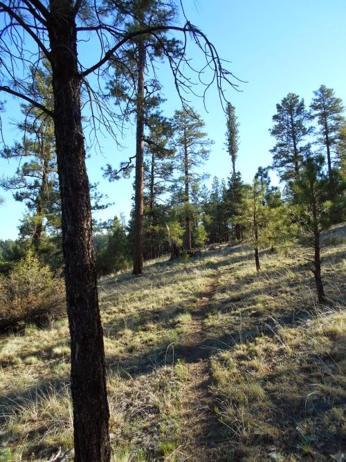
Maybe even a little boring. There were a lot of pine trees, which are pretty to look at--but they largely obscured any views that I'd otherwise have. The trail mostly followed gravel roads which are easy to walk on, but not especially interesting either.

Throughout the day, I saw maybe half a dozen mountain bikers, but they peddled on by and never stopped to chat, nor did the two ATVers I saw. In all, I saw close to a dozen people, but none of them were on foot or stopped to chat. You could tell it was a weekend with all these people on the trail--I usually see nobody so seeing nearly a dozen is quite a lot!

Water isn't as big of a problem along this section either. The stock tanks are still muddy and nasty, but they're more common here so I didn't have to carry as much during the day.


Near the end of the day, I decided to camp near Pine Spring because springs are almost always better than stock tanks and my biggest challenge of the entire day was just trying to find this darned spring! It was a tenth of a mile off trail according to the data book, which isn't much. But there was no trail or marker pointing the way, and I wound up missing it. Using my topo map, I knew approximately where it was located and followed a road, looping around where I thought the water should be and eventually found an empty water tank. I was a little discouraged at that--the data book seemed to suggest that the water source was fairly reliable and the metal tank was completely and totally empty. Maybe that wasn't the spring?

I wasn't worried about not finding the spring, though. There was supposed to be a reliable stock tank another mile or so up the trail, but I really preferred spring water which--usually--was a lot clearer and had less opportunity to get contaminated.

So I continued the search for the spring, following a fence eastward, but that didn't lead anywhere and I turned around and followed it westward where I eventually found a nice pool of water. The spring! It was practically right next to the empty metal tank--I could see the tank from the spring, but the spring was low and slightly uphill and out of view from the tank.

I probably spent 20 minutes looking for that spring which was just 0.1 miles off the trail. In fact, I could see the trail from the spring! I was a little annoyed with how difficult it was to find, but also a little proud of myself for my perseverance. I did find the spring, after all. =)

Lots of rabbits on the trail--but they're so hard to get good photos of
because they're so quick and shy! Even this guy, the photo is grainy
because I had to zoom in so far to get it. If I tried walking any closer,
he'd hop away. (It didn't help that he was in the shade either!)
Peace, dude!

A rare photo of me hiking on the trail. Of course, since I was by myself, I had
to use the 10-second timer on my camera and after this photo was taken,
walk back to pick up my camera. So this section of trail--I hiked three times!
'Twas a very flat day of walking!
There were a lot more stock tanks along the trail, but a lot more of them
also seemed to be dry.

Sheepherders Tank
Lots of walking on gravel roads today. *nodding*


I guess they really wanted to make sure cattle didn't get through here.
They installed both a gate and a cattle guard!
If someone hadn't created this giant arrow out of logs, I totally
would have missed where the trail turned off the gravel road here.
Wild Horse Tank
It's like someone created a little fort out of branches around these trees.
I wonder if it might be a hunter who created a blind or something?
(Just a guess on my part, though!) It was near Wild Horse Tank and, presumably,
it would be a good place to wait for animals who approach to drink from it.

Apparently, the person who installed this cattle guard didn't realize
that for it to be effective, you need a fence blocking both sides of it!
Otherwise, cattle will do just what I did--walk around it!
The empty water tank that disappointed me when I first found it.
Pine Spring--this is much better! =)
Treating the water--what a hassle!
Sunset near Pine Spring.

Monday, September 1, 2014

Day 34: Up the Mogollon Rim!

May 16: I got an early start to the day's hike and was hoofing it over the terrain by 5:30 in the morning. Within a couple of hours, the Arizona Trail veered off from the Highline Trail and finally ascended to the very top of the Mogollon Rim. It was a big milestone for me. The elevation at the top hovered at around 7,000 feet above sea level which left me with very comfortable temperatures. It also left me in a climate that provided plenty of trees for shade. And the trail became exceedingly flat--for the rest of the day, nearly 20 miles later, the elevation had climbed a mere 400 feet higher.

I made good time over this terrain. The main thing slowing me down was the weight of my pack--still packed with 8 days of food and a boat-load of water. Although temperatures were cooler, water sources were still relatively scarce. The longest stretch without water was nearly 15 miles. I'd need a few liters of water for that distance! Not as much as when I carried 10 liters through a hot desert for 25 miles, but even the 5 liters I carried was more weight than I would have preferred!

Just at the top of the rim, the trail crossed a gravel road where there was a monument for the Battle of Big Dry Wash--a battle I'd never heard of. They were thoughtful enough to provide a quick summary of the battle, which is probably a good idea since I bet most people have never heard of it. It read:
Seven miles north of this point, a band of Apache Indians were defeated by United States troops on July 17, 1882. A group of tribesmen from the San Carlos Apache Reservation had attacked some ranches in the vicinity killing several settlers. Cavalry and Indian scouts were immediately sent into the field in search of the hostiles. Five troops of cavalry and one troop of Indian scouts converged on the Apaches. Surrounding them at the Big Dry Wash, the resistance of the Indians was broken after four hours of stubborn fighting. The casualties numbered two soldiers and more than twenty Apaches.
Well, how 'bout them apples. But I was left wondering.... if the battle actually took place seven miles north of here, why was the monument here and not seven miles to the north?

The monument commemorating the Battle of Big Dry Wash.
I ran into two backpackers late in the morning. They looked like they were still breaking down camp when I arrived and I stopped to chat--I couldn't remember the last time I had seen a backpacker on the trail. The first guy introduced himself as Ethan, and I immediately hoped the other guy was named Allen--how cool would that be? But no, the second guy's name was Matt. Ethan Matt just doesn't have that same ring to it as Ethan Allen, does it?

Late in the afternoon, I was crossing a gravel road when, up ahead, I saw what looked like a horse gallop across the trail. A horse?! Horses were allowed on the trail, but I didn't notice anyone riding this one. And anyhow, the horse was running perpendicular to the trail, not along it. Not to mention that most people who take horses on the trail aren't running them. Did they have wild horses out here? I wasn't sure....

Then two more of the beasts ran across the trail, and since I was already looking up ahead after hearing the first one, I got a better look at these next two and... they didn't really look like horses anymore. They looked more like deer. Absolutely gigantic deer! At which point I realized they were elk. I had learned earlier on the trail that the elk in Arizona were considered the biggest in the world. Nearly half of the largest elk ever hunted have come from Arizona. These must have been some of the gigantic elk--I've seen elk before, but the sheer size of these things threw me off. They looked like horses!

I cursed the fact that they had run off before I could get a photo of them. Maybe I'd get lucky and see some more later in the hike.

Near the end of the day, the trail passed through the Blue Ridge Campground where I could use the outhouses, throw out trash and pick up good, clean water from a faucet. I talked with the campground host for the better part of an hour about the trail before imminent sunset had me pushing on to find a place to camp before dark. I suppose I could have camped at the campground, but there were too many people around. The individual sites didn't provide a lot of privacy and the place was noisy with people and cars driving through. No, I wanted to camp somewhere else.

I set up camp in the woods, just off the side of the trail where there was nobody else. Life was good!


It's an aqueduct, coming down from the top of the Mogollon Rim
to the bottom.
Someone took some effort to build this little "fort" in the wild!
Approaching the top of the Mogollon Rim did provide some pretty nice
views--minus the powerlines, of course. =)
General Spring Cabin was built in 1918 as a fire guard station.
This was one of the more unusual fences I'd seen on the trail.
A creek--or at this point, pools of water--followed along much of
General Springs Canyon.


I kind of wonder what happened to this tree.
The water at the top of the Mogollon Rim didn't really improve much
from that you find at the bottom of the rim!
It was near here where I caught sight of the biggest elk I had ever laid eyes on!
The Blue Ridge Campground--a nice place to stop!
I wasn't sure why people had built all of these "forts" out of the
logs that were scattered around. What are they for?! (Seriously, I don't know!)
I'd add a label for what this flower is, but I don' t know it! =)