Monday, June 9, 2025

Day 4: The Dolls are Watching....

May 7, 2025: According to the weather forecast, it was supposed to rain all night. However, it did not rain at all--until I woke up in the morning and wanted to start hiking for the day. Looking at the current forecast, however, it appeared that the rain would pass quickly, so I decided to try waiting it out before pushing onward.

And... I was successful! After an hour or two, the rain stopped, and I started packing up camp. While doing so, two northbound hikers came up the valley. Other hikers! Wow! These were the first hikers I had seen on the entire trail! One of them came from the UK while the other one was from Belgium, and we chatted for a few minutes.

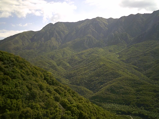
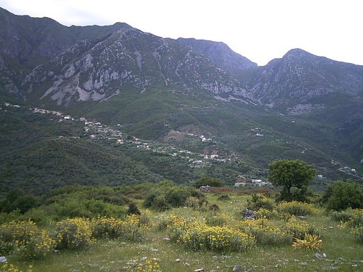
The trail would head to the bottom of this steep valley before climbing up the other side. (Not all the way to the tops of those mountains in the distance, though. Not that high!)

They reported passing a few other hikers along the route--which was news. But since I was hiking in the same direction as those other hikers, I just hadn't crossed paths with them. Most people hike the trail from north to south (southbound), but apparently if you want to see other hikers, it's better to go northbound! Although you'll just pass by them and not actually see them for very long.

Anyhow, the hikers continued onward and I finished packing up camp and headed immediately down a steep, rocky slope. The going was slow, and due to the recent rain and the sun coming out, the humidity was unbearable. Steam rose from the trail like it was being baked, and it felt miserably hot. At least I was going downhill which didn't take so much energy as going uphill!

After a few miles, I finally reached the bottom of the valley but as all things go, what goes down must go back up, and I was now heading uphill again to the small hamlet of Kudhës.I took a short break at the bottom by the river running through the bottom of the valley and it started to sprinkle a bit. Nothing serious, and it didn't last long, and while getting wet wasn't pleasant, at least the temperature felt a bit more bearable when the clouds blocked the sun.

Even that didn't last long, however, since the rain stopped and the sun came out again.

I crossed the creek at the bottom of the valley over this bridge.
 

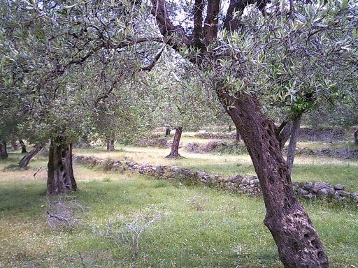
The climb up to Kudhës followed a narrow, windy road that was super steep and utterly exhausting to get up. It wound its way through an olive grove, and at one point there was a flock of sheep ahead guarded by several "angry dogs." After yesterday, that's what I started calling them. They were definitely none-to-happy to see me.

However, looking at the map ahead, the road switch-backed numerous times through the area and I suggested to Karolina that we could basically cut a switchback to largely avoid the flock and angry dogs, and that's what we did. I had to check my GPS to make sure that the road would still switchback so we could get back on the trail quickly, but it all checked out so we cut off the road, through the olive grove and directly up the hillside before reconnecting with the road several minutes later. The angry dogs were still close enough to see ne trying to sneak by and barked and howled at me with anger, but they didn't seem to want to leave their flock behind to chase me so I got by without having to throw any rocks, wave trekking poles or shout at them. One of the easier places where I got around the angry dogs.

At the edge of town, I reached a small church with a few graves that had a water spigot running out front. The spigot itself didn't seem to work. Water flowed out of it and jiggling the handle didn't make it flow faster or better, but it also didn't turn off the flow either. In any case, it didn't matter to me--it looked like good, clear water and perfectly suitable for drinking and I definitely needed to fill up with more drinking water.

I was not sure where the source of the water was, however. Did it come out of a spring? Was it piped down from higher up in the city? I had no idea, nor had I any idea if the water was treated, so I pulled out my Sawyer Squeeze and used that to treat water for us. 

A giant pig with a family of piglets passed by, seemingly not really caring about my presence.

I filled up with water from the facet at this church/cemetery.

I continued into Kudhës. Kudhës is a relatively small town, but it's long, built along a steep ridge of a hill. The one road I followed was basically the main road through town that the whole town was built around, and it was steep from top to bottom.

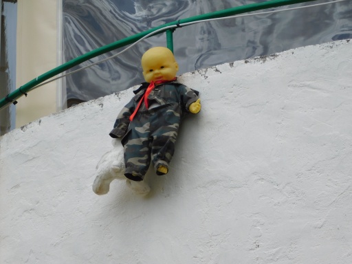
One thing I had started to notice was that many of the buildings had stuffed animals or dolls hanging off them. I first noticed it yesterday and thought it was just something that that one person had done, but then I saw another one. And another one... and I slowly started realizing that it was a "thing" that some people did here. I theorized it was probably supposed to ward off evil or bring good luck (kind opposite sides of the same coin, really), but they had often been hanging there for months or perhaps years and usually had a haunted look. It didn't help that they often seemed to be strung up by their necks or impaled in their bums with rebar. These did not look like happy toys!

Definitely not a happy toy!

Later, Karolina would message her Albanian friend whose wedding we had attended to ask about those, and she confirmed my suspicions that it was meant to ward off the "evil eye" and bring good fortune, and that elderly and superstitious people were more likely to do that--especially on newly constructed or purchased properties.

There's not much to say about Kudhës except note it's unusually steep, linear layout on the crest of a ridge. This town marked the end of another stage in the guide, so I stopped long enough to check the maps for the next stage and figure out where I might be able to stop for the night.

This is the town of Kudhës. Notice how long and narrow it is, sprawled out over a steep ridgeline.

 
Another view of Kudhës, but this time from the other side. (The previous photo was taken from the other side of the valley, while I was still descending to the bottom of the valley. This one was taken on the way out of the city.)

About halfway through the stage was a small town of Old Qeparo, which was roughly my minimum goal for the day to stay on schedule. On the maps, just before the town, it looked like there might be some decent places to stealth camp, but I wanted to go into town in the hopes of scoring a cold drink. After the town, the opportunities for stealth camping were less clear. To be fair, the maps were never designed to point out good places to camp. They were meant to provide directions, not point out campsites. But you can read a map and see if there might be nearby roads or civilization that would make stealth camping more difficult, or if there are trees and bushes around to stay better hidden, and see where terrain was flat and therefore more suitable for camping. But none of those factors were guarantees about finding a good campsite just by looking at the maps.

In any case, I decided that I had time for a longer break. On the maps, it looked like there might be a shady area not far out of town near a dry streambed which might make a good place for a break, so that's what I did.

And it was a perfectly lovely place to stop for a break for an hour or two. =)

A dry streambed. (This is not the dry streambed where I took a break, though!)

After a lengthy rest, I pushed onward toward Old Qeparo, noting an abundance of very nice stealth camping sites along the way. The section between Kudhës and Old Qeparo had so many amazing campsites! I took note of them, especially as I got close to Old Qeparo and considered the idea of going into town for a cold drink and backtracking ten minutes to a stealth campsite out of town.

The town itself was slightly off trail according to my sources, but the trail markers actually did lead through the town itself. I wasn't sure if that was because the route was officially rerouted through town or if every hiker stopped in town anyhow that they may as well mark the trail that way. In any case, I descended a steep hillside off the main trail into a short side trail into town and made my way to what I first thought was a restaurant with an outdoor patio but turned out to be a small market with an outdoor patio.

Overlooking the town of Old Qeparo. There are cold drinks down there somewhere!

Either way, however, there were cold drinks available and a shady place to sit outside, and I took the opportunity to do so. I got a Coke, and after finishing up, I went back for seconds this time I got a Fanta.

While resting on the patio, a couple of the cattle in town decided to get a little frisky between two cars, making a racket that sounded like it might be denting the cars until a woman from the market went over and shooshed the cattle away. She looked at the vehicles as if checking for damage before returning to the market. Another exciting day in Old Qeparo.

Looking at my options, I didn't feel like backtracking to the last nice campsite. Backtracking just felt wrong, even if it wasn't more than about 10 minutes or so. And now with a visual line of site ahead, I felt confident that I could find a good place to camp on the far side of town further down the trail. There were fields of olive trees ahead (which the guidebook suggested were actually abandoned and no longer farmed), and I had noticed that even when olive trees were planted on steep hillsides, that the ground had been terraformed into flat terraces that the olive trees were planted in and surely I could camp on one of those flat areas, even if it was on a steep hillside.

So I pushed onward, walking perhaps a quarter-mile out of town before following a gravel road into an old olive grove and finding a wonderful place to camp with commanding views of the Mediterranean Sea and overlooking Old Qeparo. Sunset wasn't for a few hours, however, so I suggested that we not actually set up camp just yet. Let's not look like we were camping there just in case somebody wandered by, but rather try to look like we were just taking a nice, lovely break.

I pulled out my groundsheet to lay on, then spent the next few hours reading my Kindle and finishing the latest saga of Jack Reacher kicking butt. By sunset, not a single person had wandered by and we finally set up camp.

And thus ended day four on the trail.....

I had a lovely view of the Mediterranean Sea from the campsite in the old olive grove!
  
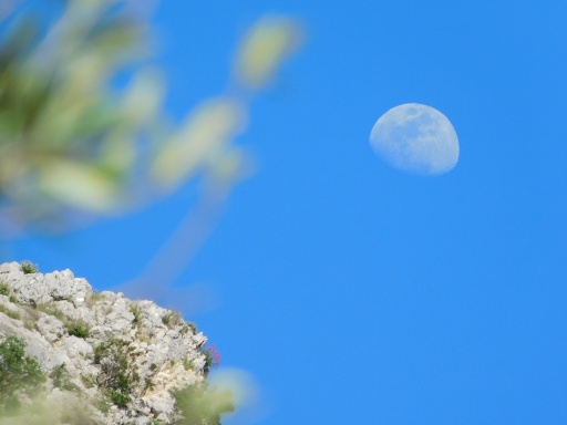
Not only could I watch the sun set, but I could also watch the moon rise! =D

Looking back toward the hilltop view of Old Qeparo.
 

The valley I had to descend into then back out of. (That's Kudhës on the left.)
 
The baby hanging by its neck wasn't the only creepy thing on this house.... Look closer near the back of the building....


It also had this mannequin checking out everyone who passed by!

A little before Old Qeparo, I passed by this fancy spring!

And there were lots of frogs swimming around in the puddle of water it created in front.

This caterpillar was trying to cozy up to me!


Friday, June 6, 2025

Day 3: The Dogs Were Angry That Day....

May 6, 2025: Early in the morning, a terrific thunderstorm rolled through the area. Rain poured from the heavens in buckets and thunder rattled the windows. None of that mattered to me since I was tucked safe and dry in a hostel, although it did disturb my sleep.

The thunderstorm eventually passed and I started preparing for the day's hike, said goodbye to Denim, and hit the trail at about 9:00am.  The trail went literally right past the front of the hostel so there was no effort to get back to the trail--I was already on it!

I put on my shoes at the hostel, preparing to start another day of hiking!

The route followed some roads out of town, but somewhere along the way I missed a turnoff and plowed onward in the wrong direction for maybe five or ten minutes. It wasn't really a big deal--but definitely an annoyance. I pulled up Google Maps to see how to get back to the proper trail and it appeared that there was a small path through some olive fields that would hook me back up with where I was supposed to be without having to backtrack quite so far, and I decided to go that route instead.

And it was a pleasant diversion. I followed a gravel road through the olive fields, away from the busy traffic on the street I had been following, and at times the gravel road became a narrow walking path. I passed one woman walking in the other direction along the way, but that was it and after five or ten minutes, rejoined the route where I was supposed to have ended up earlier.

I passed through these olive fields after missing a turn and trying to reconnect with the trail.

From here, the trail started climbing steeply and steadily into the mountains. First it followed a gravel road, winding its way up the hillside, but I had to slow down a bit when I reached a shepherd with his flock of sheep and goats that blocked the road. I continued following the road, but the shepherd took his flock cross country and I soon found myself behind him again.

This time, however, he tried to talk to me. He didn't speak English, but with a little hand-waving and pointing, I told him that we were heading to Pilur. He said something in Albanian that I couldn't understand, and I tried pulling out my phone to open Google Translate for him to talk into, but he waved that aside and pulled out his own phone and called someone. I could tell that it sounded like a young girl, and I assumed it was probably a daughter or something that spoke English and could translate for us.

They conversed for a couple of minutes then he handed the phone to me and my guess turned out to be correct--it was his daughter, and she spoke English. She explained that her dad wanted to warn us about "angry dogs" ahead, and that it wasn't really safe to continue onward. I actually could hear dogs barking not too far ahead, so I had little doubt that he was right.

"Umm... okay...." I said, wondering what I was expected to do now. I had actually passed a few "angry dogs" along the trek already, not including this shepherd who had a couple of dogs that did not seem pleased to see us when we first arrived (although now they were leaving us alone). My policy for dogs was to pick up rocks and, if they started to threaten me, throw rocks at them. The dogs back off quite quickly when you start throwing rocks at them. I had even learned while hiking the Jordan Trail several years ago that just picking up a rock can often be enough to get them to back off. They know what you're doing! So I'll sometimes just pretend to pick up a rock even if none are around (or even if I already have a rock in hand) as a warning. "Don't mess with us! We can pick up rocks!"

Anyhow, I said we would pick up some rocks and throw them at the angry dogs. It's not like I had a lot of alternatives. Even if I walked some other route, there would likely be other angry dogs! But I also asked what her dad advised.

She asked to be handed back to him, which I did, and they talked a bit more before he gave the phone back to me and she translated that her dad said to wait for a half hour and the dogs would be gone.

How could he possibly know that? I found this a little puzzling, but okay.

The flock of sheep (and some goats) that were blocking the trail.
 

I gave the phone back to the shepherd and sat down under the shade of a tree to wait for a bit. The shepherd also hung around, seemingly wanting to make sure I was okay. He talked on his phone with some other people in the meantime, then, after five or ten minutes, he waved to me and seemed to indicate that it was safe to continue onward. It hadn't been a half hour yet--not even close to it.

The only thing I can figure is that he knew the people who owned the dogs up ahead and he had called them to let them know we were walking by and that gave them enough time to put the dogs on leashes because when we passed by the structure, we did see several dogs, but they were all leashed up and of no threat. Still, I carried rocks as I walked by. Better safe than sorry! But I didn't have to threaten any of the dogs with them.

Safely past this obstacle, I powered onward up the mountain, which soon reconnected with the main route again. (Lest you've forgotten, I had decided to take an alternate route through Himarë late yesterday, and had not yet reconnected with the main route until now.) 

At this sign, I officially was back on the main trail rather than the alternative I had been following since yesterday.
 

At this point, I left the gravel road and followed an actual trail ever higher into the mountains. The air was getting thin up here! I huffed and puffed and beads of sweat dropped from my brow. It was hot. Perhaps not so much in temperature, but combined with the humidity, it was taking a toll. The trail started weaving among pine trees that became an absolute forest in places and the shade was welcome, but it didn't help with the humidity or the stagnant air.

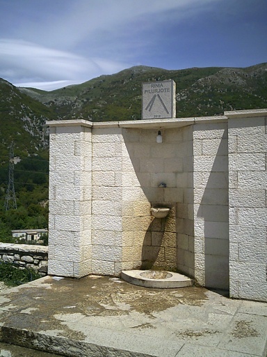
After at least another hour of hiking, I reached the town of Pilur and followed roads the rest of the way into the town center. Pilur is a small town with probably no more than a hundred or two inhabitants, but it was situated on the top of a hill, had wonderful views looking all the way out to the Mediterranean, and provided a nice fountain to fill up with water and a shady place for a break.

What it did not provide, however, were any open restaurants. I was hoping to buy a cold drink or something in town, but the couple of restaurants in the town center appeared to be closed for the season. The only liquid refreshment available was the water from a fountain that people constantly drove up to to fill up empty jugs that they loaded into their vehicles to take home. I was prepared for this eventuality, however, knowing that these smaller towns likely had no public services available. That was the main reason I veered into Himarë, after all--to fill up with groceries for the trail for the next couple of days.

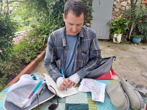
I sat down at a table and wrote in my journal, read my Kindle, played with my Rubik's Cube, and ate some snacks out of my pack.

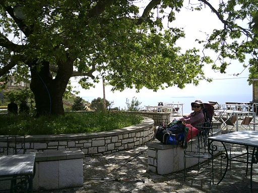
I stopped for a break here in Pilur's town center. It was a lovely place for a break with views to the Mediterranean, shade, and a nice breeze.


I spent over an hour there, and it was a pleasant stop. One local guy walked up to me and started trying to speak to me, but he didn't know any English and apparently didn't have a daughter he could call to act as a translator, but I was 't entirely sure he actually had anything important to tell me either. He just seemed like a lonely old guy that wanted to talk with some people, and I was a huge disappointment for him.

Shortly before I planned to keep going, a German couple biked up from the opposite direction and asked if any restaurants were open. "Not that I could find," I told them, and they seemed immensely disappointed about that. Unlike me, they had counted on restaurants being open.

I said that I had some food I could share if they were hungry, but they waved it off and said that they'd be fine--although they would have to fill up with water from the fountain. (As I did.)

I packed up and said goodbye to the Germans on my way out of town. For the rest of the day, the trail led mostly downhill, and my progress went a lot faster. Plus, I sweat a lot less going downhill than uphill. 

The restaurants in town, however, were closed up tight. =( 
At least I could use the tables and chairs outside, though!
 

My guidebook warned me about "angry dogs" along a certain section of trail and to be wary of them--the first time my guide mentioned a specific location along the trail with angry dogs so it was a warning I definitely heeded. I filled my pockets with several rocks and kept a couple of them in hand figuring better safe than sorry.

And the guidebook was not wrong. Near that area, a few dogs that had been running loose came running at me like I was prey to be taken down and eaten. I shouted at them and waved my trekking pole around, and I immediately used one of my rocks and threw it as hard as I could at one of the dogs and they immediately paused their attack.

I pulled another rock out of my pocket and I kept yelling at the dogs to "back off" and swinging my trekking poles at them, all the while continuing down the trail and trying to put as much distance between me and the dogs. After a few minutes, the dogs left me alone, apparently no longer in their territory.

The trail passed by a small man-made reservoir, a stagnant pool of water used by livestock that I was happy to pass by since I had filled up with water in Himarë.

The small reservoir that I passed along the trail.

The trail hopped over a small ridge, perhaps 30 feet high, before plunging down a steep hillside where it flattened out in a small area near a valley bottom. It was only a little after 3:00 in the afternoon, quite early to stop for the day, but the weather forecast called for rain to start sometime between 4:00 and 5:00 and looking ahead on the map, I wasn't sure that I would find a better place to camp for the rest of the stage.

So I suggested to Karolina that we stop to camp for the night right then and there, and seeing the wisdom of my suggestion, agreed to it.

This gave us hours to kill before sunset, and I used the time to read the latest Reacher adventure on my Kindle. 

By 5:00, the rain still hadn't started, and I had begun to regret stopping so early in the afternoon. The whole point of stopping was to set up camp before any rain began, but if there was no rain, then there had been no reason to stop so early! 

The hours marched onward, and still the rain held off. Some ugly clouds did roll in, but no rain came from them.

However, a little after sunset, I saw a flash. Then another one. The fireflies were coming out!

And as darkness descended, the fireflies came out with a vengeance!  Hundreds and hundreds of them, all around the campsite, as far as the eye could see! It was positively magical! It reminded me of one of the best firefly displays I had ever seen while thru-hiking the Appalachian Trail. Wow, wow, wow!

I must have watched them for over an hour, mesmerized by the flashing lights before turning into bed and going to sleep. Maybe stopping so early for this campsite wasn't such a bad idea after all... =D


I tried to take photos and videos of the fireflies, but alas, they really didn't turn out. As amazing as it was to see in real life, they were much too dim for my cameras to catch. So instead, I'll show you what I ate for lunch: tortillas filled with salami and cheese. =)


A post about Albania would not be complete without a photo of more bunkers. =)
 

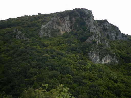
The trail today went quite high into the mountains and was even filled with a proper forest!
 

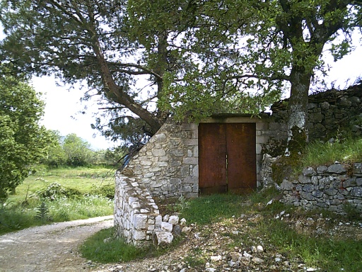
Road into Pilur
 

Water fountain in Pilur
 

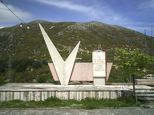
Monument in Pilur


Tuesday, June 3, 2025

Day 2: Ghost Towns

May 5, 2025: I woke up to... rain. The weather forecasts were accurate. However, the good news was that it stopped early in the morning long before I had to start hiking!

I learned that there was a short, half-hour (one-way) trail up Gjipe Canyon. I had camped at the end of the canyon and it looked gorgeous, so I decided to enjoy the hike through it. It was popular with climbers. I had no plans of climbing, though, just sightseeing. Since it was an out-and-back trail, however, I decided to slackpack and left most of my gear in camp.

Gjipe Canyon was quite scenic!
 

At times, there wasn't even much of a trail, where I just followed a dry streambed upstream. At times, it required a bit of scrambling over the large boulders piled into it, but nothing that was particularly problematic. It was a nice little detour, and after a half hour or so, I turned back and returned to camp to pick up all my possessions and continue the real hike.

From Gjipe Canyon, the trail climbed up onto a badly overgrown trail overlooking the sea. The overgrown trail was a nuisance, however, Inever lost the trail like I did yesterday. =)

Very scenic (albeit overgrown) trail overlooking the Mediterranean.
 

The trail then led down to Jale Beach, a small resort town on the coast. Even from a distance, the town looked surprisingly empty of people, but I didn't think much of it until I reached a large hand-painted sign just before a staircase into town that said not to enter and that it was private property ahead.

Looking at my maps, this was a problem. The only alternative around the closure was a long road walk that would bypass the town entirely then require a bit of backtracking if I actually wanted to go into town. It seemed like a needlessly stupid detour. Even more annoying, there was also signage pointing to businesses, beaches, and other facilities down that same staircase. Make up your minds! Was it really private property, or a public walkway?

Taking a closer look at the town, however, I realized that it seemed like the entire town was under construction. Every building I could see appeared to be uninhabited except for construction workers making a lot of noise. Some buildings looked essentially finished, gleaming and shiny with newness, while others were mere skeletons and shells of structures that had months of work left to go, but pretty much every single structure I could see appeared to be under construction. I suspected the closure was due to this construction.

The whole town around Jale Beach appeared to be under construction!
 

Not wanting to take such an enormous detour, however, I decided to charge through anyhow and ignore the hand-painted signs for the more official-looking directional signage that pointed me there. And... walk through the construction area as quickly as possible before anyone started yelling at me. =)

I surveyed the scene for several minutes, trying to get a sense of where the workers were actually working and the best path through that might avoid them then descended the stairs and pushed my way through.

I passed a few workers along the route, but they did nothing more than wave or say hi before continuing with their work and didn't seem at all bothered about me walking through.

I breathed a sigh of relief upon reaching a road closure--it was closed to traffic coming from the other direction--so I figured that meant I was once again in an area that was "open to the public." Safe!

I had already walked through most of the town, but there was still a bit of beach and a few businesses open along it. In fact, I only counted two small restaurants and a small market/convenience store that were open. Everything else, as far as I could tell, was still closed. One of the restaurants had no people at all in it while the second one had a table filled with what appeared to be construction workers on a break and another table that I would later find out were the owners of the establishment. 

I took a table at one of the restaurants, ready for lunch, and asked for a menu--but they had none. "We have pasta," the waitress told me  

"Pasta? Just pasta?" I asked.

Well, there were different flavors of pasta. There was seafood pasta, for instance. Not being keen on seafood myself, I asked if there was an option without seafood, and the waitress said they could make a vegetarian pasta. "Great, I'll have that," I told her.

Karolina's "seafood pasta" (i.e. shrimp pasta)

While lunch was being prepared, I tried to figure out where we might stay for the night and catch-up writing in my journal. 

The food was eventually served. We paid the bill--and for a full lunch for two, the prices were quite reasonable by my standards. I suspected it was considered ridiculously expensive by Albanian standards, but you could get a very large, filling plate at a beachside restaurant for about $10. With these kind of prices, I wanted to eat out every day!

But anyhow, it was time to continue onward. The trail followed a gravel road out of town which made the walking comparatively easy. It followed near the coast (albeit not on the coast) and often provided wonderful birds-eye views from high points.

The trail next reach Livadi Beach, another town that appeared devoid of tourists. To be fair, this town actually had several restaurants and hotels that were open (but mostly empty) and definitely a few tourists, but it again felt strangely empty as if the town had been evacuated due to an impending tsunami.I had heard that many businesses along this coastline were closed during the off-season. May is more of a shoulder-season, though, with peak season not really ramping up until June. But it was positively eerie how empty these towns felt. Nothing like Dhërmi Beach from yesterday that seemed bursting at the seams with activity!

While a lot of construction was going on in this town, at least this town didn't seem like the whole town was being built. It just seemed like most places were still closed and not yet opened for the busy tourist season. 

The main beachside street along Livadi Beach seemed strangely empty of people.
 

I was still full from lunch on Jale Beach, though, and had no reason to stop here and just pushed through town.

The main trail led away from the coast and into the mountain, but there was an alternative route that followed near the coast into the town of Himarë and I decided to take the alternative. I had a couple of reasons for doing so. 

First, I knew about a hostel where we could stay for about $10 per person per night. That's where Denim was staying, so I already had a firsthand account that it was a great place to stay and relatively cheap. If I stayed on the main route, I would have to wild camp and I couldn't be sure how easy or nice that would be. There were no official campgrounds or other lodging options in the area.

But the second and more important reason for going into Himarë was that I needed food. Technically, the trail would go through a couple of towns along the way, but they looked very small and given the lack of services in the last two towns today, I had low expectations that anything would really be available. The next reliable place where I could find restaurants and markets would take two to three days to reach, so I needed to buy food. And Jali Beach and Livadi Beach were not great options. Himarë would have a real market where I could buy a couple of days of food, however.

So, I decided on the detour into Himarë. I missed a turn along the way, but it turned out to be a little importance. It made the walk a bit longer, but it also avoided a steep, overgrown section so that was fine.

When I arrived at Himarë, it was still fairly early in the afternoon. Himarë, I'm happy to report, was a bustling town with lots of activity and every business actually seemed to be open, so I stopped at an ice cream shop where I got ice cream. Afterwards, I caught up with emails and other messages on my phone.

I walked to the Oasis Hostel and checked in, catching up with Denim for a bit and getting more details about the angry taxi driver yelling at him when dropping him off. Was that just yesterday? It seemed like a lot more time had passed!

Checking in at the Oasis Hostel
 

I still needed to buy food for the next couple of days and get something for dinner, though, so I headed back out again and did some shopping at a grocery store--a real grocery store! It was a small one, but definitely bigger than a convenience store which is the largest option I had seen so far on the trail. Then stopped at a pizzeria for dinner before returning to the hostel again for the night.

Day two was official done! 

Looking down on Gjipe Beach as we were leaving.
 

Crossing a rocky scree field!
 

So many tables and chairs and other debris piled up outside on Livadi Beach.
 

Of course, we passed more of those infamous Albanian bunkers....
 

We found this frog in a pool of water in Gjipe Canyon.


Livadi Beach


Dinner at a pizzeria!


Guests hanging out in the hostel's kitchen area.

Sunday, June 1, 2025

Day 1: I went to Albania?!

May 4, 2025: I was never supposed to walk today, but yet I found myself in a taxi, careening around sharp turns in the road on my way to Dhërmi and mentally preparing to start hiking as soon as I got out.

But before I get to that, let me catch you up on what happened. My friend, Karolina had been invited to a wedding in Albania by a friend of hers, and she very much wanted to go. But not content to fly across Europe just to attend a wedding and fly back, she searched around for trails that she might be able to hike while she was in the area and found one called the Southern Coastal Trail that ran, not surprisingly, along the southern coast of Albania through an area known as the Albanian Riviera. Then she asked if I would be interested in joining for the hike.

The Southern Coastal Trail in Albania was marked with these white-red-white markers. At least some of the time. Other times, it wasn't marked at all!
 

That sounded like an intriguing idea for me. Albania! I never really even had that country on my radar before, but sure, why not? It might be interesting!

Somehow, I ended up attrnding the wedding as well. Originally, the plan was that I would just "hang around" and do my own thing sightseeing or whatever, but Karolina got me an official invitation so hey, dinner!

It's a little odd when you have to pack a bag to handle both a wedding and a backpacking trip at the same time. My hiking clothes did not seem particularly suitable for a wedding, and wedding clothes didn't seem particular suitable for hiking, and hiking with wedding clothes in one's backpack is just crazy--even if I do know of one person who actually hiked in an actual wedding dress. I would not be wearing any wedding dresses, just to be clear, but looking through my clothes, I didn't really have anything that I thought would be suitable for both hiking and a wedding. What to do, what to do?

I wound up bringing a tie. That's an easy, lightweight way to look a little classier. =) 

And then, instead of wearing my own hiking shirt to the wedding, I would up wearing Karolina's. She had bought a new shirt to hike in so it was fresh, clean and spotless--for now and with a tie, it seemed like something that I could get away with wearing to a wedding.

Crashing a wedding with a Wallace and Gromit tie and Karolina's purple hiking shirt. =)

We spent the night in Golem, on the coast of Albania, and woke up the next morning to go to Dhërmi and the start of the Southern Coastal Trail. I expected it to be an all-day thing. In fact, checking buses, I wasn't even sure if we could make it to the trailhead today. The fastest route on public transit according to Google wouldn't get us to the trailhead until about 8:00am the next morning!

But during breakfast, while chatting with one of the other wedding guests (Denim, who comes from South Africa),I learned that he was heading to Himara, the town right next to Dhërmi, and I decided to pool our money into paying for a taxi, which would get us to the trailhead in just a few hours.

I was thrilled about this. Turning a 24-hour trip on public transit into a three-hour taxi ride seemed like a good trade, and split with Denim, it was expected to cost only about 50 euros.

The ride went well. I fell asleep in the back seat for a little bit, but when I woke up, the views around Vlorë were amazing! Giant, towering, snow-covered mountains inland! Beautiful Mediterranean Sea to the coast! This was looking like a great idea!

We arrived at a sharp turn in the road that marked the official start of the Southern Coastal Trail. The taxi pulled over to let us out, and I gave Denim about 70,000 lek (about 70 euros) to cover half of the cost of the taxi plus a tip and "just in case" the driver demanded more than expected. For 70 euros, it still seemed pretty cheap for a three-hour taxi ride.

The cars were being rinsed with water from a creek running down this canyon.
 

Denim continued onward and we rearranged a few items in our packs and prepared to start hiking. At the trailhead, several cars stopped and sprayed their vehicles with water from a hose that pulled water out from a nearby creek. The free, local car wash, I guess?

The trailhead started at the edge of town, a few hundred feet above sea level, and immediately plunged down a steep canyon toward the Mediterranean Sea. There was no grand monument to mark the location, but rather just a simple sign pointing the direction with destinations and estimated travel times.

After adjusting all of my gear and putting on my hiking shoes, I started down the trail. This section of trail from the trailhead down to Dhërmi Beach was also known as the Mills Trail according to a sign, and had been used for hundreds of years by the locals and would pass by some old mills, a couple of historic churches and even an old, abandoned hydroelectric plant.

Along the way, I passed a herd of sheep and goats being directed by a shepherd. I also lost the trail on one occasion, following a prominent trail to the right over a large, red bridge that crossed over a small creek. It wasn't until I hit a dead end a few minutes later and I checked my GPS that I realized that the bridge lured me into the wrong direction. The trail never crossed the bridge, but rather continued straight on a smaller, slightly overgrown path.

Fortunately, it didn't take me more than a few minutes in the wrong direction and I quickly corrected.

A herd of sheep and goats blocked the path for a minute or so.

After about a half hour or so, I hit a paved road and followed it the rest of the way down to Dhërmi Beach and the Mediterranean Sea.

I stopped at the first restaurant I csne across. Or maybe it was the second restaurant, but basically I hadn't had lunch and I was hungry so I stopped for food more-or-less immediately as a late lunch and/or early dinner. They served Italian food. I guess the fact that Italian food was common was no surprise--Italy was just 50-or-so miles away across the Adriatic Sea--and I didn't realize it at the time, but it often turned out that Italian food outnumbered all the other types of restaurants combined! Good thing I like Italian, but where was all the Albanian food?!

Anyhow, I took a seat at the open-air restaurant and I tried to order the ravioli, but they told me that they were out of ravioli and it was no longer an option. *sigh* So after getting my hopes up, I settled on the risotto instead.

I spent time on my phone trying to figure out where we might be able to spend the night and found a campground a few miles ahead at Gjipe Canyon that seemed to be available and decided to shoot for that.

I ate lunch/dinner at this restaurant on the beach.
 

Afterwards, we stopped at a nearby market to pick up a few snacks for the trail. To call it a market is a bit of an exaggeration--it was more like a convenience store and a terrible place for hikers to resupply, but it was the best option we had at the time.

I followed Dhërmi Beach to its end, at which point I had to start scrambling over some large boulders where the cliffs plunged into the sea, and it started to become somewhat sketchy. I obviously wasn't the first person to travel this way, but it was clearly not a well-traveled path. I remember reading a description of the trail saying that areas were often overgrown and difficult, but this particular section seemed positively miserable and Karolina demanded that we turn back, convinced it had to be the wrong direction and this direction was too dangerous. I was optimistic the difficult section would soon end just as soon as we got around the headland, but I eventually relented and we eventually turned back to the beach.

We wandered up and down at the end of the beach looking for a trail or junction that we might have missed and, finding nothing, we asked one of the locals for directions. He was uncertain if there was actually any trail at all but suggested looking somewhere near some bunkers at the end of the beach.

The bunkers... indeed! Albania is somewhat famous (or infamous) for their ubiquitous bunkers.  Hundreds of thousands of them had been built when the Hoxhaist government ruled from the 1960s to the 1980s--a colossal waste of money and resources. Plus the bunkers were never even used for their intended purposes. On average, the country had about 15 bunkers for every square kilometer in the country, and they would be a daily sight along the trail.

One of the infamous bunkers of Albania.
 

Anyhow, I found a bunker without any trouble, and found a small trail that led up to the bunker along the steep hillside. I followed it to the bunker where the overgrown trail continued onward and onward. Ah ha! I was on the right track again!

The trail climbed steadily and steeply, eventually reaching a high viewpoint near an old monastery before dropping back down on a gravel road to Gjipe Canyon. By the time I arrived, it was near sunset--quite a bit later than I had expected to stop for the day. I quickly checked in and set up camp for 500 lek each. Albanian lek was the local currency, which converted into about 5 euros (or about $5.50). Practically a bargain for a beach-side resort! ;o)

I walked out to the beach and made myself comfortable on a lounge chair where I watched the sky darken, the stars come out and caught up with email on my phone. 

Karolina, I guess, decided to stay in camp and sleep early. I also had plugged in my other devices to charge--the campground was hooked up to solar power panels so we were able to charge devices with a provided outlet.

The solar panels that seem to run the beachside campground, and Gjipe Canyon looming inland.

Back on my phone, I got a message from Denim that the taxi driver shouted at him and tried to rip him off after he got dropped off in Himara. We expected the taxi to cost about 10,000 lek (about 100 euros), but because a tunnel was closed the taxi had to drive around it, it was now 13,000 lek (about 130 euros). Anyhow, it sounded like a lot of drama and while I felt sympathy for Denim, I was kind of glad I had missed the spectacle. =)

Interestingly, when I connected online, my phone gave me a "welcome to Greece!" message. It likes to welcome me whenever I enter a new country, but I had to admit being a little shocked to discover that I had somehow wandered into Greece. Clearly, I was not actually in Greece and had not been in Greece at any point, but I was close enough to Greece that my phone had connected to their network! There were several islands offshore that were visible that, according to Google Maps, actually belonged to Greece and I figured it might be connecting to one of them. I was actually a little surprised that I got any service at all in Gjipe Canyon since it was fairly primitive there (running on solar power and all), but I guess the cell phone signal must have been coming from those islands.

As darkness descended, I was surprised when I saw a few flashes of light nearby. Fireflies! I had no idea that there were fireflies in Albania! They weren't particularly thick or anything, just a few of them flitting around, but I so rarely get to see them, it's always a treat when I do. =)

When I eventually returned to the campsite, I had left the rainfly off my tent thinking it would be nice, but a forecast of rain definitely changed the calculations and I found myself putting the rainfly on at nearly 11:00 at night.

I took this photo of the moon while hanging out on the beach that evening.

And thus ended my first day on the trail..... In all, I completed about 7.6 kilometers (4.7 miles). Pretty good for a day in which I had not expected to do any hiking at all!


So many hoses pulling water from the creek!

Dhërmi Beach
 
Dhërmi Beach

Gjipe Beach ahead! And I would camp in those trees, a little left of the beach (but not visible in this photo).