Wandering around the world long distances on foot....
Wednesday, December 14, 2016
Day 13: The Mason-Dixon Line
July 17: I slept well, and woke ready to get an early start to the day. I only had a few miles to reach the Mason-Dixon line marking the boundary between Maryland and Pennsylvania. It was time to get into a new state!
Borden Tunnel
Barely a mile away, I passed through the Borden tunnel. Constructed in 1911 and 957 feet long, it wasn't particularly noteworthy except that it existed and hiking through tunnels is still a novelty for me. Inside, the temperatures were cool, but a part of me was disappointed that it was so early in the morning and not particularly hot out in the first place. Seemed like a waste to go through it and not be able to enjoy the coolness of the tunnel on an otherwise hot and humid day. I'd have appreciated its air-conditioning much more later in the afternoon.
I reached the Pennsylvania border about an hour later where I stopped for photos and a quick snack, contemplating if I should stand in Maryland and pee into Pennsylvania, or stand in Pennsylvania and pee into Maryland. Or maybe stand with one foot in each state and pee directly on the state line. I was a little obsessed with peeing--my bladder was full, so I figured I should make the most of it.
Before I made a decision, a dad with two young kids pulled up on bicycles and I canceled my plans for peeing on the border. The family had rode their bikes in from
Frostburg, and it seemed like it would be in poor taste to pee in front
of the kids. The dad probably wouldn't like it either!
But I was still left with the perplexing question about where should I snack? In Maryland or Pennsylvania? A row of seat-high blocks marked the border which spelled "Mason & Dixon"--one letter per block. Being a convenient place to sit down, I sat on one of the blocks to eat.
Signage described the history of the Mason-Dixon line:
The Mason-Dixon line began as a dispute between two British colonial families. The Penn and Calvert families fought over the boundary for three generations, and eventually a British court defined the Pennsylvania-Maryland border as 15 miles south of Philadelphia.
Charles Mason and Jeremiah Dixon then surveyed the line over a period of years that now bears their name and marks the traditional boundary between the north and the south.
After eating a quick snack, I continued on and found a place on a side of the trail to pee. Pennsylvania got the prize! But I stood in Pennsylvania while peeing into Pennsylvania, which isn't really all that noteworthy and somewhat of a disappointment for me.
I hadn't made it more than about five or ten minutes when I remembered someone telling me that Verizon works pretty much immediately after crossing into Pennsylvania, and I wanted to fact check that. So I pulled out my phone and turned it on... and got a signal! Dang, they were right! Verizon might hate Western Maryland, but they certainly had no problem with Pennsylvania! I called Amanda to tell her that after a week with no service, I was finally back on the grid! Hopefully it would stay that way....
When I first lost service for good in Harpers Ferry, apparently I did get enough of a connection that my phone could tell me I had one voice mail waiting for me. I wasn't able to listen to the voice mail, however, and that message taunted me for the entire week. Finally, though, I was able to listen to the message! It was a message from Amanda, long since obsolete, but I was glad to finally know what this message was and get it to stop telling me that I had one new voicemail.
A mile or so past the border, I reached another tunnel way too early in the morning to fully appreciate it: The Big Savage Tunnel was completed in 1912 and spans 3300 feet (1000
m)—the longest tunnel along the trail. The rail line was abandoned in
1975 and the tunnel quickly deteriorated. In the late 1990s, support for
tunnel restoration grew which was completed in 2003.
And other mile beyond that, I reached the Eastern Continental Divide which splits rainfall that flows to the Atlantic from rainfall that flows into the Gulf of Mexico. It also marks the highest point of my entire hike--it was, quite literally, all downhill from here! Not a very steep downhill, but downhill nonetheless.
So much interesting stuff on the trail! Two tunnels, a continental divide, and phone service?! And it wasn't even noon yet! What else would the trail have in store for me?
My next stop came a few hours later when I reached the small town of Meyersdale, Pennsylvania. The old train station has been turned into a visitor information booth, gift shop and museum. By the time I arrived, it was early in the afternoon and temperatures were once again very hot and very humid. I rested in the shade and drank a cold Coke from a vending machine and ate an M&M ice cream sandwich from the gift shop (which, obviously, had some snacks). I looked through the museum exhibits and the model trains set up in the adjacent room, then checked out an old caboose sitting outside.
I chatted with several bicyclists who had also stopped here, although most of them seemed to be out for a weekend ride rather than thru-biking the trail. It was a Sunday afternoon and bike traffic on the trail increased dramatically on the weekends.
Two of the bicyclists, Joel and Janet, who were out for the afternoon were from Pittsburgh and asked me all sorts of questions about hiking the trail including when I thought I'd arrive in Pittsburgh. I didn't have a specific date in mind, although I figured I'd probably get there in another four or five days. Joel said he commuted to work in downtown Pittsburgh for a few miles along the GAP and that he'd look for me around then. I asked if they wanted a stroller because when I reached Pittsburgh, I'd be done with it. Free stroller! I'd even give them a call to have them pick it up, but they weren't interested in the stroller. I said they could always sell it on Craigslist for $10--which is exactly how I acquired it--but they didn't seem to think it was worth the effort. They were probably right.
I wound up spending close to two hours by the old train station, but it was time to move on.
Late in the afternoon, I reached a trailhead at Garrett where I caught up with Joel and Janet who were getting off trail here. They gave me all sorts of food and a map of the trail--I didn't have any maps of the trail--which I was happy to take off their hands. I didn't really need any food--I had plenty in my stroller--but their food wasn't the same dehydrated crap that I was carrying.
My goal for the day was to camp somewhere near Rockwood, and I arrived early in the evening to set up an illegal camp. When setting up illegal camps, I like to do it as late in the day as possible. Less chance of being discovered!
Not long after crossing over the Eastern Continental Divide, the old railroad bed reached the Casselman River and follows alongside it more-or-less continuously to its end. But it meant I was camped near a river again, and after two days of not being able to swim, I could swim again! Yea!
I wasn't sure how the water temperature compared to the temps in the Potomac, and tested it out with my hand first. It was... chilly. It seemed like it might be a bit colder than the Potomac, but probably not by much. I was totally going to give skinny dipping another try. Getting in this water was a bit more difficult than the Potomac, but I did get in and soaked in the river for maybe 20 minutes before the chill got to me enough that I quit and went back to camp. Generally speaking, the end of a pleasant--albeit hot--day.
The Mason-Dixon line, spelled out one letter at a time with these large blocks lined up on the Maryland-Pennsylvania border. (I'm on the Maryland side, and Pennsylvania is on the other side.)
Charles Mason and Jeremiah Dixon then surveyed the line that now bears
their name using chains 66 feet long. They didn't have GPS, after all! The chain, represented in full
size, is shown where the trail crosses the boundary. Know that it took
over 18,000 of these carefully placed lengths to cross Pennsylvania!
The wind blows hard across the ridge tops in this area making Big and Little Savage Mountain ideal for a wind farm. The wind turbines here are part of the Twin Ridges Wind Farm, and began operating in 2012. A cable carries the electricity to Frostburg, and from there to western Maryland, southwestern Pennsylvania and beyond.
Entrance to the Big Savage Tunnel--the longest tunnel of the trail.
The tunnels on the GAP do have lights installed inside so flashlights or headlamps aren't necessary.
And over a half a mile later, I exit the Big Savage Tunnel here.
This bridge over the trail marks the Eastern Continental Divide (see the label across the top of it?) and the highest point of the entire trail. All rain on this side of the bridge will flow into the Atlantic Ocean while all of the rain on the other side of the bridge will take a very different route into the Gulf of Mexico.
Looking out from under the bridge. It's a nice place to get out of the sun, but it's not long enough to feel like an air-conditioner is running like those two other railroad tunnels earlier in the day.
Under the bridge, there was an elevation profile of the trail from Washington DC to Pittsburgh! That flat section along most of it is the C&O Canal. The steepest section just beyond it is the part of the GAP that I covered so far. I'm at the very top of that "hill." And the downhill after that is the rest of the GAP all the way to Pittsburgh. Which tells me two things: It's all downhill from here, and the end is near!
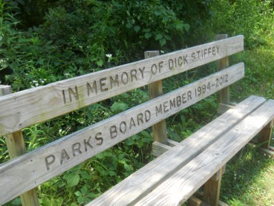
The GAP had lots of these memorial benches along the trail, but this one made me stop and take a closer look. Dick Stiffey? I couldn't help but wonder if that was a real name or if it was a prank by someone... I hoped they fact-checked that name before installing this bench!
A nearby sign described the story of this bridge: The Bollman Bridge is a rare iron bridge built in 1871 to carry the B&O over Wills Creek east of Meyersdale, and in 1910 it was moved to carry a farm road over the B&O tracks west of Meyersdale. Slated for demolition, the bridge was rescued and moved a second time in 2006 to serve as a bridge for the trail.
The old railroad station in Meyersdale. Now a gift shop/museum/information center
A it's a convenient place for bicyclists (and hikers!) to stop and rest.
This is Caboose No. 3235, built in April 1969 by the International Car Company of Kenton, Ohio.
A model train in the old railroad station!
The Salisbury Viaduct soars 1908 feet across the Casselman River Valley, up to 101 feet above the ground. Hundreds of spectators cheered when the first train crossed in 1912. It was built to accommodate a second track which was never added. The route was abandoned in 1975 and decked for trail use in 1998, so now you can walk (or bike!) across it and get fabulous views like this.
On a sadder note, the highway underneath the viaduct is Highway 219,
also known as the Flight 93 Memorial Highway. Flight 93—the plane that
passengers and crew tried to retake on 9/11—crashed less than 20 miles
away, and might have even been visible on the horizon from this
location.
The Garrett Trailhead had a covered pavilion where I caught up with Joel and Janet who wound up giving me all of the extra food they had in their packs since they were just out for the day and driving back to Pittsburgh from here. (That's them in the photo, although I'm too far away to see them clearly.)
Trail magic! There are water bottles in the ice chest, but any ice in them was long since gone and the water wasn't cold anymore.
You can tell this is a major waterfall by Pennsylvania standards because they put a bench in front of it for people to stop and contemplate it. *nodding*
This was one of my "artistic shots" of the stroller on the trail. =)
Casselman River--which I'd go skinny dipping in later in the evening! =)
I wonder if my stroller counts as an "all terrain" vehicle? Hmm....
Just in case you wanted to see the stroller in action, I took this video! Just ignore the part where I run away from the camera to get the stroller. =)

 Signage described the history of the Mason-Dixon line:
 So much interesting stuff on the trail! Two tunnels, a continental divide, and phone service?! And it wasn't even noon yet! What else would the trail have in store for me?


No comments:
Post a Comment