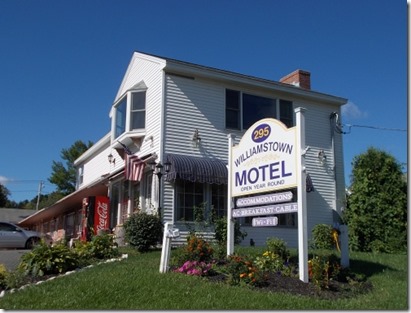
 Sept 4: I woke up a little after 7:00 in the morning. I had booked a room at the Williamstown Motel in Williamstown, MA—not a very imaginative name for the motel, but it was a nice little room. I stretched, got up, showered, shaved, get dressed and wandered over to the motel lobby for their breakfast. I went for a couple of bowls of cereal, a banana, orange juice, and a muffin. =)
I needed my energy—the Long Trail, I knew from experience, was a tough trail. Just getting to the Long Trail would be an arduous hike climbing steep, rocky terrain. I didn’t have a ride to the trailhead, but I had two trailheads to choose from within a mile or two of the motel. I was familiar with the Appalachian Trail route trailhead from my AT thru-hike ten years earlier. The AT runs down from Mount Greylock, the highest point in Massachusetts, between the towns of Williamstown and North Adams, then climbs up to the Massachusetts/Vermont border where the Long Trail begins. That’s my experience on the Long Trail—the 105 miles where the Long Trail and Appalachian Trail overlap.
The Long Trail stretches from the Massachusetts border, cutting through the Green Mountains of Vermont until reaching the Canadian border 273 miles to the north. I’ve wanted to do this trail ever since I finished the Appalachian Trail but never seemed to get around to it. Things like the PCT and Camino de Santiago took priority. =) Now, with Walking 4 Fun, I even had a business reason to do it! But—when I did the Long Trail, I wanted to do it in September/October when leaf peeping season hit its peak. I’d never been around for leaf peeping, and hiking the Long Trail seemed like the perfect way to see it. So after a great letterboxing gathering in Massachusetts over Labor Day weekend, it seemed as good as time as any to start the Long Trail.
The Long Trail, technically speaking, begins right at the Massachusetts/Vermont border, but the nearest trailhead is 3.3 miles away. The only way to get to the start of the Long Trail is to hike there, and I remembered a long, steep climb to get there when I did the AT.
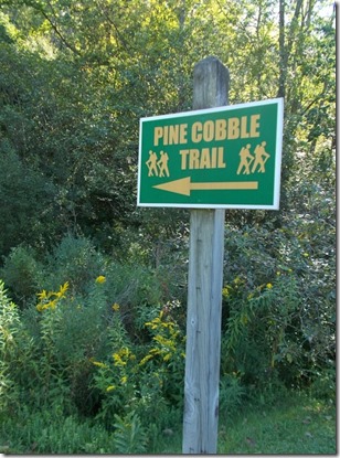
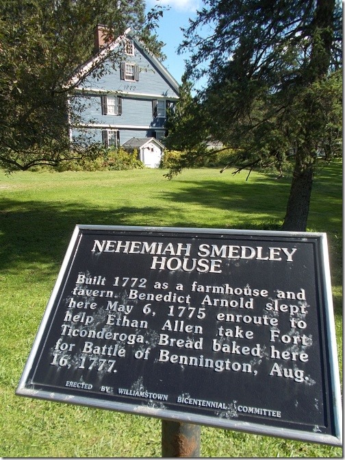 So I focused on the other trailhead, which was about a half-mile shorter on the other side of Williamstown called the Pine Cobble Trail. I also liked this option because it was new to me. =) I do prefer hiking on new trails over familiar trails, and 2.1 of those 3.3 miles would be completely new to me. =) The Pine Cobble Trail intersects with the Appalachian Trail, which leads to the MA/VT border and the beginning of the Long Trail.
Are you confused yet?
And from the motel, both trailheads were about the same distance. On my maps, the Pine Cobble Trailhead looked a little bit closer, but for practical purposes, it wasn’t a significant difference. I wanted the trail that was new to me.
I did have a few tasks to take care of before I left, though. I did a few small, quick updates to Atlas Quest. I repaired a buckle on my backpack that had plagued me for hundreds of miles on previous trips. I examined maps and plotted a course for the next five days that would land me in Manchester Center for my next resupply point, and I surfed the Internet looking for cheap lodging options. There weren’t really any cheap options—the going rate for hotel rooms there seemed to start at $100, but eventually I found an EconoLodge which, if I jumped through a few hoops, got me a room for $66. Then I had to pack my backpack…
Which is when I pulled out my leftover food from the Wonderland Trail and realized I had far more than I thought I did! Way too much food… I counted my meals. I needed 4 breakfasts, and had enough cereal to last me 7 days. I needed 4 dinners, and had enough dinners to also last 7 days. Lunches are harder for me to count since I tend to snack on half a dozen types of food throughout the day in no particular order, but I figure a pound and a half of food for lunch each day is about right. For five days, I’d need about 7.5 pounds of food for lunch. I didn’t have a scale, but it definitely weighed a lot more than that.
I also had my laptop. Hiking the Camino with my laptop didn’t bother me so much—I only had to carry a day’s worth of food at any given time. Even with a laptop, my backpack on the Camino was still far lighter than it was on my previous hikes. But on the Long Trail, the thought was absurd. It wasn’t even possible to get online in the backcountry! On the Camino, I could often get online every day in bars and restaurants during the day even when I camped out at night. So I needed to do something about the laptop and considered mailing it ahead to the post office in Manchester Center.
Except…. I was expected to arrive there on a Sunday. I wouldn’t be able to pick up my laptop there.
 I scratched my head a bit, trying to decide what to do. I decided to leave some of the extra food behind. Not all of it—I didn’t have the heart to waste that much food—but I left behind about 2 pounds of food. But I probably still had 7 nights of food even though I’d be out for only 4 nights, which I figured added an unnecessary 7.5 pounds of weight to my pack. And not knowing where I could ship my laptop in Manchester that I could pick up on a Sunday, I decided to carry it as well.
I stuffed everything in my pack and—good grief, it was heavy. Utterly, miserably heavy. Picking the darned thing up off the floor could have thrown out a person’s back if they weren’t careful! I don’t think I carried such a heavy pack since I headed into the High Sierras loaded down with more food than I ever carried along with a bear canister and ice axe. I’m not sure which was heavier.
I wobbled out of the room, getting my sea legs with the pack, and walked over to the front office where I checked out of the motel. The guy manning the lobby asked me if I was headed north or south, and when I told him north, he asked if I’d recommend his hotel to those headed south. “We’re very friendly to hikers!” he told me. I agreed, he certainly was. I enjoyed my stay very much. =)
Then I headed out to the streets of Williamstown with nothing but the crudest of maps to point me to the Pine Cobble trailhead. Fortunately, it’s not a big town and I found all three streets my map showed in exactly the order I was supposed to come across them.
Although my pack was heavy, I picked up speed walking on those wonderful, flat and even sidewalks. Sunlight brightened the skies. Drivers seemed happy. I didn’t see any other hikers, though.
From the Pine Cobble trailhead, the trail immediately started climbing. It dived into thick trees. The AT is often described as the Long Green Tunnel, and there’s a lot of truth to that statement. It’s true on a lot of trails in the east, though, including this one. I soon warmed up and took off my trademarked hat and handkerchief from behind my neck. I’d been hiking with those ever since hiking the deserts of the PCT. The Camino saw a lot of sun, so I continued the tradition. The Tahoe Rim Trail and Wonderland Trail often saw lots of sun, and I continued doing it there. On this trail, though… I didn’t need it. I put away the hat, handkerchief, glovelets, and sunglasses. Nope, I wouldn’t need those out here. Maybe the sunglasses at an occasional viewpoint along the way, though.
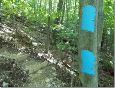
The Pine Cobble Trail wasn’t particularly noteworthy. If you were dropped on it and nobody told you where you were, you’d quickly deduce that you weren’t on the AT only because the blazes were blue instead of white, but that would be the only thing you could deduce. Whoever was assigned to blaze the trail must have had a heck of a lot of blue paint to throw around, though—I was a little surprised at all the blazes along this short little segment of trail. I wouldn’t call that a complaint—I much prefer too many blazes than not enough, and trees will fall down over time. =)
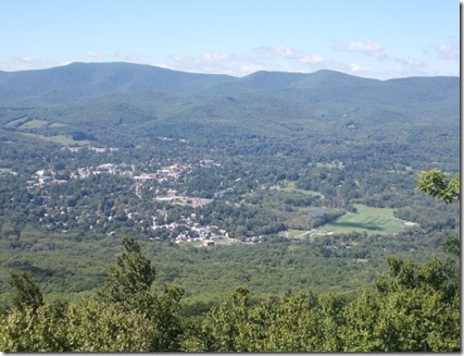
Eventually, a short side trail took me to the summit of Pine Cobble with impressive views overlooking North Adams and Williamstown, and I could even see the summit marker on Mount Greylock to the south.
Onward I pressed, through thickening mud. After 2.1 miles, I reached the end of the Pine Cobble Trail and hopped onto the Appalachian Trail heading north. A little over a mile later, I reached the MA/VT border and the start of the Long Trail. My hike would finally begin! I checked the time. It was a little after 1:00. Not an early start to the day, but it would have to do.
A large group of college students with backpacks that looked as overburdened as mine were resting at the border, so I waved hello and they all greeted me kindly, but I didn’t really feel like talking with a large group of people and largely minded my own business. A register was housed in a container at the border, so I signed that, ate a few snacks, then tromped through the mud and definitively into Vermont.
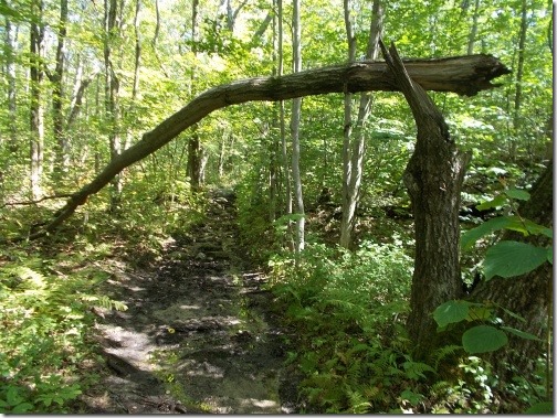
The climb up to the Long Trail was steep which probably helps drain water. Once I reached the top of the ridge, though, the trail never really became flat—just less steep, but it seemed to be enough to not allow water to drain off the trail properly because the mud became absolutely dreadful. Ankle-deep mud for miles on end. I mostly walked around the edges where I could—they say you aren’t supposed to because it makes the trail fat and widens it (which is true), but there was too much of the stuff to plow through it all or jump over it completely. The trail needed some serious drainage work.
I didn’t stop to rest much. I wanted to reach the Congdon Shelter before dark. The weather forecast called for rain overnight, and I wanted to spend rainy nights in a shelter. The first shelter, the Seth Warner Shelter, was a mere 2.8 miles from the border, but the Congdon Shelter was a respectable 10.0 miles away.
The mud slowed me down. The rocks on the trail slowed me down. My heavy pack definitely slowed me down. And I sprained an ankle which also slowed me down.
 Oddly, I walked off the ankle sprain pretty quick, but after that, my right knee started to hurt a little. It wasn’t much—just a slight soreness if I bent the knee more than a typical walking step—so I tried to take it easy on that knee after that, but I wasn’t especially concerned about it either.
And I finally arrived at the shelter a little surprised to see a campfire burning outside of it and a shelter filled with all sorts of people. Officially, the sun hadn’t set yet, but it was already getting dark since the sun had long since hidden itself behind a nearby mountain. I could see daylight on the distant peaks, but the shelter was in a claustrophobic cluster of trees in a valley that seems like it’s in perpetual darkness.
In the shelter I was introduced to Sheryl, who I learned was also thru-hiking the Long Trail northbound. We might be seeing a lot more of each other before this hike was done. I also met Tom and John who were section hiking the Appalachian Trail and also headed northbound. I might see them for a few more days, but they’d be getting off the trail in four more days. The most intriguing person was a fellow from Austria who started hiking the Appalachian Trail in Monson, Maine, headed southbound for as long as he could before he had to go home. He had about a month left before he’d have to go home. He also was responsible for building the fire with very wet wood. I wouldn’t be seeing him after this night, though, since he was headed in the opposite direction.
Nor would I see another fellow who was thru-hiking the Long Trail southbound and was spending his last night on the trail.
I don’t remember anything about the other hikers in the shelter. They all made room for me on the floor of the shelter, though, and I settled in warning the rest that overnight rain was in the forecast. None of them took the forecast seriously, though! To be fair, when I arrived, it was about 6:30 in the evening and the sky was completely clear. The day was absolutely beautiful, and there was certainly no hint that foul weather was headed our way. I might have been more skeptical except that the forecast was less than 12 hours old—those tend to be pretty accurate in my experience. Most of the time. Usually. I hunkered down for rain, but it didn’t bother me any if nobody else believed it. =)
 The monument marking the top of Mount Greylock (the highest point
in Massachusetts) was visible from the summit of Pine Cobble. I had
to seriously zoom into this photo for this image, though, which
is why it’s so grainy.
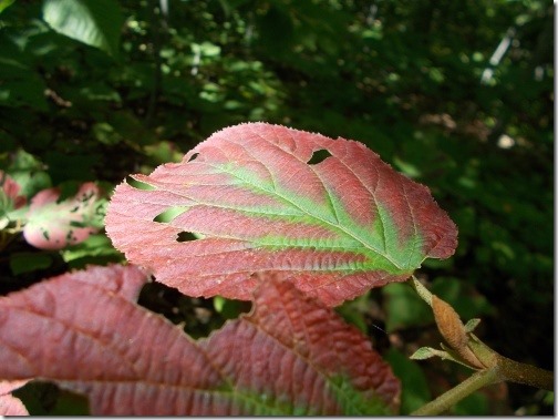
As you can see from previous photos, the fall foliage hadn’t
really gotten started yet, but if you looked closely, you’d
see hints of fall coming…
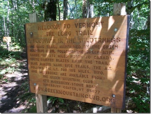
This sign welcomes you to Vermont and the beginning of the Long Trail.
(By today’s standards, it’s not really all that long, but when it was
completed in 1920, it was the longest trail in America.)
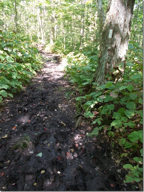
Just look at that mud! It was like that everywhere!
Also note the white blaze, which marks both the
Appalachian Trial and Long Trail.
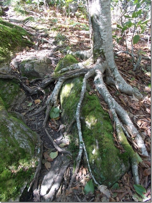
I just liked the roots of this tree. =)
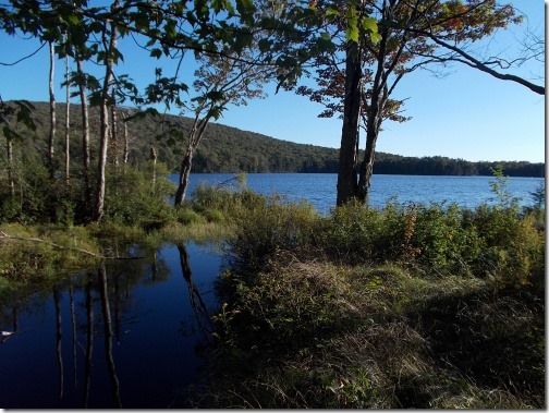
Sucker Pond. According to my guidebook, this is a water source
for the town of Bennington, VT, so camping isn’t
allowed around here. Which was fine, because I wasn’t
going to camp here. But the view is nice!
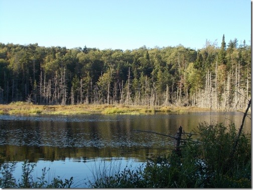
This is a beaver pond. I don’t think it has a name (I don’t think
most beaver ponds get a name). But I suspect the flood of water caused
by the beaver dam killed all of those trees in the background.
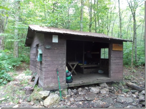
The Congdon Shelter was small, dark and claustrophobic, but
I squeezed in anyhow. (I took this photo the next morning
after most everyone had already left the shelter which is
why it doesn’t appear as crowded as I described in the text above.)
6 comments:
what a trip down memory lane. hope you're having a grand time. i have to say, i have hiked in that much mud - although not on my thru hike; it was a drought year.
What tiggermama said! I was born and raised in Rutland, Vt and my father was a lifelong member of the Green Mountain Club. I finished the LT during high school and have been back a few times since to revisit favorite sections of it. Have a great time on the trail! Mud and all!
PI Joe
Looking forward to following a fall New England hike. Stay safe!
DC Stones
GT if you post a time when you're north of Camel's Hump, I'd be happy to help you re-supply.
Fish or man
I'm well north of Camels Hump now. I'm in Stowe! =)
-- Ryan
Post a Comment