Sunday, January 30, 2011

Cathedral Rock, Boots, and Ed

It was about here when I saw a fighter jet
fly just over the ridge on the right.
September 11: The rain held off all night long, and the few clouds that lingered till morning looked wispy enough to blow away. I hoped that meant good things for me!

I was the last to leave camp. It was cold, and as much as I liked hanging out with Little Engine, Plain Slice, Neon, Max Chill, and Epic, it felt a little crowded with that many people around. So I was perfectly content to let them get a good head start on me.

The trail climbed up towards Cathedral Peak, a long, steady climb. While hiking near Deep Lake, a fighter jet flew what looked like mere feet above the ridge I was climbing. Military games. I remembered this from previous visits to the area, but still found it amazing how close those planes would fly along the ridges. Very cool, but also very loud. Kind of ruins that whole wilderness experience.

When I reached the top of the ridge, I was accosted by a photographer. Click! Click! Click! It was a little disorienting--I didn't expect the paparazzi to find me out here! Then he introduced himself as Boots. He was hiking southbound, taking photos of all of the thru-hikers he met along the way that he'd upload to his website later. I still think his trail name should have been Paparazzi. It's a much more unique name than Boots, and totally appropriate! I went to his website, UltimateTrailHiker.com, and found two photos he uploaded here and here. All those hazy photos before mine, about a dozen of them, are the folks I camped with who I gave the head start to. Boot's camera suffered from the rain and cold and hadn't cleared up before he met them on the trail. When I found him, he had been laying out on the exposed ridge drying out and drying his camera equipment out, so my photos turned out clear. =)

I continued on, passed Cathedral Rock, a few day hikers and weekend campers, but it was a largely uneventful day. The sun came out to play for most of the afternoon, always a nice feeling. Near Deception Pass, I thought about Amanda. The last time I hiked this section of the trail, I got off the PCT here and walked to a parking lot another mile down the canyon to where Amanda was waiting to pick me up. She wouldn't be at the parking lot waiting for me this time, though. I was on my own. =(

Cathedral Rock, up ahead!
I didn't catch up with Little Engine, Plain Slice, and Epic until they were already setting up camp and working on building a campfire late in the afternoon. Neon and Max Chill, they told me, had hiked too far by accident and were still ahead. I wanted to get a few more miles on, though, and didn't stop, but told the three that if I saw Neon and Max Chill, I'd let them know where to find you guys.

I did catch up with Max Chill, standing on the side of the trail waiting for Neon another 15 or so minutes later and relayed the message, and Neon I ran into another 15 minutes after that hiking in the other direction. Neon told me that Wyoming was just ahead, which surprised me since I thought she was behind me. How did she get ahead? Where did she pass me? Must have been when I was still in camp that morning, but I totally missed her going by.

The trail climbed a steep slope, which had me complaining that this was supposed to be a horse trail, and why the hell was the trail so freakishly steep here, but I finally made it to the top of the ridge near mile 2265. There was a tent set up, just off the trail, and I assumed it must have been Wyoming. "Is that you, Wyoming?" I asked. No, it was not. It was Ed, from Issaquah, out for a few days. Oops. =)

Still, I was done for the day, and set up my own tarp on the trail. There was a chance of showers overnight, but the ridgetop was also exposed and I was concerned about severe condensation. And it was getting cold! A tarp won't trap heat very well, but if it blocked even the tiniest wind, I could still avoid that horrible wind chill factor.

Boots, catches me red-handed while hiking.
I cooked dinner, and had trouble getting my lighter going. At first I thought the problem was my frozen fingers not working very well, but when I shook the lighter, I didn't hear any lighter fluid. Hmm.... I'd been carrying the lighter since Big Bear. Had it finally run out of gas? I did manage to get my stove going, but now I was suddenly paranoid that my lighter could die at any moment. I needed a new lighter, but my next resupply point wouldn't be until Stehekin several days away. Argh! Hoped it held out until then.

A little after sunset, three trail workers from AmeriCorps hiked by. They had been doing trailwork but took the late afternoon/evening off to do a little hiking and sightseeing. They asked about my thru-hike and offered me some food. I didn't really need anymore food, but off the cuff, I decided to ask if they had an extra lighter they could spare, and they had one! Woo-who! Worries about my lighter running out of gas were now behind me!

Cathedral Rock--BEAUTIFUL!

I just love the Alpine Lakes Wilderness. =)

Looking south, shortly before reaching Deception Pass.

While the sun had come out today, the plants were still wet from the rain and condensation from before.


According to my maps, the PCT runs parallel near the far side of this lake.
Looks like fun!

Looks like someone has lost their clothes!

The Canada part was already written in the trail when I arrived,
but I felt it was necessary to add Mexico too. We should all remember our roots! =)
I set up camp about three feet away in the direction of Mexico.

The view north on the PCT from my ridge-top campsite.

Saturday, January 29, 2011

Another Crash Update....

This is like the story that never quits. I was just browsing the West Seattle Blog and found a couple of new updates regarding that crash I posted about earlier.

Update numero uno:
The driver charged with vehicular assault in the car-vs.-pole crash earlier this month is out of jail – but wasn’t supposed to be, and a warrant is out for his arrest. So confirms Commander William Hayes of the King County Jail, though he tells WSB they are still investigating how the mistake happened. You might recall that after the crash on January 9th, 23-year-old driver Mohammad Nema and his passenger – an estranged girlfriend who had a protection order against him – both wound up in the hospital. She got out a few days later, but he was still in the hospital when we followed up on January 14th – that’s when we reported that, after investigators determining that he had been driving under the influence, prosecutors charged him with vehicular assault/domestic violence. We kept checking the King County Jail Register for signs that he was out of the hospital and in jail – and then suddenly discovered a few days ago that he was listed as having been in jail for about an hour on January 16th, with the release reason listed as “error”:


Trying to find out who could tell us how that happened, we finally spoke this afternoon with Commander Hayes, who says he doesn’t know – in situations like this, patients are supposed to be transferred to county custody before getting out of the hospital, and apparently Nema wasn’t – the arrest warrant filed yesterday says simply that he “left Harborview.” (The brief notation from January 16th was apparently a mistaken “booking in absentia”). Cmdr. Hayes hopes to have more information on the investigation by the end of the week. We’ll be checking on that, and we’ll keep watching to see if Nema turns up in custody; at the time of the crash, he had a Burien address.

How do mistakes like that happen?! I don't know, but there was another update a day later--Update numero dos:
The day after we reported that the driver in a crash, Mohammad Nema, was out of jail but shouldn’t have been, we just got word from King County Jail Commander William Hayes that he is now behind bars:
I have had an opportunity to obtain more information regarding Mr. Nema. Our Department never took over guarding him from SPD on January 16th. One of our officers understood that we were to guard him so he booked Mr. Nema into our system. An hour later, it was determined that Mr. Nema was not at the hospital prior to us taking possession. Because we could not take custody of him, we could not book him, and it was coded as an error in the system. However, today Mr. Nema was scheduled for a hearing in court today at the MRJC. He was arrested by the King County Sheriff’s office when he arrived and booked into jail. He is now in our custody.
We just verified that via the jail register – he was booked at 2 this afternoon, bail set at $100,000. We’ll continue to watch the case as he progresses through the system.
(Quick recap if you don’t recall the story: Nema was driving the car that hit a pole at the bottom of a steep hill early the morning of January 9, cutting power for hours to more than 2,000 West Seattle homes and businesses. He and his passenger, a woman described as his estranged girlfriend, who had protection orders against him, were cut out of the wreckage by rescuers. Both wound up in the hospital. She got out before he did. He is charged with vehicular assault/domestic violence; investigators believe he was driving drunk.)

Friday, January 28, 2011

Lemah Meadows and Area

It wasn't raining, but it wasn't exactly warm and dry either!
September 10: The rain continued hard nearly the entire night, but it finally lifted by morning. I lurked under my tarp for awhile, hoping to let the tree snot drop off before hitting the trail, during which time Neon, Little Engine, Plain Slice, Wyoming, and Otter passed me. Lots of hikers on the trail today! Even more remarkable, I actually knew all of them already!

I finally got hiking and Epic and Max Chill caught up with me shortly afterward. More people! These two I had both met before, but just briefly and I didn't feel like I really knew either of them.

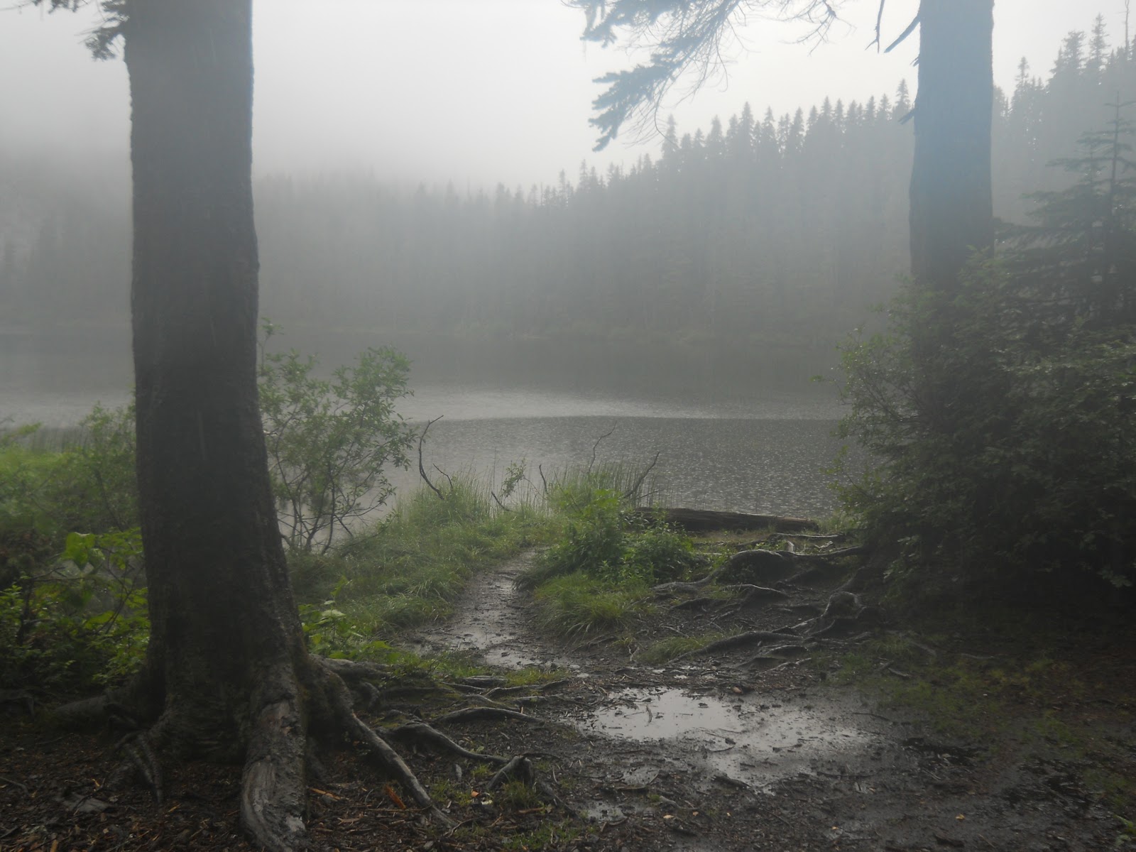
Today I was pretty excited. I was in the Alpine Lakes Wilderness, an area I had been in a couple of times before. Today I would pass through the Lemah Meadows area, where I had done trail work a few years ago. I was anxious to see how the trail was looking all this time later--it would be my first visit back since I did the trail work in 2007. And, I knew from my previous visits, the area had absolutely spectacular scenery. Not that you'd know it looking around at the moment. The views were largely obscured at first by clouds and fog, but it would improve throughout the day.

Spectacle Lake was awesome, and marked the furthest point south I had ventured on the trail during my trail work days. I sat down to admire the lake, which looked suspiciously like spectacles... spectacular spectacles! One thing had changed significantly since the last time I was there, however. A large burn area, just to the north and east of the lake. That was new, having burned badly the summer before. This section of trail, in fact, had been closed due to fire damage for most of the summer and only reopened a few weeks before.

I cursed the clouds, trying to ruin my view!
While sitting and admiring the view, the other seven hikers caught up with me. They were hiking mostly together now and I passed them earlier in the morning, and I wanted to sit and enjoy the view, eating from my bag of White Thins. We were all taking pictures, and I asked one of them if they'd get my picture. Fussing around with my camera, I accidentally dropped my bag of Wheat Thins, spilling out onto the trail. Simultaneously, seven other hikes gasped. "Nooo!!!" If it were a movie, they would have played the scene in slow motion, me trying to grab the bag in mid-air, and the camera zooming into the other faces with growing looks of horror. It was a tragedy of the greatest proportions!

Little Engine took a couple of photos of me with my camera, with the Wheat Thins still spread across the trail. I picked up the Wheat Thins and put them back in the Ziplock bag. It wasn't raining, so they weren't wet, and I didn't drop them on a particularly muddy part of the trail, so they were largely dirt free. Good enough for me! They were still edible in my book! =)

The trail descends steeply from Spectacle Lake down to Lemah Meadows, through the area burned by the Lemah Fire. I remembered this section of trail being severely overgrown. Our trail group didn't work on this side of the meadows, and I wondered if it had still been severely overgrown before the fire swept through. If so, the fire certainly cleared a lot of that problem out of the way! =)

Nooo!!!! Not the Wheat Thins!!!!
Near the bottom of the slope, I found Neon taking a snack break and I stopped to chat. I was a little surprised to see her at all--the last time I had seen her, she told me that she was getting off the trail in Ashland to go back and do a large hunk of the High Sierras she had missed earlier. At that point, I figured she was a couple of hundred miles behind me, and I made some big miles going through Oregon. How the heck had she caught up with me? I assumed I'd never see her again! At least not until Just Dave told me he'd seen her at the convenience store at White Pass.

I also had heard that she had hiked three consecutive 40-mile days. "Is this true?" I asked.

"And where did you hear that?" she asked in return.

Umm.... Where did I hear that? I closed my eyes, trying to think. It seems like I heard that nearly a week earlier. Who said that. Think! Think! I rubbed my forehead, but I couldn't think of it.

She watched me straining my brain for about ten or fifteen seconds, and suggested that maybe it was Noga.

"Yes! That's it! She told me that!"

"Well, it's true," she finally answered.

I shook my head. "You're crazy. Definitely crazy." =)

Notice the bag of Wheat Thins,
still at my feet.
I'm pretty sure I could hike 40 miles if I had the drive to do so, but I think it would be miserable. I'd have to start before sunrise and finish after sunset. I'd be tired and miserable. And--more importantly--I had no reason to push myself that hard. I just don't have that "get up and go" kind of attitude. So I did what I thought were respectably big miles through Oregon, but Neon's miles put mine to shame.

I also told Neon of a particular "reroute" I made of the PCT. I wanted to see if I could find that reroute. There was an "iceberg" boulder involved, where a small part of the rock stuck out of the ground, but the bulk of it was buried and would have been difficult to remove, so I left it in place. But the trail used to go around the right side of the rock, and I rerouted it to go around the left side of the rock. Nothing else about that section of trail was at all noteworthy, but I knew I could remember that iceberg rock. It was unique, and I spent a lot of time working around it. I wanted to find that rock and see if my reroute from August 17, 2007, was still holding up. It was the one piece of work I did that I knew I'd still recognize as my own. =)

Neon and I were in the burn area, and I couldn't figure out why they felt the need to close the trail for a year because of the fire. I had heard it was closed because an important bridge burned, but all of the bridges I crossed looked like they had been there for quite some time. Maybe they were afraid of dead trees or branches falling down onto hikers? Several minutes of hiking ahead, Neon and I caught up with the rest of the hikers who were stopped at a washed out bridge. The one bridge that looked like it had been washed out (rather than burned down) was still washed out, but the trail was open now.

The Lemah Fire burned through this area.
I had already told everyone that I did some trail work near Lemah Meadows and was excited to see how it looked now, and when Plain Slice and I were looking down at the washed out bridge, he joked about my "shoddy" work. I told him that all of MY shoddy work was on the other side of Lemah Meadows. =)

I pulled ahead of the others and continued hiking, passing Lemah Meadows where our work party had camped. I also found a waterbar we had installed on our first day of work: August 12, 2007. I remembered them explaining how to make a good solid waterbar, and I remembered thinking at the time that that's nice, but why are you showing us this? We were supposed to be brushing the trail, not creating waterbars. And where we installed it, I couldn't really see a good reason why it was even necessary.

But I found that waterbar. I knew it was the right one because it was the only one on that section of trail for probably a mile in either direction. It was holding up well, but it did seem completely unnecessary even today. But I still smiled--I helped install that waterbar. I even had a picture to prove it! =)

Further along, I found the reroute I had created. The iceberg rock was still on the left side of the trail, and it looked like that that was where the trail always was. The dirt on the trail didn't look fresh anymore. The trail looked like it could have been there for a hundred years, and there's nothing to indicate that the trail ever went on the right side of the rock. I was so pleased with myself. =)
A photo of me three years earlier building
a waterbar.

The same waterbar today.
I built a tiny little cairn in the trail next to my handiwork. If I saw Neon again, I could ask her if she saw that cairn, and say that THAT was the iceberg rock I had told her about earlier that morning. Then I took pictures of the trail from the same angle I remembered I had taken photos of it when I originally completed the work. After, and WAY after photos for comparison. =)

Then I started hiking up and up and up, a few thousand feet through the area that I carried up a cross-cut saw and rolled large trees down the steep slope on August 14th and 16th. Good times! =) I really need to go on another work party.

At the top of the ridge, everyone stopped to throw out their gear to dry out from the rain the night before, including myself. My tarp was soaked, and the sun had finally come out in force. Use it while we can! When I saw Neon there, I asked her if she noticed the little cairn I created in the trail and told her, "YES! That was where I single-handedly rerouted the PCT!" =)

Little Engine overheard that and said she had noticed the cairn too and had wondered about it. It was so small and cute, but so completely in the middle of nowhere. Usually cairns are used to mark tricky spots in the trail, or perhaps at a viewpoint where idle hands do their best work, but that particular cairn seemed to have no reason for existing. I think Little Engine was pleased to find that it did have a use. There was a reason for its existence.

The others left while I was still packing up my tarp, now dry. I took about 20 steps on the trail when I heard a loud SNAP! and my shoulder strap flung upwards. Damn! Again?!

I stopped to check out the damage. This time, it was my other strap buckle that broke. Well, technically speaking, broke for a second time. It was the same buckle that broke while descending Forester Pass over a thousand miles earlier. I didn't have any extra buckles this time. I used the one I did have the day before fixing the other strap's buckle. And like yesterday, this buckle broke exactly the same way the one yesterday did, and tying a simple knot in the straps wasn't going to fix things. Hmm......

The reroute as it looks today.
Note the little cairn I created on
the left side of the trail. =)
The PCT reroute I created back in 2007.
The only reason I could find this exact spot again
is because of that iceberg rock on the right (now!)
side of the trail.

I had a plan. I took off the buckle, then hand-sewed a loop onto the bottom strap, and used a spare piece of rope, threaded through the loops, to tie the two straps together. I was a little concerned about how well this arrangement would hold, but I didn't see that I had any choice in the matter either. I was probably 35 miles away from the nearest paved road.

The broken strap set me back, and I didn't catch up with the others again until I found them camped near the Waptus River where I joined them for the night.

Time to dry out!
Beautiful scenery!
After the fix.

Before the fix.

Watum Lake. The PCT skirts near the far side of this lake. (Not ON the shore, but fairly close.)

Some of the fall colors are starting to come out in the trees. =)

Wednesday, January 26, 2011

Jack, Packs, and Buckles

I didn't get this kind of body from chocolate milkshakes
all day. Sometimes I have a vanilla instead! HA!
September 9: I woke up early, at 7:00, still on hiker time, but was in no rush to hit the trail early. The forecast called for rain. I played on the computer, checking e-mail, and eventually packed up my worldly possessions. I replaced almost all of the Ziplocks I had--they were old and worn, and the weather forecast called for rain every day for the next week. They needed to keep my food and gear dry. What is WRONG with the weather?! Washington was turning into an absolutely miserable part of the hike. Cold and wet. But I was too close to quit now.

Amanda and I stopped at Safeway for a few food items, but my mail drop had the bulk of what I'd need for the next section of trail. We also stopped at Jack in the Box because by golly, I was in civilization and I wanted fast food, and as many calories as I could consume. I ordered the Deli Trio sandwich, a large fries, and a large drink.

Amanda doesn't much care for Jack In the Box, but while driving up to Snoqualmie Pass, she was badmouthing the company. "I don't know why you like that crap. It's terrible!"

I nodded agreeably. "Yes, it's crap, but damn it's good!"

Amanda looked at my sandwich, asking what it was. "Deli trio. Good." And took another bite.

"That doesn't actually look too bad," she continued.

"Did you want to try a bite?" I offered.

Amanda accepted the offer and took a big bite. "That's pretty good, actually."

"Yeah, I know!" =)

Amanda drops me off at the trailhead.
The weather in Seattle wasn't too bad at all--partly cloudy, no rain. It was in the mountains where the forecast was bad. I checked the forecast for Snoqualmie Pass, Skykomoish, and Stehekin. I tried to get the forecast for Stevens Pass but couldn't get that search to work, and ended up using Skykomish instead. I didn't give that forecast much credibility, though. That town was far below the mountain pass where the trail was. It could be completely sunny in Skykomish and still be pouring rain at Stevens Pass. The ten-day forecast for Snoqualmie Pass included rain every single friggin' day, but Stehekin actually showed a couple of days of partly cloudy. Still, the forecast was rain for most days, but a couple of days of partly cloudy gave me hope.

When Amanda dumped me out at Snoqualmie Pass, it wasn't raining, but the clouds and fog certainly looked menacing, and it did look like it had been raining earlier in the morning. I left my Jack trash with Amanda to dispose of properly, shouldered my pack, and started hiking hard. I wanted to get as many miles in as possible before it started raining again. If I was really lucky, maybe I could even set up camp and stay warm and dry under my tarp before it started. Gotta move, though!

The climb up from Snoqualmie Pass was steep, climbing thousands of feet within a few miles. The higher I climbed, the more the clouds turned into fog, and fat drops of fog attacked. It wasn't rain, but I was getting wet. I finally seemed to reach the crest again where the trail would level out (more or less), and I was zooming along quickly near Ridge Lake when I heard a SNAP and my pack shifted.

CRAP! I stopped to assess the situation. The buckle on my shoulder strap broke. I thought the strap itself had broke, my sewing had failed, but it was just the buckle. My sewing was solid as ever. Somehow, this comforted me. I felt better knowing that the pack didn't break because of my sewing. It wasn't MY fault. Stupid buckle. I could blame Seattle Fabrics, where I bought the buckle. =) (If you're ever looking for outdoor fabrics, BTW, that's where I bought packcloth, silicone impregnated nylon, and other specialized fabrics you won't find in most stores.)

The trail crosses under I-90 as Amanda drives away...

As luck would have it, I actually had a spare buckle in my pack! The buckle on my strap had broke coming down Forester Pass, and I tied a knot in the straps to hobble together something that worked long enough to get me into town to replace it. I managed to score a replacement buckle from hikers coming in the other direction, trading my sunscreen for it. Knotting the straps ended up working so well, though, I never even bothered to replace the buckle. But I was still carrying the replacement buckle all this time, too lazy to actually replace it.

This time, the buckle broke in such a way that tying the straps together with a knot wasn't going to cut it. Nope, this time, the buckle needed to be replaced completely.

I pulled out my miniature sewing kit (a lesson learned from my test run of the first home-made backpack on the West Coast Trail) and proceeded to cut out my original stitches to free the broken buckle. And, boy, let me tell you, I did an excellent job of sewing that buckle on. I had a devil of a time freeing it! The stitching had held up incredibly well and was as solid as the day I sewed it. Very difficult to free the buckle, especially when it's cold and wet.

I put on another layer of clothes--this would take awhile to fix, and now that I wasn't hiking, the chill started to set in.

Stupid broken buckle.....
But the broken buckle finally came free and I sewed the new one in by hand. My hand stitching wasn't as sturdy as the original machine stitched job, but it should hold. And in twelve days, I should be done with the trail completely. The patch job only needs to work for twelve days.

All told, I spent a half hour repairing my pack. I hurried as best I could, and thank goodness it wasn't pouring rain at the time. In my haste, I did stick myself with a needle a couple of times, and cursed the lack of a thimble. Maybe I should add that to my miniature sewing kit for next time.

But I got it back together and continued hiking. I was thick in the fog now, and at one point, the trail traversed the side of a steep cliff that freaked me out a little. Because of the fog, I couldn't see the bottom of the cliff, and that made me a little nervous. It looked like a bottomless pit. If I jumped, I'd continue falling forever. Of course, that was ridiculous, but I couldn't get that feeling out of my head and it bothered me greatly. At least if I fell off a cliff with a bottom, there was an END to it. This cliff seemed to have no end....
The new buckle is sewed on, and I took a photo of it next to the old one for comparison. =)
Just a matter of slipping off the old one and threading the strap through the new buckle.
I stopped for the day at about 6:15. I wanted to go further, but my topo map showed a lot of steep, rocky terrain ahead and I had doubts if I could find a suitable campsite before dark in that. So I decided that an early stop was better than setting up camp in the dark when it was pouring rain while on the side of an exposed cliff face!

So I set up camp near a viewpoint of Joe Lake. The rain didn't start coming down with enthusiasm until just after 8:00 as darkness descended.

This toggle had broken quite some time ago. It cinches the top of my pack closed.
But I never bothered to fix this one. =) How much longer will this home-made pack go on?!

This cliff made me a little nervous. Not being able to see the
bottom of it really bothered me!

I'm sure the views would have been spectacular if it wasn't for all the fog. =(

Joe Lake, if I remember correctly. You can see a switchback of the PCT down there too!
(The trail doesn't actually go all the way down to the lake, though.)

Camped out next to the trail, under my tarp. Rain was
definitely in the forecast!

Monday, January 24, 2011

Snoqualmie Pass or Bust!

Noga tries to stay dry under her tent as I start my hike.
September 8: The rain finally stopped by morning, but the clouds continued to look menacing. I didn't want it to rain on me during the day, but I wasn't too concerned if it did. I was getting off the trail. No matter what the weather did, I would be spending the tonight indoors, under a roof, warm and dry. And the sooner I hit the trail, the sooner I could get off at Snoqualmie Pass to warm up and dry out.

Noga was still in her tarp when I left, not even close to being ready to leave. She was awake--I could hear her moving around--and wished her a good morning as I left.

And it started raining almost immediately upon my hitting the trail. Darn it! Stupid rain. What was WRONG with the weather? September is supposed to be a beautiful month for hiking in the Pacific Northwest!

About an hour later, I reached Stampede Pass, named for a horrible prank involving pizza and a large group of thru-hikers. Just kidding, I have no idea how the pass got its name, but I'm sure there's an equally good story behind it. =) There I ran into "Phil's Dad"--that's a trailname as well as a description. He set up a rain/sun tarp and a grill to cook hot chili and hot dogs and offered muffins, and drinks to passing thru-hikers. It was a trail angel. I wasn't particularly hungry--I had breakfast just an hour before--but he had hot food on this cold, miserable day not to mention a tarp to keep the rain at bay. It would likely be the only dry place to stop until Snoqualmie Pass, so I stopped and talked to Phil's Dad for the next hour.

Phil's Dad
Phil's Dad, as you might have guessed, is the father of a fellow named Phil. Phil thru-hiked the PCT the previous year, and Phil's Dad had come out to Stampede Pass for a little trail angeling the year Phil hiked the trail, and liked the experience so much, he started making a regular habit of it. He had just arrived mere minutes before I did and was still setting things up when I arrived, and asked if I knew how many hikers were behind me.

The only person I knew without a shadow of a doubt that was close behind me was Noga, but I knew there were quite a few others still behind me.... somewhere.... Just Dave couldn't have been too far back considering that we left White Pass together. And a couple of the hikers I passed the day before but I didn't know probably weren't far behind either. How far behind, though, I didn't really know. Noga, I told him, could walk in at any minute. After that.... it was fuzzier.

And I told him a little about Noga--she was from Israel, and if you really wanted to surprise her, when she does get here, tell her, "Boker tov!" =) Then mentioned that she was planning to get off the trail at Rainy Pass--a mere 60 miles from the Canadian border. She had told me this the day before. There was a wedding for someone in her family that she absolutely would not miss, and part of the reason for her long miles through Oregon was to finish the trail and still have time to fly back to Israel for the wedding. At some point, she realized that she was not having fun anymore, rushing to make as many miles as she could, and slowed down to a more comfortable hiking pace that meant she would not reach the Canadian border in time. And came to accept the fact that she would quit the trail a mere 60 miles from the end. From Mexico to Rainy Pass. About 2,600 miles, and deliberately quit with just 60 miles left to go.

The rain was coming down really hard when I passed
by Mirror Lake. Not very mirror-like today!
I don't think I could do that. I'd probably miss my own wedding before giving up a thru-hike being so close to the end. Whoever it was that was getting married--I can't imagine they have any idea what Noga was giving up for them. But Noga seemed at peace with her decision. But wow, I'd never heard of anyone deliberately choosing not to complete a thru-hike while so close to the end before. It's unusual and impressive.

I lingered with Phil's Dad for about an hour, eating the hot chili, a couple of hot dogs, a muffin, and drinking a Coke. I kept stalling, hoping the rain would let up and I could continue hiking without the rain, but it didn't let up. The punishing storm continued. I finally wrenched myself away, just as Noga arrived. I welcomed her to this little bit of paradise with a Boker tov! then continued my march. Snoqualmie Pass, here I come!

The rest of the hike was miserable. Even when the rain did stop for a few minutes, the tree snot did not. In many places, water ran down the trail like it was a creek bed--just like it did in the High Sierras. The trail crossed one small creek five times for no discernible reason, and assumed that the person who routed the trail just hated hikers. There's no other logical explanation for it.

I pulled out my cell phone and Peek device and put them in an inside pocket, and about three miles before I reached Snoqualmie Pass, I felt the Peek vibrating. I had mail! I didn't bother pulling that out first--first I pulled out my cell phone to see if it too had a signal, which it did. YES! I called Amanda, hoping she was in Seattle. I didn't know Amanda's schedule, and most of the time, it didn't really matter. Whether she was in London or Philly, it made no difference--she wasn't around. But if she was in Seattle, Snoqualmie Pass was only about an hour's drive away. She could visit! If, that is, she was actually IN Seattle and not jetting around the countryside for work. =)

So I called Amanda, and she answered the phone, and she was in Seattle! Sweet! "Feel like driving out to Snoqualmie Pass to pick me up?" She was delighted to do so. =) I told her that I estimated it would take me about an hour to reach Snoqualmie Pass, and she figured it would take about an hour to drive there from Seattle. We weren't sure who'd arrive first--it was too close to call--but we could meet at the Chevron there. I had sent a maildrop to the Chevron and needed to stop there anyway. I sent food to myself at Snoqualmie Pass from Cascade Locks since I wasn't certain if I'd see Amanda or get a ride into civilization at the time. Now that I knew I'd be seeing Amanda, the maildrop wasn't really necessary anymore. But it was there--may as well grab it! =) So we agreed to meet at the Chevron at Snoqualmie Pass, in about an hour.

It took me about an hour and fifteen minutes to reach Snoqualmie Pass--a little slower than I expected, but Amanda must have had the same problem because I saw a green Subaru get off at the I-90 offramp that looked suspiciously like Amanda's. I pulled out my cell phone and called Amanda.

"Was that you I just saw getting off of I-90?" I asked. "Because if it was, I wouldn't mind if you gave me a ride the rest of the way to the Chevron." =)

It was her I saw pulling off of the highway. The Chevron couldn't have been more than a tenth of a mile off the PCT--certainly walkable, but why bother when your girl has a car nearby? =)

I could hear the roar of traffic from I-90 through
those clouds. Snoqualmie Pass was near!
She drove me up the rest of the way to the gas station, and I went in to ask about my maildrop. The guy directed me into the back of the store, and told me to walk into the cooler next to the sodas where I'd find my maildrop. Into the cooler? I opened the glass door and stepped in. It wasn't very cool in there, though. It was either broken or turned off--not sure which--and none of the shelving or anything was in the way. It was still kind of weird back there, though, and boxes of maildrops were stacked like a giant game of Jenga. I found my box, which I brought back to the counter for the fellow to verify that I was the proud owner of this maildrop, then Amanda drove me home. Home, sweet, home! =)

I'd never gone home during a thru-hike before. It almost felt like cheating. =)

But wow, what a mess! With the sale of the house in North Carolina, Amanda started sending boxes of stuff to our little place in Seattle and it was piled high with boxes of... I don't know what all those boxes had, actually. There wasn't even any room on the bed for me to sleep. But I didn't care, I was just glad to be home for the night. =) Not camping. Not in a hotel room. Home!

I showered, got on the computer, and Amanda made spaghetti and garlic bread for us for dinner. Delicious!

And I told Amanda that I could quit the trail. I had nothing to prove, and I looked up the weather forecast which called for rain for the next TEN days! "I don't want to hike in the cold, wet rain for the next ten days!" And what the hell was wrong with the weather anyhow? This was September! It's not supposed to rain for ten consecutive days until the depths of winter!

There it is! The ski area at Snoqualmie Pass!
I'm almost off this rain-soaked trail! =) And I-90 passing
just behind the buildings. Where are you, Amanda?!
I looked for her waving at me, but didn't see her anywhere...
My threats to quit the trail were a joke--of course I couldn't quit so close to the end, now only about 200 miles and less than two weeks away. However, I was very tempted to take a couple of days off the trail for better weather conditions. My goal, when I started the trail, was to finish by the end of September. I was on track to finish 9 days before then. I could take several zero days and still make it by the end of September. Trading a few rainy days for a few sunny days seemed worth the effort. Yeah, I could do that.

Amanda had to go to work the next evening, so if I did take a couple of days off, I'd have to arrange my own transportation back to Snoqualmie Pass. I could hitchhike. Check, I could even walk there if I had to! But Amanda told me no, she only had a few days available to pick me up at the end in Canada, and she really wanted to be there for the end. I was absolutely not allowed to take any zero days. Nope, no, and not going to happen. She'd throw me out at Snoqualmie Pass whether I liked it or not. "But why do you hate me so much!" I whined. She didn't hate me, though. I had simply come too far to quit, she she knew that as well as I did. =)

If only the lifts were running, I could have rode them the rest of the way down
to Snoqualmie Pass! =) They do put ladders on those poles for a reason, right?

Saturday, January 22, 2011

A Perfect Day For Misery

Government Meadows
September 7: Sometimes, I make myself laugh when I read my journal entries to type these blog entries. For today, the first thing I wrote was, "For the love of god--make the rain STOP!!!!" I remember that day well. =) Not fondly, but I definitely remember it well....

It was a wet, wet day. It started with hope, raining most of the night, but stopping by sunrise and even the tree snot was starting to dry out. I was on the trail hiking by 8:00, relatively dry and lighthearted.

I reached a ski hut an hour or so later--very nice little setup, and the stove inside radiated heat from a fire someone must have built overnight. If I realized how nice this place was, I would have pushed on the evening before just to camp here overnight. As it was, since the fire was burning, I knew there were people just ahead of me on the trail. I didn't know who, but there were hikers near. The weather started misting again, and I thought about hanging out in the hut in the hopes it would blow off. I grew impatient, though, and the forecast I last saw called for good weather. So I pushed on ahead.

The misting turned to a sprinkle, and the sprinkle turned into a rain, and the rain turned into a drenching, demoralizing downpour.

The ski hut
And it never stopped. There were times when it seemed like it was about to tapper off, giving me hope, turning into that misting kind of rain for a few minutes. But the weather gods were toying with me and would turn the water faucets back on harder than ever.

The one bright spot of the whole day was catching up with Noga, who I hadn't seen since Mammoth Lakes. I thought she was behind me and was stunned when I found her hiking ahead of me and in the same direction as me. I hadn't seen her in any registers. Nobody had mentioned she was nearby. We compared notes and it sounds like she pulled ahead of me when I took those two days off near Cascade Locks. I asked about Shani and Evan, who she was last hiking with, and Shani--as it turned out--was merely a section hiker, never having planned to thru-hike the entire trail. She did all of California before leaving, though, and--as Noga explained, was probably enjoying a drink on a Mexican beach somewhere right now. "I think she had a good idea," I told Noga, as we stood miserable in the pouring rain.

Evan--I don't remember what she said happened to him, and I apparently didn't see fit to write it down in my logbook. I think he went off to school or to do some work in Israel or something. But he too was now off the trail. Once those two had left, Noga started pulling huge miles through Oregon, catching up and passing me by shortly into Washington.

I also wished Noga a "Boker tov!" and she seemed surprised that I remembered how to say good morning in Hebrew. =) "Yes, it's just one of those things that are stuck in my head now. I'll always remember 'boker tov.'" *nodding*

She also told me about a conversation she had with her dad. Her dad had done a Google search for Noga and Shani's name with the term "PCT" and found my blog entry about the day we went over Forester Pass. But he didn't tell her that--he started telling her details about that day that she hadn't mentioned. Like the sunscreen that turned Noga's face white. And the incident with Charmin rushing ahead to catch up with Hasty, who was actually behind her.

"Dad," she asked him, "how do you know all this?!"

And he just told her that "Ryan" says to say hi.

"Who's Ryan?" Of course, she didn't know my real name--only my trail name. But my blog has my real name on it. "Ryan," he told her. "You hiked with him." Which confused her even more.

Finally the secret of his intimate knowledge of that day was revealed, and she finally worked out that the Green Tortuga was also known as Ryan, blogger extraordinaire. =)

Wet, wet, wet.... Would it ever end?!
Noga told me that her mom was thrilled to see photos of her with her face white from sunscreen. "Good girl!" I guess her mom had worried that Noga wasn't applying enough sunscreen during her hike, and was very pleased to see those photos of her painted with it. =) Her dad e-mailed the link to my blog entry which Noga read later, astounded at all of the detail that was in it.

I pulled out my camera and took a picture of Noga, saying I'd post it to my blog for her dad to enjoy. =) "Of course, it'll probably be five months before I post about this day and you'll already be off the trail, but say 'boker tov' for dad!"

I do tell people about my blog if they ask if I keep one, and I'll even volunteer that it's one of the best hiker blogs out there, but most of the time, they just nod their head, and I know they're thinking, "Yeah, whatever. Everyone thinks their blog is the best thing out there." I've seen a lot of hiker blogs, and I wouldn't go so far as to say that I'm the funniest blogger out there, nor can turn the best phrase, nor spell the best, but by golly, it's hard work to describe every single day of my hike in as much detail as I do--and even include photos! It takes an enormous amount of time and dedication that most thru-hikers aren't willing to commit to. And I've seen a lot of hiker blogs over the years--many of which I've enjoyed reading--but I knew mine was something special. In a class by itself. So I'll tell people that my blog is one of the best ones out there, and they nod their head in that, "Yeah, I've heard that before," kind of attitude, and just smile to myself thinking, "If only they knew...." So my blog isn't a big secret, but at the same time, most hikers I meet don't know about it, and those that do rarely follow up and read it. So Noga hadn't read my blog before, not until her dad found it and pointed it out.

Say "Boker tov" for dad! =)
At one point, Noga and I passed another guy in camo carrying bows and arrows and Noga stopped to talk which is when I finally learned that they were hunting elk. Today was the first day of elk season. Today? Hmm.... Why have I been seeing hunters since the Goat Rocks, then?  Noga asked the hunter about the weather forecast. The hunter told us that he checked the weather forecast the night before and it was supposed to be sunny and beautiful today. Yeah, well, that was dead wrong. Ha! I kept saying, "This is September! The weather NEVER stays bad for very long in this part of the country!" The hunter agreed, but Noga, understandably, seemed skeptical of our claims. =)

Noga and I passed each other several times throughout the afternoon. Late in the afternoon, I set up camp at an unidentified road crossing. I wasn't exactly sure where in the trail I was at--with all of the rain, I didn't want to pull out my maps to look and ruin them or get them wet. As long as I was on the trail, I didn't worry too much about where on the trail I was located. I set up my tarp and dug some small trenches around my lair with stakes to make sure the water flowed around me okay.

Noga showed up about a half hour later and told me she was thinking about pushing on ahead. Her map showed this thing called an "outhouse" about a half-mile ahead and, as she explained, "It sounds like a protected structure!"

It was hard for me to keep a straight face. "Yes, they usually are protected," I told her, "but the weather would have to be a heck of a lot worse than this before I'd consider sleeping in one!"

I love hiking with foreigners when English isn't their first language. =) I'd actually sometimes forgot she was from Israel because her English is almost completely accent-free, but then she'd say something like that to remind me that she's not from around these parts. =)

So I told her what an outhouse was. "Remember that small little structure behind the ski hut you stayed in last night?" She nodded. "That's an outhouse."

She decided that setting up camp in an outhouse wasn't her idea of fun, and set up camp near me instead.

Noga asks a hunter about the
weather forecast.


The view from under my tarp. That's Noga's tent set up nearby.